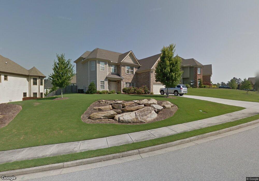
3693 Lost Oak Dr Unit 3 Buford, GA 30519
Estimated Value: $578,020 - $656,000
5
Beds
4
Baths
3,273
Sq Ft
$186/Sq Ft
Est. Value
About This Home
This home is located at 3693 Lost Oak Dr Unit 3, Buford, GA 30519 and is currently estimated at $607,255, approximately $185 per square foot. 3693 Lost Oak Dr Unit 3 is a home located in Gwinnett County with nearby schools including Harmony Elementary School and Glenn C. Jones Middle School.
Ownership History
Date
Name
Owned For
Owner Type
Purchase Details
Closed on
Aug 3, 2021
Sold by
Stein Dawn M
Bought by
Manifold Zachary E and Jiner Manifold Julie
Current Estimated Value
Home Financials for this Owner
Home Financials are based on the most recent Mortgage that was taken out on this home.
Original Mortgage
$394,250
Outstanding Balance
$356,944
Interest Rate
2.9%
Mortgage Type
New Conventional
Estimated Equity
$250,311
Purchase Details
Closed on
Oct 25, 2012
Sold by
Ferrell Evangeline Joan
Bought by
Stein Dawn M
Home Financials for this Owner
Home Financials are based on the most recent Mortgage that was taken out on this home.
Original Mortgage
$153,500
Interest Rate
3.42%
Mortgage Type
New Conventional
Create a Home Valuation Report for This Property
The Home Valuation Report is an in-depth analysis detailing your home's value as well as a comparison with similar homes in the area
Home Values in the Area
Average Home Value in this Area
Purchase History
| Date | Buyer | Sale Price | Title Company |
|---|---|---|---|
| Manifold Zachary E | $425,000 | -- | |
| Stein Dawn M | -- | -- |
Source: Public Records
Mortgage History
| Date | Status | Borrower | Loan Amount |
|---|---|---|---|
| Open | Manifold Zachary E | $394,250 | |
| Previous Owner | Stein Dawn M | $153,500 |
Source: Public Records
Tax History
| Year | Tax Paid | Tax Assessment Tax Assessment Total Assessment is a certain percentage of the fair market value that is determined by local assessors to be the total taxable value of land and additions on the property. | Land | Improvement |
|---|---|---|---|---|
| 2025 | $7,078 | $247,960 | $54,400 | $193,560 |
| 2024 | $7,095 | $240,040 | $48,000 | $192,040 |
| 2023 | $7,095 | $190,200 | $33,600 | $156,600 |
| 2022 | $5,623 | $170,000 | $33,600 | $136,400 |
| 2021 | $4,397 | $137,800 | $29,600 | $108,200 |
| 2020 | $4,429 | $137,800 | $29,600 | $108,200 |
| 2019 | $4,105 | $128,320 | $26,400 | $101,920 |
| 2018 | $4,112 | $128,320 | $26,400 | $101,920 |
| 2016 | $3,657 | $106,400 | $26,400 | $80,000 |
| 2015 | $3,698 | $106,400 | $18,400 | $88,000 |
| 2014 | -- | $78,000 | $20,800 | $57,200 |
Source: Public Records
Map
Nearby Homes
- 3663 Lost Oak Dr
- 2727 Lost Mill Trace
- 2692 Bogan Creek Dr
- 3685 Rolling Creek Dr
- 4041 Lost Mill Ln
- 2380 Black Bear Ct
- 3665 Mystic Dr Unit 2
- 2551 E Maddox Rd
- 3483 Lost Oak Dr
- 2330 Black Bear Ct
- 2753 Blue Moon Dr Unit 4
- 3775 Rolling Creek Dr
- 4023 Lost Oak Dr
- 2262 Silver Fox Ln
- 2705 Chandler Grove Dr
- 3765 Woodlawn Ct
- 4017 S South Bogan Rd
- 2350 E Maddox Rd
- 2352 E Maddox Rd
- 2101 E Maddox Rd
- 3693 Lost Oak Dr
- 3703 Lost Oak Dr
- 3684 Lost Oak Dr NE
- 3653 Lost Oak Dr
- 3674 Lost Oak Dr
- 3713 Lost Oak Dr
- 3713 Lost Oak Dr Unit 3
- 2747 Lost Mill Trace
- 3664 Lost Oak Dr
- 2757 Lost Mill Trace
- 2600 Mossy Rock Place
- 3643 Lost Oak Dr
- 3714 Lost Oak Dr
- 3654 Lost Oak Dr
- 2595 Mossy Rock Place
- 2737 Lost Mill Trace
- 2767 Lost Mill Trace
- 3644 Lost Oak Dr
- 2580 Mossy Rock Place
- 2580 Mossy Rock Place Unit 3