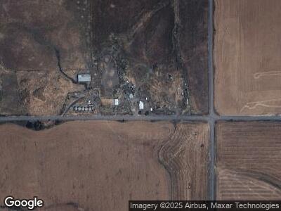
36937 Growler Point Rd Reubens, ID 83548
Estimated Value: $259,000 - $977,000
4
Beds
1
Bath
3,012
Sq Ft
$167/Sq Ft
Est. Value
About This Home
This home is located at 36937 Growler Point Rd, Reubens, ID 83548 and is currently estimated at $503,894, approximately $167 per square foot. 36937 Growler Point Rd is a home located in Nez Perce County with nearby schools including Highland School.
Ownership History
Date
Name
Owned For
Owner Type
Purchase Details
Closed on
Nov 30, 2024
Sold by
Jeri Ann Thelen Revocable Living Trust and Thelen Kelly Jordyn
Bought by
Frear Craig
Current Estimated Value
Purchase Details
Closed on
Oct 30, 2024
Sold by
Medeiros Jessica and Thompson Johnny
Bought by
Thompson Johnny and Thompson Jessica
Purchase Details
Closed on
Oct 29, 2024
Sold by
Shawver Roger H and Shawver Michele Mf
Bought by
Shawver Roger H and Shawver Michele Mf
Purchase Details
Closed on
Oct 28, 2024
Sold by
Hacker Jamie Lynn and Hacker John
Bought by
Traylor Christopher and Traylor Jessica
Purchase Details
Closed on
Oct 25, 2024
Sold by
Roeder Gordon M and Broncheau Jaclyn Ruth
Bought by
Terhaar Norman and Terhaar Myrna
Purchase Details
Closed on
Oct 24, 2024
Sold by
Howell Thomas C
Bought by
Jones Ethan and Jones Sasha
Purchase Details
Closed on
Oct 4, 2024
Sold by
Vervalen Stephen B
Bought by
Vervalen Mark
Create a Home Valuation Report for This Property
The Home Valuation Report is an in-depth analysis detailing your home's value as well as a comparison with similar homes in the area
Home Values in the Area
Average Home Value in this Area
Purchase History
| Date | Buyer | Sale Price | Title Company |
|---|---|---|---|
| Frear Craig | -- | Titleone | |
| Thompson Johnny | -- | Alliance Title | |
| Shawver Roger H | -- | None Listed On Document | |
| Traylor Christopher | -- | Alliance Title | |
| Traylor Christopher | -- | Alliance Title | |
| Elliott Howard L | -- | Alliance Title | |
| Connerley Stacy | -- | Alliance Title | |
| Terhaar Norman | -- | Titleone | |
| Jones Ethan | -- | Alliance Title |
Source: Public Records
Mortgage History
| Date | Status | Borrower | Loan Amount |
|---|---|---|---|
| Previous Owner | Hill Stanley L | $46,100 | |
| Previous Owner | Hill Stanley L | $52,000 |
Source: Public Records
Tax History Compared to Growth
Tax History
| Year | Tax Paid | Tax Assessment Tax Assessment Total Assessment is a certain percentage of the fair market value that is determined by local assessors to be the total taxable value of land and additions on the property. | Land | Improvement |
|---|---|---|---|---|
| 2024 | $17 | $52,851 | $37,573 | $15,278 |
| 2023 | $1,647 | $181,978 | $33,516 | $148,462 |
| 2022 | $1,758 | $181,978 | $33,516 | $148,462 |
| 2021 | $1,788 | $163,732 | $29,957 | $133,775 |
| 2020 | $1,590 | $134,883 | $15,794 | $119,089 |
| 2019 | $1,617 | $134,872 | $15,783 | $119,089 |
| 2018 | $1,231 | $95,601 | $15,701 | $79,900 |
| 2017 | $1,216 | $0 | $0 | $0 |
| 2016 | $1,216 | $0 | $0 | $0 |
| 2015 | $1,200 | $0 | $0 | $0 |
| 2014 | $1,161 | $89,675 | $14,293 | $75,382 |
Source: Public Records
Map
Nearby Homes
- 341 Stubbs Ave
- 33685 Culdesac Rd
- 0 Tbd Old Culdesac Rd
- NNA Laufers Rd
- 2326 Reubens Rd
- 85 Orchard Dr
- TBD Old Culdesac Rd
- NKA 24acs Jacks Canyon Rd
- 22545 Angel Ridge Rd
- TBD Dent Bridge Rd
- TBD Elwood St Parcel A
- TBD Elwood St Parcel B
- 21650 Antler Ln
- 000 Central Ridge Rd
- TBD May St Blk 56 Lot 10
- TBD May St Blk 56 Lot 9
- TBD May St Blk 56 Lot 8
- TBD Pine St Blk 56 Lot 5
- 415 W Howard St
- TBD May St Blk 56 Lot 7
