Estimated Value: $175,000 - $238,000
2
Beds
2
Baths
1,092
Sq Ft
$179/Sq Ft
Est. Value
About This Home
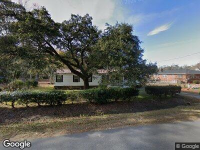
This home is located at 3695 Bombing Range Rd, Longs, SC 29568 and is currently estimated at $195,708, approximately $179 per square foot. 3695 Bombing Range Rd is a home with nearby schools including Riverside Elementary School, North Myrtle Beach Middle School, and North Myrtle Beach High School.
Ownership History
Date
Name
Owned For
Owner Type
Purchase Details
Closed on
Jun 14, 2023
Sold by
Woods Earlene M
Bought by
Evans Jake and Evans Lenearl
Current Estimated Value
Purchase Details
Closed on
Nov 20, 2014
Sold by
Bryant Beth A
Bought by
Woods Earlene E
Create a Home Valuation Report for This Property
The Home Valuation Report is an in-depth analysis detailing your home's value as well as a comparison with similar homes in the area
Home Values in the Area
Average Home Value in this Area
Purchase History
| Date | Buyer | Sale Price | Title Company |
|---|---|---|---|
| Evans Jake | -- | -- | |
| Woods Earlene E | -- | -- |
Source: Public Records
Tax History Compared to Growth
Tax History
| Year | Tax Paid | Tax Assessment Tax Assessment Total Assessment is a certain percentage of the fair market value that is determined by local assessors to be the total taxable value of land and additions on the property. | Land | Improvement |
|---|---|---|---|---|
| 2024 | $1,786 | $5,815 | $530 | $5,285 |
| 2023 | $1,786 | $5,815 | $530 | $5,285 |
| 2021 | $1,327 | $10,556 | $1,116 | $9,440 |
| 2020 | $1,238 | $10,556 | $1,116 | $9,440 |
| 2019 | $1,238 | $10,556 | $1,116 | $9,440 |
| 2018 | $1,121 | $8,849 | $806 | $8,043 |
| 2017 | $1,106 | $5,057 | $461 | $4,596 |
| 2016 | -- | $5,057 | $461 | $4,596 |
| 2015 | $1,106 | $8,850 | $807 | $8,043 |
| 2014 | $1,069 | $3,372 | $308 | $3,064 |
Source: Public Records
Map
Nearby Homes
- TBD Della Rd Unit N/W Hwy 90
- 3285 Della Rd
- TBD Pint Cir
- TBD Mill Swamp Rd
- 2946 Mill Swamp Rd
- 0 S Carolina 90 Unit 1925770
- 10.79 acres S Carolina 90
- 8217 S Carolina 90
- 3641 Half Pint Rd
- 1038 Jase Dr Unit Lot 60
- 1009 Jase Dr Unit Lot 74
- 1044 Jase Dr Unit Lot 59
- 1026 Jase Dr Unit Lot 62
- 1041 Jase Dr Unit Lot 82
- 1025 Jase Dr Unit Lot 78, Darcy II C
- 1060 Jase Dr Unit Lot 56
- 1064 Jase Dr Unit Lot 55
- 1220 Mill Bank Dr Unit Lot 46
- 1209 Mill Bank Dr Unit Lot 50
- 170 Waterloo St Unit Lot 47 Dover
- 3695 Bombing Range Rd
- 8440 Highway 90
- 3550 Prince Dr
- 3673 Bombing Range Rd
- 8449 Highway 90
- 3674 Bombing Range Rd
- 8496 Highway 90
- 4301 Hwy 90
- 115 Audrey Ct
- 8395 Highway 90
- 8510 Highway 90
- 3655 Bombing Range Rd
- 2201 Livingston Ln
- 8519 Highway 90
- 2971 Lane Cir
- 8381 Highway 90
- 808 Pint Creek Rd Unit Poplar Community
- 808 Pint Creek Rd
- 2195 Livingston Ln
- 8499 Highway 90