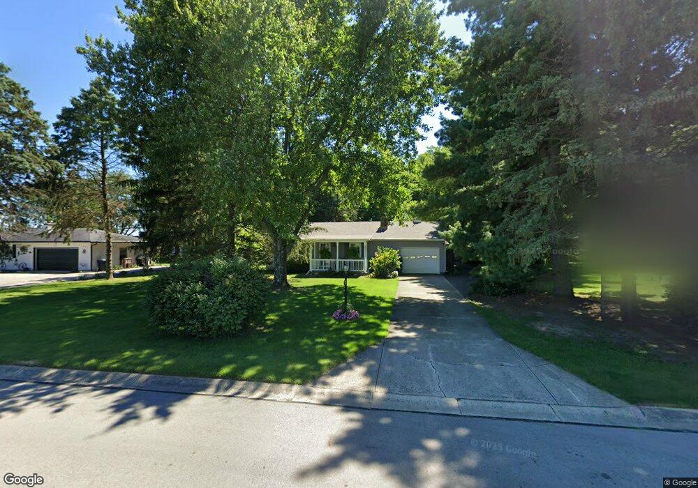
3695 Mumper Rd Springfield, OH 45502
Estimated Value: $189,495 - $241,000
2
Beds
1
Bath
972
Sq Ft
$227/Sq Ft
Est. Value
About This Home
This home is located at 3695 Mumper Rd, Springfield, OH 45502 and is currently estimated at $220,624, approximately $226 per square foot. 3695 Mumper Rd is a home located in Clark County with nearby schools including Northridge Elementary School and Kenton Ridge Middle & High School.
Ownership History
Date
Name
Owned For
Owner Type
Purchase Details
Closed on
Sep 2, 2006
Sold by
Baker Danny L and Baker Robin J
Bought by
Baker Danny L and Baker Robin J
Current Estimated Value
Home Financials for this Owner
Home Financials are based on the most recent Mortgage that was taken out on this home.
Original Mortgage
$15,000
Outstanding Balance
$8,917
Interest Rate
6.77%
Mortgage Type
Credit Line Revolving
Estimated Equity
$211,707
Purchase Details
Closed on
Feb 1, 1979
Sold by
Lightle James Allen
Bought by
Baker Danny L
Create a Home Valuation Report for This Property
The Home Valuation Report is an in-depth analysis detailing your home's value as well as a comparison with similar homes in the area
Purchase History
| Date | Buyer | Sale Price | Title Company |
|---|---|---|---|
| Baker Danny L | -- | None Available | |
| Baker Danny L | $40,500 | -- |
Source: Public Records
Mortgage History
| Date | Status | Borrower | Loan Amount |
|---|---|---|---|
| Open | Baker Danny L | $15,000 |
Source: Public Records
Tax History
| Year | Tax Paid | Tax Assessment Tax Assessment Total Assessment is a certain percentage of the fair market value that is determined by local assessors to be the total taxable value of land and additions on the property. | Land | Improvement |
|---|---|---|---|---|
| 2025 | $1,759 | $48,920 | $10,340 | $38,580 |
| 2024 | $1,701 | $40,170 | $7,570 | $32,600 |
| 2023 | $1,701 | $40,170 | $7,570 | $32,600 |
| 2022 | $0 | $40,170 | $7,570 | $32,600 |
| 2021 | $1,676 | $33,410 | $6,210 | $27,200 |
| 2020 | $1,678 | $33,410 | $6,210 | $27,200 |
| 2019 | $1,710 | $33,410 | $6,210 | $27,200 |
| 2018 | $1,570 | $29,440 | $5,730 | $23,710 |
| 2017 | $1,346 | $29,439 | $5,730 | $23,709 |
| 2016 | $1,337 | $29,439 | $5,730 | $23,709 |
| 2015 | $649 | $27,525 | $5,730 | $21,795 |
| 2014 | $1,298 | $27,525 | $5,730 | $21,795 |
| 2013 | $634 | $27,525 | $5,730 | $21,795 |
Source: Public Records
Map
Nearby Homes
- 4273 Kay Ave
- 6360 Renee St
- 5670 Prairie Rd
- 5060 Morris Rd
- 4293 Yale St
- 1812 Willow Lakes Dr
- 1836 Dunseth Ln
- 9 Middle Urbana Rd
- 1470 Oldham Dr Unit 12
- 1707 Berwick Dr
- 5564 Ridgewood Rd E Unit 7
- 4500 Bosart Rd
- 5722 Victorian Way Unit 31
- 1495 Victorian Way
- 5564 Ridgewood Rd W
- 1521 Erika Dr
- 1709 Thomas Dr
- 5033 Ridgewood Rd E
- 937 Willow Rd
- 4180 Briarwood Dr
- 3717 Mumper Rd
- 3671 Mumper Rd
- 3741 Mumper Rd
- 3647 Mumper Rd
- 3763 Mumper Rd
- 3601 Mumper Rd
- 3781 Mumper Rd
- 3617 Mumper Rd
- 3807 Mumper Rd
- 3625 Mumper Rd
- 3625 Mumper Rd
- 3825 Mumper Rd
- 3851 Mumper Rd
- 3873 Mumper Rd
- 3525 Mumper Rd
- 6440 Morris Rd
- 3895 Mumper Rd
- 3917 Mumper Rd
- 3480 Sandalwood Ave
- 3939 Mumper Rd
Your Personal Tour Guide
Ask me questions while you tour the home.