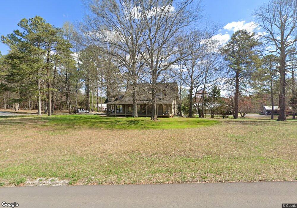
3699 N Highway 27 La Fayette, GA 30728
Noble NeighborhoodEstimated Value: $205,000 - $321,000
--
Bed
--
Bath
1,837
Sq Ft
$150/Sq Ft
Est. Value
About This Home
This home is located at 3699 N Highway 27, La Fayette, GA 30728 and is currently estimated at $275,034, approximately $149 per square foot. 3699 N Highway 27 is a home located in Walker County with nearby schools including Rock Spring Elementary School and Lafayette High School.
Ownership History
Date
Name
Owned For
Owner Type
Purchase Details
Closed on
Apr 9, 2018
Sold by
Walden Charlotte M
Bought by
Vanhorn Scott and Vanhorn Tammy
Current Estimated Value
Purchase Details
Closed on
Jul 28, 2017
Sold by
Walden Charlotte
Bought by
Carlock David Y
Purchase Details
Closed on
Jan 15, 2009
Sold by
Walden Charlotte
Bought by
Walden Rachel M
Purchase Details
Closed on
May 2, 1988
Sold by
Christopher Christopher C and Christopher Charlot
Bought by
Walden Charlotte
Purchase Details
Closed on
Dec 24, 1979
Bought by
Christopher Christopher C and Christopher Charlot
Create a Home Valuation Report for This Property
The Home Valuation Report is an in-depth analysis detailing your home's value as well as a comparison with similar homes in the area
Home Values in the Area
Average Home Value in this Area
Purchase History
| Date | Buyer | Sale Price | Title Company |
|---|---|---|---|
| Vanhorn Scott | -- | -- | |
| Carlock David Y | $70,000 | -- | |
| Walden Rachel M | -- | -- | |
| Walden Charlotte | $15,000 | -- | |
| Christopher Christopher C | -- | -- |
Source: Public Records
Tax History Compared to Growth
Tax History
| Year | Tax Paid | Tax Assessment Tax Assessment Total Assessment is a certain percentage of the fair market value that is determined by local assessors to be the total taxable value of land and additions on the property. | Land | Improvement |
|---|---|---|---|---|
| 2024 | $1,884 | $107,013 | $31,486 | $75,527 |
| 2023 | $1,710 | $96,576 | $24,220 | $72,356 |
| 2022 | $1,516 | $77,419 | $24,220 | $53,199 |
| 2021 | $2,302 | $68,815 | $24,220 | $44,595 |
| 2020 | $2,275 | $65,345 | $24,220 | $41,125 |
| 2019 | $2,309 | $65,345 | $24,220 | $41,125 |
| 2018 | $1,729 | $65,345 | $24,220 | $41,125 |
| 2017 | $2,823 | $76,475 | $35,350 | $41,125 |
| 2016 | $2,132 | $95,258 | $50,500 | $44,758 |
| 2015 | $1,918 | $67,979 | $30,600 | $37,379 |
| 2014 | $1,765 | $67,979 | $30,600 | $37,379 |
| 2013 | -- | $67,979 | $30,600 | $37,379 |
Source: Public Records
Map
Nearby Homes
- Lot 3 Cedar Farm Rd
- 516 W Reed Rd
- 521 Wheeler Rd
- 906 Diamond Cir
- 0 E Warren Rd Unit RTC2681365
- 0 E Warren Rd Unit 1395828
- 63 Loughridge Ln
- Hanover Plan at Price's Crossing
- Cali Plan at Price's Crossing
- Belhaven Plan at Price's Crossing
- Aria Plan at Price's Crossing
- Penwell Plan at Price's Crossing
- Salem Plan at Price's Crossing
- 894 896 Wheeler Unit 1 & 2
- 894 896 Wheeler
- 663 Diamond Cir
- 0 Straight Gut Rd Unit 1521484
- 144 Old Warren School Rd
- 154 Old Warren School Rd
- 164 Old Warren School Rd
- 275 Sequatchie Trail
- 425 Sequatchie Trail
- 195 Sequatchie Trail
- 435 Sequatchie Trail
- 270 Sequatchie Trail
- 320 Sequatchie Trail
- 320 Sequatchie Trail
- 384 Sequatchie Trail
- 400425 Sequatchie Trail
- 400-425 Sequatchie Trail
- 0 Wheeler Rd Unit 1241899
- 0 Wheeler Rd Unit 1201444
- 0 Wheeler Rd Unit 1181432
- 0 Wheeler Rd Unit * 1186557
- 0 Wheeler Rd Unit 1156797
- 0 Wheeler Rd Unit 1124849
- 0 Wheeler Rd Unit 1005938
- 0 Wheeler Rd Unit 8032762
- 0 Wheeler Rd Unit 1330377
- 0 Wheeler Rd Unit 8921319