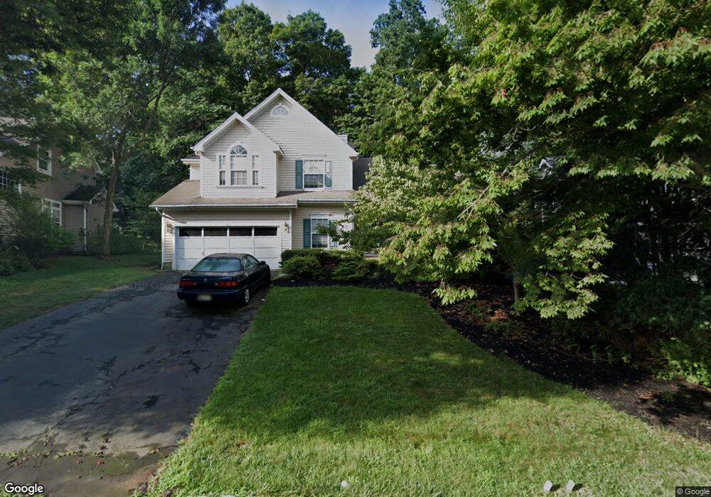
37 Alder Ln Basking Ridge, NJ 07920
Estimated Value: $970,003 - $1,072,000
--
Bed
--
Bath
2,328
Sq Ft
$448/Sq Ft
Est. Value
About This Home
This home is located at 37 Alder Ln, Basking Ridge, NJ 07920 and is currently estimated at $1,042,001, approximately $447 per square foot. 37 Alder Ln is a home located in Somerset County with nearby schools including Mount Prospect Elementary School, William Annin Middle School, and Ridge High School.
Ownership History
Date
Name
Owned For
Owner Type
Purchase Details
Closed on
Oct 1, 2003
Sold by
Manfredi Joseph
Bought by
Asero Lawrence and Asero Rosanne
Current Estimated Value
Home Financials for this Owner
Home Financials are based on the most recent Mortgage that was taken out on this home.
Original Mortgage
$428,000
Outstanding Balance
$201,646
Interest Rate
6.35%
Estimated Equity
$840,355
Purchase Details
Closed on
Sep 5, 1996
Sold by
Glover Jill
Bought by
Manfredi Joe and Manfredi Angela
Home Financials for this Owner
Home Financials are based on the most recent Mortgage that was taken out on this home.
Original Mortgage
$262,000
Interest Rate
8.11%
Create a Home Valuation Report for This Property
The Home Valuation Report is an in-depth analysis detailing your home's value as well as a comparison with similar homes in the area
Home Values in the Area
Average Home Value in this Area
Purchase History
| Date | Buyer | Sale Price | Title Company |
|---|---|---|---|
| Asero Lawrence | $535,000 | -- | |
| Manfredi Joe | $305,000 | -- |
Source: Public Records
Mortgage History
| Date | Status | Borrower | Loan Amount |
|---|---|---|---|
| Open | Asero Lawrence | $428,000 | |
| Previous Owner | Manfredi Joe | $262,000 |
Source: Public Records
Tax History Compared to Growth
Tax History
| Year | Tax Paid | Tax Assessment Tax Assessment Total Assessment is a certain percentage of the fair market value that is determined by local assessors to be the total taxable value of land and additions on the property. | Land | Improvement |
|---|---|---|---|---|
| 2025 | $14,659 | $903,200 | $339,300 | $563,900 |
| 2024 | $14,659 | $824,000 | $304,300 | $519,700 |
| 2023 | $14,375 | $762,200 | $304,300 | $457,900 |
| 2022 | $12,643 | $678,400 | $299,300 | $379,100 |
| 2021 | $13,018 | $639,500 | $299,300 | $340,200 |
| 2020 | $13,691 | $653,800 | $299,300 | $354,500 |
| 2019 | $13,648 | $671,000 | $302,400 | $368,600 |
| 2018 | $13,454 | $671,000 | $302,400 | $368,600 |
| 2017 | $12,938 | $650,500 | $302,400 | $348,100 |
| 2016 | $12,775 | $654,800 | $302,400 | $352,400 |
| 2015 | $12,339 | $644,000 | $287,400 | $356,600 |
| 2014 | $11,443 | $591,700 | $287,400 | $304,300 |
Source: Public Records
Map
Nearby Homes
- 21 Parkside Rd
- 14 Sussex Ct
- 39 Academy Ct
- 22 Morgan Ct
- 10 Morgan Ct
- 25 Stevens Ct
- 14 Hadley Ct
- 19 Gatehouse Rd
- 41 Dickinson Rd
- 6 Wood Duck Pond Road Ondo
- 23 Hansom Rd
- 12 Hansom Rd
- 2 Berkley Ln
- 4 Hansom Rd
- 9 Stone Run Rd
- 22 Tansy Ct
- 153 Cortland Lane Ondo Unit 153
- 15 Ray Ct
- 6 Ray Ct Unit 13706
- 25 Spruce Ct
- 33 Alder Ln
- 41 Alder Ln
- 152 Smoke Rise Rd
- 8 Drummers Log Ln
- 154 Smoke Rise Rd
- 29 Alder Ln
- 47 Alder Ln
- 150 Smoke Rise Rd
- 32 Alder Ln
- 42 Alder Ln
- 10 Drummers Log Ln
- 6 Drummers Log Ln
- 156 Smoke Rise Rd
- 25 Alder Ln
- 148 Smoke Rise Rd
- 50 Alder Ln
- 26 Alder Ln
- 158 Smoke Rise Rd
- 4 Drummers Log Ln
- 146 Smoke Rise Rd