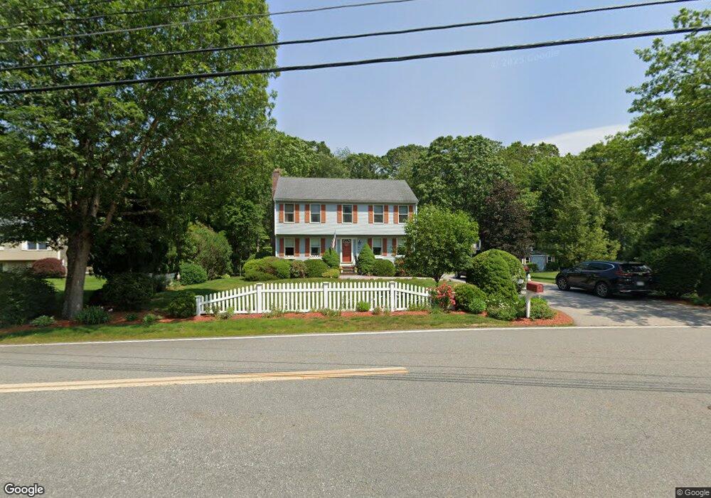
37 Bird Rd Mansfield, MA 02048
Estimated Value: $735,621 - $904,000
4
Beds
3
Baths
1,800
Sq Ft
$443/Sq Ft
Est. Value
About This Home
This home is located at 37 Bird Rd, Mansfield, MA 02048 and is currently estimated at $797,155, approximately $442 per square foot. 37 Bird Rd is a home located in Bristol County with nearby schools including Jordan/Jackson Elementary School, Everett W. Robinson Elementary School, and Harold L. Qualters Middle School.
Ownership History
Date
Name
Owned For
Owner Type
Purchase Details
Closed on
Oct 27, 2000
Sold by
Kuras Brian and Kuras Karen M
Bought by
Johnson George F and Johnson Noreen
Current Estimated Value
Purchase Details
Closed on
Feb 13, 1995
Sold by
Bertarelli William F and Bertarelli Paul H
Bought by
Kuras Brian and Kuras Karen M
Create a Home Valuation Report for This Property
The Home Valuation Report is an in-depth analysis detailing your home's value as well as a comparison with similar homes in the area
Home Values in the Area
Average Home Value in this Area
Purchase History
| Date | Buyer | Sale Price | Title Company |
|---|---|---|---|
| Johnson George F | $286,000 | -- | |
| Kuras Brian | $172,790 | -- |
Source: Public Records
Mortgage History
| Date | Status | Borrower | Loan Amount |
|---|---|---|---|
| Open | Kuras Brian | $301,000 | |
| Closed | Kuras Brian | $288,000 |
Source: Public Records
Tax History
| Year | Tax Paid | Tax Assessment Tax Assessment Total Assessment is a certain percentage of the fair market value that is determined by local assessors to be the total taxable value of land and additions on the property. | Land | Improvement |
|---|---|---|---|---|
| 2025 | $7,832 | $594,700 | $254,300 | $340,400 |
| 2024 | $7,637 | $565,700 | $254,300 | $311,400 |
| 2023 | $7,420 | $526,600 | $254,300 | $272,300 |
| 2022 | $7,145 | $471,000 | $235,600 | $235,400 |
| 2021 | $7,073 | $460,500 | $206,000 | $254,500 |
| 2020 | $6,820 | $444,000 | $196,200 | $247,800 |
| 2019 | $6,293 | $413,500 | $163,500 | $250,000 |
| 2018 | $6,254 | $401,700 | $156,100 | $245,600 |
| 2017 | $5,868 | $390,700 | $151,800 | $238,900 |
| 2016 | $5,705 | $370,200 | $144,300 | $225,900 |
| 2015 | $5,561 | $358,800 | $144,300 | $214,500 |
Source: Public Records
Map
Nearby Homes
- 261 East St
- 260 Massapoag Ave
- 148 Stearns Ave
- 485-487 Stearns Ave
- 4 Erick Rd Unit 90
- 16 Erick Rd Unit 34
- 132 Cannon Forge Dr
- 251 Poquanticut Ave
- 34 Kevins Way
- 15 Coach Rd
- 619 N Main St
- 26 Kathleen Grant Rd
- 4 Concetta Cir
- 46 Hope St
- 81 Chilson Ave
- 45 Kingsbrook Way
- 22 Pleasant St Unit C
- 212 Mill St
- 266 N Main St Unit 3
- 28 Court St
Your Personal Tour Guide
Ask me questions while you tour the home.