Estimated Value: $485,425 - $566,000
2
Beds
2
Baths
1,463
Sq Ft
$365/Sq Ft
Est. Value
About This Home
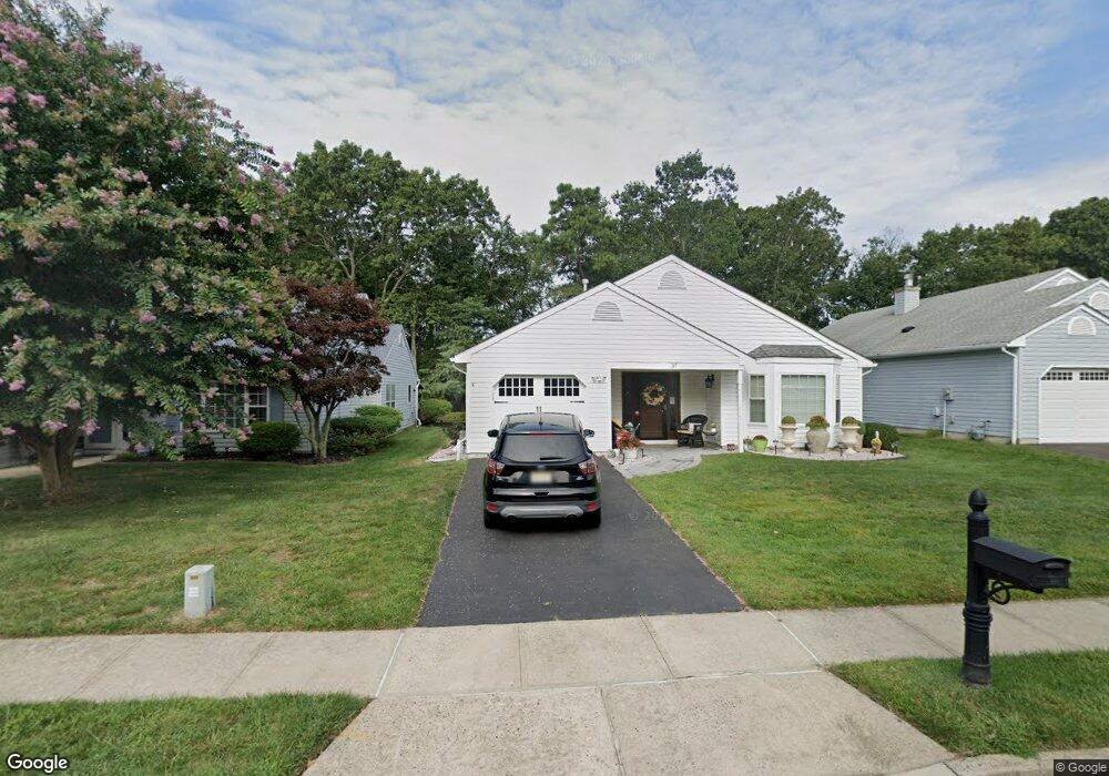
This home is located at 37 Brant Dr, Brick, NJ 08724 and is currently estimated at $534,106, approximately $365 per square foot. 37 Brant Dr is a home located in Ocean County with nearby schools including Midstreams Elementary School, Veterans Memorial Middle School, and Brick Township Memorial High School.
Ownership History
Date
Name
Owned For
Owner Type
Purchase Details
Closed on
Apr 28, 2006
Sold by
Bratten Richard A and Bratten Lilly Ann
Bought by
Bratten Richard A
Current Estimated Value
Purchase Details
Closed on
Sep 30, 2004
Sold by
Trocchia Salvatore M and Trocchia Lillian M
Bought by
Bratten Richard A and Bratten Lilly A
Purchase Details
Closed on
May 9, 2001
Sold by
Cichetti Rocco
Bought by
Trocchia Salvatore and Trocchia Lillian
Purchase Details
Closed on
Aug 24, 1993
Sold by
W & F Dev
Bought by
Cichetti Lena
Create a Home Valuation Report for This Property
The Home Valuation Report is an in-depth analysis detailing your home's value as well as a comparison with similar homes in the area
Home Values in the Area
Average Home Value in this Area
Purchase History
| Date | Buyer | Sale Price | Title Company |
|---|---|---|---|
| Bratten Richard A | -- | Old Republic National Title | |
| Bratten Richard A | $315,000 | Old Republic National Title | |
| Trocchia Salvatore | $169,500 | -- | |
| Trocchia Salvatore | $169,500 | -- | |
| Cichetti Lena | $116,400 | -- |
Source: Public Records
Tax History
| Year | Tax Paid | Tax Assessment Tax Assessment Total Assessment is a certain percentage of the fair market value that is determined by local assessors to be the total taxable value of land and additions on the property. | Land | Improvement |
|---|---|---|---|---|
| 2025 | $5,980 | $229,100 | $100,000 | $129,100 |
| 2024 | $5,675 | $229,100 | $100,000 | $129,100 |
Source: Public Records
Map
Nearby Homes
- 13 Golden Rod Ct
- 36 Sleepy Hollow Dr
- 94 Sleepy Hollow Dr
- 209 Winchester Dr
- 241 Old Squan Rd
- 4 East Trail
- 74 Fairview Ave
- 17 East Trail
- 3 C Trail
- 106 Arrowhead Park Dr
- 1 Princeton Pines Place
- 14 Coolidge Dr
- 203 Lorraine Place
- 24 Davos Rd
- 140 Meridian Dr
- 106 Coolidge Dr
- 982 Falkenberg Rd
- 49 N Cherokee Ln
- 313 Shawnee Dr
- 315 Shawnee Dr
Your Personal Tour Guide
Ask me questions while you tour the home.