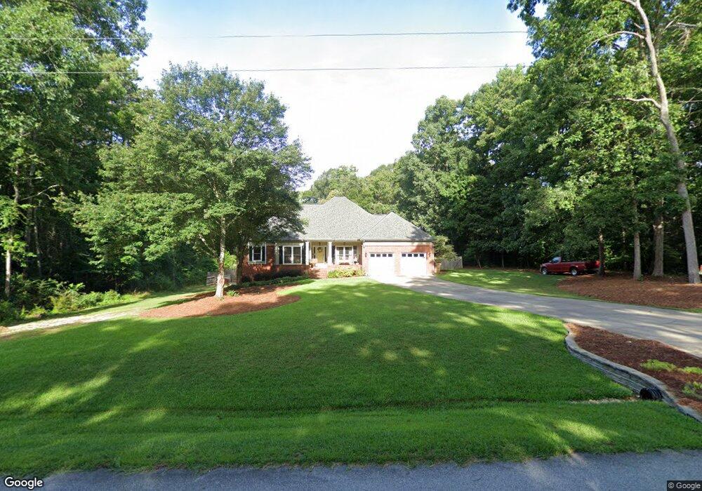
37 Brooks Dr Stockbridge, GA 30281
Estimated Value: $407,000 - $429,521
3
Beds
3
Baths
2,930
Sq Ft
$143/Sq Ft
Est. Value
About This Home
This home is located at 37 Brooks Dr, Stockbridge, GA 30281 and is currently estimated at $419,130, approximately $143 per square foot. 37 Brooks Dr is a home located in Henry County with nearby schools including Woodland Elementary School, Woodland Middle School, and Woodland High School.
Ownership History
Date
Name
Owned For
Owner Type
Purchase Details
Closed on
Sep 28, 2020
Sold by
Layton Preston A
Bought by
Stewart Nelson Lemuel
Current Estimated Value
Home Financials for this Owner
Home Financials are based on the most recent Mortgage that was taken out on this home.
Original Mortgage
$304,232
Outstanding Balance
$269,986
Interest Rate
2.9%
Mortgage Type
FHA
Estimated Equity
$149,144
Create a Home Valuation Report for This Property
The Home Valuation Report is an in-depth analysis detailing your home's value as well as a comparison with similar homes in the area
Home Values in the Area
Average Home Value in this Area
Purchase History
| Date | Buyer | Sale Price | Title Company |
|---|---|---|---|
| Stewart Nelson Lemuel | $309,900 | -- |
Source: Public Records
Mortgage History
| Date | Status | Borrower | Loan Amount |
|---|---|---|---|
| Open | Stewart Nelson Lemuel | $304,232 |
Source: Public Records
Tax History
| Year | Tax Paid | Tax Assessment Tax Assessment Total Assessment is a certain percentage of the fair market value that is determined by local assessors to be the total taxable value of land and additions on the property. | Land | Improvement |
|---|---|---|---|---|
| 2025 | $5,626 | $194,840 | $18,000 | $176,840 |
| 2024 | $5,626 | $167,360 | $18,000 | $149,360 |
| 2023 | $4,710 | $161,000 | $16,000 | $145,000 |
| 2022 | $4,674 | $139,360 | $14,000 | $125,360 |
| 2021 | $4,186 | $119,960 | $14,000 | $105,960 |
| 2020 | $2,963 | $96,160 | $10,000 | $86,160 |
| 2019 | $2,996 | $97,360 | $10,000 | $87,360 |
| 2018 | $2,993 | $97,160 | $10,000 | $87,160 |
| 2016 | $2,951 | $84,600 | $10,000 | $74,600 |
| 2015 | $2,416 | $67,360 | $10,000 | $57,360 |
| 2014 | $2,236 | $62,240 | $6,800 | $55,440 |
Source: Public Records
Map
Nearby Homes
- 88 Bowen Rd
- 120 Bowen Rd
- 80 Bowen Rd
- 108 Bowen Rd
- 36 Snapfinger Trail
- 2100 Highway 138 E
- 0 E Mays Rd Unit 10496305
- 301 Vicki Ln
- 0 Georgia 155 S Unit TRACT 3 10311477
- 200 Edmonson Ct
- 208 Edmonson Ct
- 204 Edmonson Ct
- 212 Edmonson Ct
- 213 Edmonson Ct
- 209 Edmonson Ct
- 205 Edmonson Ct
- 404 Marilyn Ct
- 222 Hemlock Dr
- 106 Valley Rd
- 260 White Acres Dr
- 81 Brooks Dr
- 19 Brooks Dr
- 174 Snapfinger Trail
- 40 Brooks Dr Unit 1
- 60 Brooks Dr
- 196 Snapfinger Trail
- 154 Snapfinger Trail
- 106 Denise Dr
- 72 Brooks Dr
- 0 Brooks Dr Unit 41 8410499
- 0 Brooks Dr Unit 42 8410497
- 0 Brooks Dr Unit 41 8307418
- 0 Brooks Dr Unit 42 8307421
- 0 Brooks Dr Unit 41 8217373
- 0 Brooks Dr Unit 42 8217377
- 0 Brooks Dr Unit LOT 37 3185633
- 0 Brooks Dr Unit 38 7559436
- 0 Brooks Dr Unit LOT 37 7559400
- 0 Brooks Dr Unit 41 7578749
- 0 Brooks Dr Unit 42 7579712
Your Personal Tour Guide
Ask me questions while you tour the home.