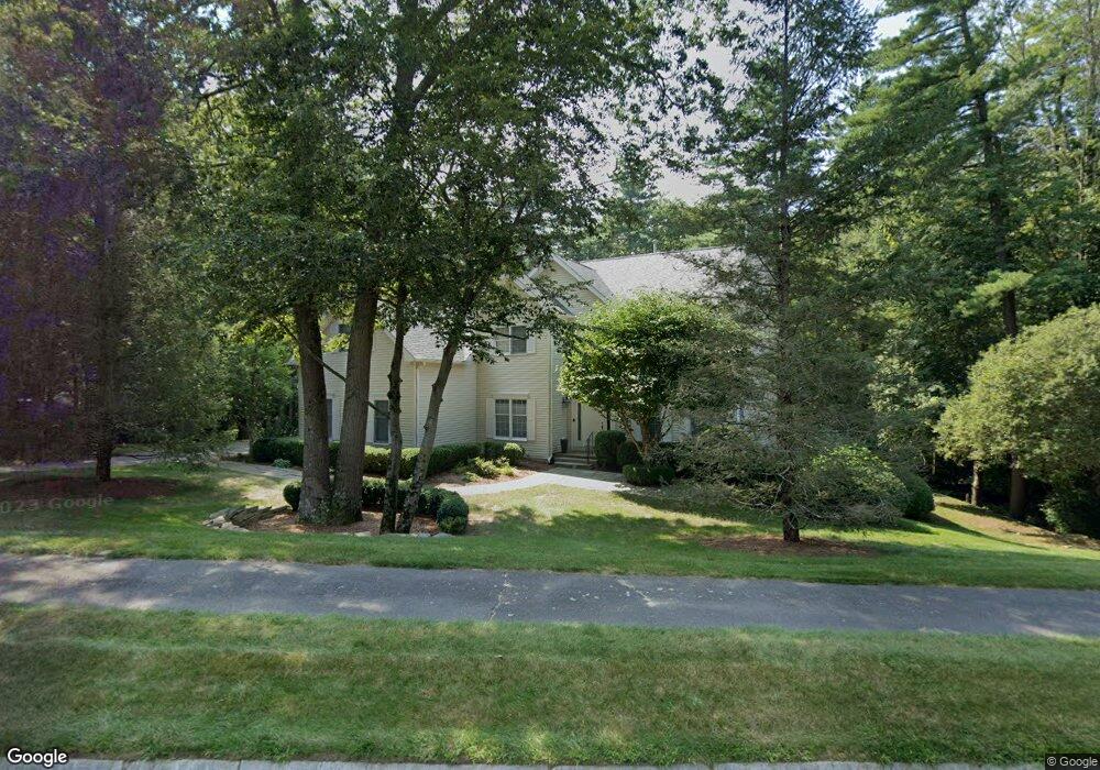
37 Charles River Dr Franklin, MA 02038
Estimated Value: $1,049,000 - $1,156,000
4
Beds
3
Baths
4,006
Sq Ft
$272/Sq Ft
Est. Value
About This Home
This home is located at 37 Charles River Dr, Franklin, MA 02038 and is currently estimated at $1,091,343, approximately $272 per square foot. 37 Charles River Dr is a home located in Norfolk County with nearby schools including Oak Street Elementary School, Horace Mann Middle School, and Franklin High School.
Ownership History
Date
Name
Owned For
Owner Type
Purchase Details
Closed on
Mar 11, 2005
Sold by
Gibson Hans B
Bought by
Visvis Catherine and Belsky David
Current Estimated Value
Home Financials for this Owner
Home Financials are based on the most recent Mortgage that was taken out on this home.
Original Mortgage
$340,000
Outstanding Balance
$172,713
Interest Rate
5.64%
Mortgage Type
Purchase Money Mortgage
Estimated Equity
$918,630
Purchase Details
Closed on
Jan 27, 1995
Sold by
Franklin Farms Lp
Bought by
Dusenberry Charles K and Dusenberry Beryl A
Home Financials for this Owner
Home Financials are based on the most recent Mortgage that was taken out on this home.
Original Mortgage
$285,200
Interest Rate
9.24%
Mortgage Type
Purchase Money Mortgage
Create a Home Valuation Report for This Property
The Home Valuation Report is an in-depth analysis detailing your home's value as well as a comparison with similar homes in the area
Purchase History
We collect this data history from publicly available records. To have your information removed, we recommend requesting removal directly through your county’s website.
| Date | Buyer | Sale Price | Title Company |
|---|---|---|---|
| Visvis Catherine | $640,000 | -- | |
| Dusenberry Charles K | $304,939 | -- |
Source: Public Records
Mortgage History
We collect this data history from publicly available records. To have your information removed, we recommend requesting removal directly through your county’s website.
| Date | Status | Borrower | Loan Amount |
|---|---|---|---|
| Open | Visvis Catherine | $340,000 | |
| Previous Owner | Dusenberry Charles K | $312,000 | |
| Previous Owner | Dusenberry Charles K | $285,200 |
Source: Public Records
Tax History
| Year | Tax Paid | Tax Assessment Tax Assessment Total Assessment is a certain percentage of the fair market value that is determined by local assessors to be the total taxable value of land and additions on the property. | Land | Improvement |
|---|---|---|---|---|
| 2025 | $10,711 | $921,800 | $372,400 | $549,400 |
| 2024 | $10,834 | $918,900 | $372,400 | $546,500 |
| 2023 | $10,597 | $842,400 | $345,600 | $496,800 |
| 2022 | $10,324 | $734,800 | $298,000 | $436,800 |
| 2021 | $9,801 | $669,000 | $285,400 | $383,600 |
| 2020 | $9,469 | $652,600 | $288,300 | $364,300 |
| 2019 | $9,523 | $649,600 | $285,400 | $364,200 |
| 2018 | $8,909 | $608,100 | $282,500 | $325,600 |
| 2017 | $8,993 | $616,800 | $291,200 | $325,600 |
| 2016 | $8,348 | $575,700 | $252,400 | $323,300 |
| 2015 | $8,411 | $566,800 | $243,500 | $323,300 |
| 2014 | $7,900 | $546,700 | $223,400 | $323,300 |
Source: Public Records
Map
Nearby Homes
- 41 Kimberlee Ave
- 7 Maple Brook Ln
- 6 Edmunds Way
- 6 Lena Cir
- 2412 Franklin Crossing Rd Unit 2412
- 1803 Franklin Crossing Rd Unit 1803
- 8 Thomas Dr
- 23 Highwood Dr
- 25 Brookview Rd
- 14 Lexington St
- 3 Edwards St
- 3 Jrs Ln
- 17 Longhill Rd
- 360 W Central St
- 834-836 W Central St
- 90 Oliver Pond Cir Unit 43
- 89 Oliver Pond Cir Unit 4
- 77 Oliver Pond Cir Unit 10
- 81 Oliver Pond Cir Unit 8
- 5 Flintlocke Rd
- 39 Charles River Dr
- 36 Charles River Dr
- 11 Franklin Springs Rd
- 41 Charles River Dr
- 34 Charles River Dr
- 4 Bogastow Brook Ln
- 2 Bogastow Brook Ln
- 9 Franklin Springs Rd
- 9 Spring St
- 38 Charles River Dr
- 6 Bogastow Brook Ln
- 32 Charles River Dr
- 43 Charles River Dr
- 7 Franklin Springs Rd
- 40 Charles River Dr
- 20 Norumbega Cir
- 1 Bogastow Brook Ln
- 10 Franklin Springs Rd Unit 11-10
- 10 Franklin Springs Rd
- 3 Bogastow Brook Ln
Your Personal Tour Guide
Ask me questions while you tour the home.