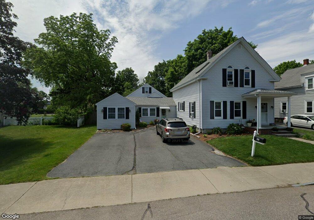
37 Davis St Unit 2 Mansfield, MA 02048
Estimated Value: $638,000 - $801,000
3
Beds
4
Baths
2,450
Sq Ft
$304/Sq Ft
Est. Value
About This Home
This home is located at 37 Davis St Unit 2, Mansfield, MA 02048 and is currently estimated at $745,428, approximately $304 per square foot. 37 Davis St Unit 2 is a home located in Bristol County with nearby schools including Everett W. Robinson Elementary School, Jordan/Jackson Elementary School, and Harold L. Qualters Middle School.
Ownership History
Date
Name
Owned For
Owner Type
Purchase Details
Closed on
Sep 26, 2005
Sold by
Leblanc Barbara A and Leblanc Raymond L
Bought by
Delang Lori A
Current Estimated Value
Home Financials for this Owner
Home Financials are based on the most recent Mortgage that was taken out on this home.
Original Mortgage
$247,920
Outstanding Balance
$134,033
Interest Rate
5.92%
Mortgage Type
Purchase Money Mortgage
Estimated Equity
$611,395
Create a Home Valuation Report for This Property
The Home Valuation Report is an in-depth analysis detailing your home's value as well as a comparison with similar homes in the area
Home Values in the Area
Average Home Value in this Area
Purchase History
| Date | Buyer | Sale Price | Title Company |
|---|---|---|---|
| Delang Lori A | $309,900 | -- |
Source: Public Records
Mortgage History
| Date | Status | Borrower | Loan Amount |
|---|---|---|---|
| Open | Delang Lori A | $247,920 |
Source: Public Records
Tax History
| Year | Tax Paid | Tax Assessment Tax Assessment Total Assessment is a certain percentage of the fair market value that is determined by local assessors to be the total taxable value of land and additions on the property. | Land | Improvement |
|---|---|---|---|---|
| 2025 | $9,905 | $752,100 | $0 | $752,100 |
| 2024 | $9,108 | $674,700 | $0 | $674,700 |
| 2023 | $8,661 | $614,700 | $0 | $614,700 |
| 2022 | $8,642 | $569,700 | $0 | $569,700 |
| 2021 | $8,251 | $537,200 | $0 | $537,200 |
| 2020 | $7,867 | $512,200 | $0 | $512,200 |
| 2019 | $5,367 | $352,600 | $0 | $352,600 |
| 2018 | $5,341 | $340,600 | $0 | $340,600 |
| 2017 | $5,116 | $340,600 | $0 | $340,600 |
| 2016 | $4,665 | $302,700 | $0 | $302,700 |
| 2015 | $4,346 | $280,400 | $0 | $280,400 |
Source: Public Records
Map
Nearby Homes
- 44 Fairfield Park Unit 44
- 28 Court St
- 46 Hope St
- 150 Rumford Ave Unit 110
- 266 N Main St Unit 3
- 22 Pleasant St Unit C
- 152 Central St
- 81 Chilson Ave
- 1 Deer Path Ln
- 166 Chauncy St
- 73-75 Draper Ave
- 460 Ware St
- 571 Ware St
- 14 Windchime Dr
- 619 N Main St
- 4 Concetta Cir
- 356 Central St
- 19 Barberry Rd
- 212 Mill St
- 4 Erick Rd Unit 90
Your Personal Tour Guide
Ask me questions while you tour the home.