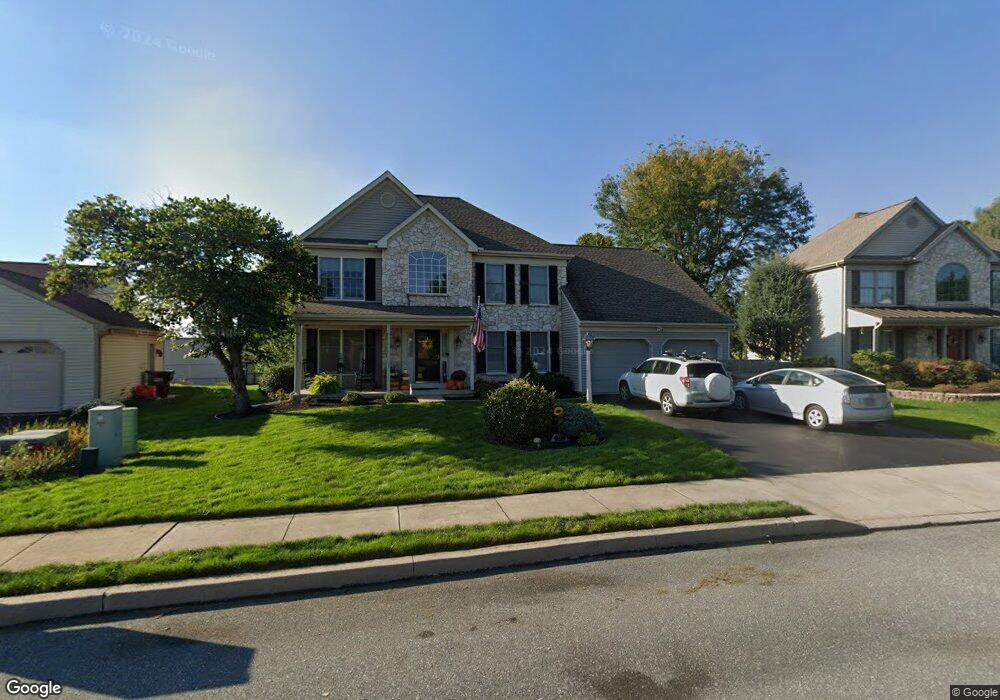
37 Duffield Dr Lititz, PA 17543
Estimated Value: $502,606 - $582,000
4
Beds
3
Baths
2,310
Sq Ft
$232/Sq Ft
Est. Value
About This Home
This home is located at 37 Duffield Dr, Lititz, PA 17543 and is currently estimated at $535,152, approximately $231 per square foot. 37 Duffield Dr is a home located in Lancaster County with nearby schools including Warwick Senior High School, Lititz Christian School, and Linden Hall.
Ownership History
Date
Name
Owned For
Owner Type
Purchase Details
Closed on
Jan 28, 2026
Sold by
Knisley Scott W and Knisley Jean L
Bought by
Knisley Family Trust and Knisley
Current Estimated Value
Purchase Details
Closed on
Jul 30, 1999
Sold by
Horst & Huffman Associates
Bought by
Knisley Scott W and Knisley Jean L
Home Financials for this Owner
Home Financials are based on the most recent Mortgage that was taken out on this home.
Original Mortgage
$166,700
Interest Rate
7.61%
Create a Home Valuation Report for This Property
The Home Valuation Report is an in-depth analysis detailing your home's value as well as a comparison with similar homes in the area
Home Values in the Area
Average Home Value in this Area
Purchase History
| Date | Buyer | Sale Price | Title Company |
|---|---|---|---|
| Knisley Family Trust | -- | Csc Document Recording (Record | |
| Knisley Scott W | $175,563 | Lawyers Title Insurance Corp |
Source: Public Records
Mortgage History
| Date | Status | Borrower | Loan Amount |
|---|---|---|---|
| Previous Owner | Knisley Scott W | $166,700 |
Source: Public Records
Tax History
| Year | Tax Paid | Tax Assessment Tax Assessment Total Assessment is a certain percentage of the fair market value that is determined by local assessors to be the total taxable value of land and additions on the property. | Land | Improvement |
|---|---|---|---|---|
| 2025 | $5,144 | $262,400 | $63,500 | $198,900 |
| 2024 | $5,144 | $262,400 | $63,500 | $198,900 |
| 2023 | $5,121 | $262,400 | $63,500 | $198,900 |
| 2022 | $5,121 | $262,400 | $63,500 | $198,900 |
| 2021 | $5,121 | $262,400 | $63,500 | $198,900 |
| 2020 | $5,121 | $262,400 | $63,500 | $198,900 |
| 2019 | $5,121 | $262,400 | $63,500 | $198,900 |
| 2018 | $4,181 | $262,400 | $63,500 | $198,900 |
| 2017 | $5,033 | $203,300 | $43,100 | $160,200 |
| 2016 | $5,033 | $203,300 | $43,100 | $160,200 |
| 2015 | $815 | $203,300 | $43,100 | $160,200 |
| 2014 | $3,893 | $203,300 | $43,100 | $160,200 |
Source: Public Records
Map
Nearby Homes
- 44 Duffield Dr
- 33 Tara Dr
- 1500 Furnace Hills Pike
- 138 Moorland Ct
- 100 Pepperton Ct
- 119 Saybrooke Dr
- 3 Amberly Way
- 146 N Cedar St
- 211 Noble St
- 902 Perry Rd
- 213 N Locust St
- 113 Cameron Ln
- 912 Perry Rd
- 48 N Broad St Unit 205
- LOT 14 Thaton Rd
- LOT 12 Thaton Rd
- 333 Cameron Ln Unit NOTTINGHAM
- 333 Cameron Ln Unit HAWTHORNE
- 333 Cameron Ln Unit DEVONSHIRE
- 333 Cameron Ln Unit SEBASTIAN
Your Personal Tour Guide
Ask me questions while you tour the home.