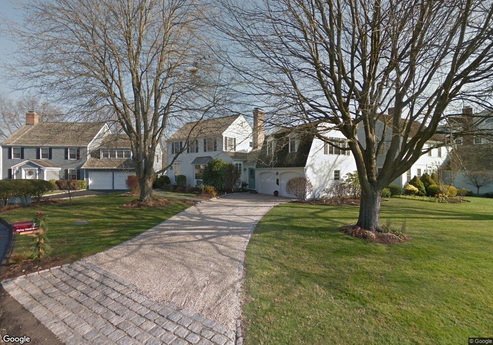
37 Flying Cloud Rd Stamford, CT 06902
Waterside NeighborhoodEstimated Value: $2,223,632 - $2,526,000
3
Beds
4
Baths
2,700
Sq Ft
$870/Sq Ft
Est. Value
About This Home
This home is located at 37 Flying Cloud Rd, Stamford, CT 06902 and is currently estimated at $2,348,908, approximately $869 per square foot. 37 Flying Cloud Rd is a home located in Fairfield County with nearby schools including Stillmeadow Elementary School, Cloonan School, and Westhill High School.
Ownership History
Date
Name
Owned For
Owner Type
Purchase Details
Closed on
May 10, 2004
Sold by
Blendstrup Gerharo and Gilligan Mary Karen
Bought by
Ranta Jeffrey A
Current Estimated Value
Purchase Details
Closed on
Dec 31, 1997
Sold by
Palatnick Murray
Bought by
Blendstrup Gerhard
Create a Home Valuation Report for This Property
The Home Valuation Report is an in-depth analysis detailing your home's value as well as a comparison with similar homes in the area
Home Values in the Area
Average Home Value in this Area
Purchase History
| Date | Buyer | Sale Price | Title Company |
|---|---|---|---|
| Ranta Jeffrey A | $1,400,000 | -- | |
| Ranta Jeffrey A | $1,400,000 | -- | |
| Blendstrup Gerhard | $532,500 | -- | |
| Blendstrup Gerhard | $532,500 | -- |
Source: Public Records
Mortgage History
| Date | Status | Borrower | Loan Amount |
|---|---|---|---|
| Open | Blendstrup Gerhard | $850,000 | |
| Closed | Blendstrup Gerhard | $250,000 |
Source: Public Records
Tax History Compared to Growth
Tax History
| Year | Tax Paid | Tax Assessment Tax Assessment Total Assessment is a certain percentage of the fair market value that is determined by local assessors to be the total taxable value of land and additions on the property. | Land | Improvement |
|---|---|---|---|---|
| 2025 | $26,796 | $1,120,250 | $723,180 | $397,070 |
| 2024 | $26,169 | $1,120,250 | $723,180 | $397,070 |
| 2023 | $28,275 | $1,120,250 | $723,180 | $397,070 |
| 2022 | $28,163 | $1,036,550 | $669,830 | $366,720 |
| 2021 | $27,925 | $1,036,550 | $669,830 | $366,720 |
| 2020 | $27,313 | $1,036,550 | $669,830 | $366,720 |
| 2019 | $27,313 | $1,036,550 | $669,830 | $366,720 |
| 2018 | $26,463 | $1,036,550 | $669,830 | $366,720 |
| 2017 | $26,671 | $991,850 | $649,990 | $341,860 |
| 2016 | $25,907 | $991,850 | $649,990 | $341,860 |
| 2015 | $25,223 | $991,850 | $649,990 | $341,860 |
| 2014 | $24,588 | $991,850 | $649,990 | $341,860 |
Source: Public Records
Map
Nearby Homes
- 54 Signal Rd
- 50 Signal Rd
- 46 Signal Rd
- 42 Signal Rd
- 20 Cook Rd
- 34 Davenport Dr
- 602 Fairfield Ave
- 45 Binney Ln
- 98 Southfield Ave Unit 101
- 137 Shore Rd
- 348 Sound Beach Ave
- 145 Shore Rd
- 7 Highview Ave
- 8 Park Ave
- 8 Quintard Ave
- 11 Shorelands Place
- 40 Orchard St
- 51 Forest Ave Unit 98
- 74 Rogers Rd
- 38 Van Rensselaer Ave
- 23 Flying Cloud Rd
- 39 Flying Cloud Rd
- 28 Flying Cloud Rd
- 15 Flying Cloud Rd
- 147 Dolphin Cove Quay
- 22 Flying Cloud Rd
- 139 Dolphin Cove Quay
- 32 Flying Cloud Rd
- 41 Flying Cloud Rd
- 18 Flying Cloud Rd
- 1 Flying Cloud Rd
- 36 Flying Cloud Rd
- 12 Flying Cloud Rd
- 135 Dolphin Cove Quay
- 8 Flying Cloud Rd
- 38 Flying Cloud Rd
- 146 Dolphin Cove Quay
- 136 Dolphin Cove Quay
- 161 Dolphin Cove Quay