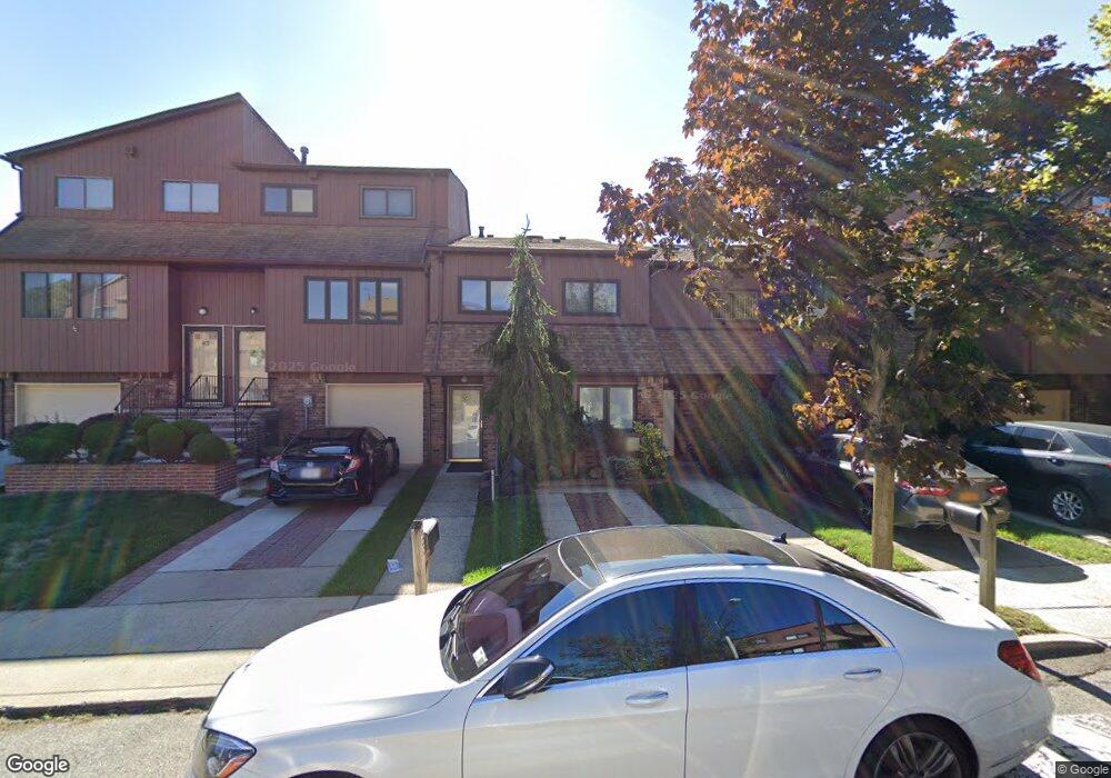
37 Gateway Dr Unit 179 Staten Island, NY 10304
Concord NeighborhoodEstimated Value: $684,983 - $750,000
3
Beds
2
Baths
1,640
Sq Ft
$432/Sq Ft
Est. Value
About This Home
This home is located at 37 Gateway Dr Unit 179, Staten Island, NY 10304 and is currently estimated at $707,996, approximately $431 per square foot. 37 Gateway Dr Unit 179 is a home located in Richmond County with nearby schools including P.S. 48 - William C. Wilcox, I.S. 49 Berta A Dreyfus, and New Dorp High School.
Ownership History
Date
Name
Owned For
Owner Type
Purchase Details
Closed on
Jan 20, 2014
Sold by
Pappas Virginia A
Bought by
Pappas Virginia A and Virginia A Pappas Revocable Tr
Current Estimated Value
Purchase Details
Closed on
Sep 25, 2000
Sold by
Federal Home Loan Mortgage Corporation
Bought by
Pappas Virginia A
Home Financials for this Owner
Home Financials are based on the most recent Mortgage that was taken out on this home.
Original Mortgage
$77,000
Interest Rate
7.64%
Purchase Details
Closed on
Dec 4, 1996
Sold by
Chepovetsky Stanislav and Chepovetsky Lidia
Bought by
Mirazita Michael and Mirazita Rosalie
Create a Home Valuation Report for This Property
The Home Valuation Report is an in-depth analysis detailing your home's value as well as a comparison with similar homes in the area
Home Values in the Area
Average Home Value in this Area
Purchase History
| Date | Buyer | Sale Price | Title Company |
|---|---|---|---|
| Pappas Virginia A | -- | The Judicial Title Insurance | |
| Pappas Virginia A | $228,000 | -- | |
| Mirazita Michael | $187,000 | -- |
Source: Public Records
Mortgage History
| Date | Status | Borrower | Loan Amount |
|---|---|---|---|
| Previous Owner | Pappas Virginia A | $77,000 |
Source: Public Records
Tax History Compared to Growth
Tax History
| Year | Tax Paid | Tax Assessment Tax Assessment Total Assessment is a certain percentage of the fair market value that is determined by local assessors to be the total taxable value of land and additions on the property. | Land | Improvement |
|---|---|---|---|---|
| 2025 | $5,468 | $39,705 | $4,194 | $35,511 |
| 2024 | $5,480 | $32,440 | $5,095 | $27,345 |
| 2023 | $5,200 | $27,004 | $5,161 | $21,843 |
| 2022 | $4,548 | $26,895 | $5,774 | $21,121 |
| 2021 | $4,755 | $24,033 | $5,774 | $18,259 |
| 2020 | $5,108 | $26,265 | $5,774 | $20,491 |
| 2019 | $4,989 | $25,353 | $5,774 | $19,579 |
| 2018 | $4,558 | $23,818 | $5,638 | $18,180 |
| 2017 | $4,281 | $22,470 | $5,774 | $16,696 |
| 2016 | $4,009 | $21,604 | $5,775 | $15,829 |
| 2015 | $3,878 | $21,274 | $5,774 | $15,500 |
| 2014 | $3,878 | $21,798 | $5,508 | $16,290 |
Source: Public Records
Map
Nearby Homes
- 63 Gateway Dr Unit 172
- 164 Stonegate Dr
- 89 Columbus Ave
- 98 N Railroad Ave
- 62 Columbus Ave
- 31 Alan Loop Unit 65
- 25 Marie St
- 23 Marie St
- 22 Scranton St
- 72 Alan Loop
- 81 Providence St
- 16 Tacoma St
- 84 Sheridan Ave
- 4 Sheridan Ave
- 69 Fayette Ave
- 1160 Richmond Rd Unit 7B
- 1160 Richmond Rd Unit 6A
- 1160 Richmond Rd Unit 2F
- 39 Winfield Ave
- 32 Hunton St
- 39 Gateway Dr Unit 180
- 35 Gateway Dr Unit 178
- 41 Gateway Dr Unit 181
- 43 Gateway Dr
- 45 Gateway Dr
- 73 Gateway Dr
- 61 Gateway Dr Unit 173
- 65 Gateway Dr Unit 171
- 57 Gateway Dr Unit 174
- 67 Gateway Dr Unit 170
- 55 Gateway Dr
- 53 Gateway Dr
- 51 Gateway Dr Unit 177
- 975 W Fingerboard Rd Unit 282
- 977 W Fingerboard Rd
- 973 W Fingerboard Rd
- 979 W Fingerboard Rd Unit 284
- 971 W Fingerboard Rd Unit 280
- 981 W Fingerboard Rd
- 27 Gateway Dr