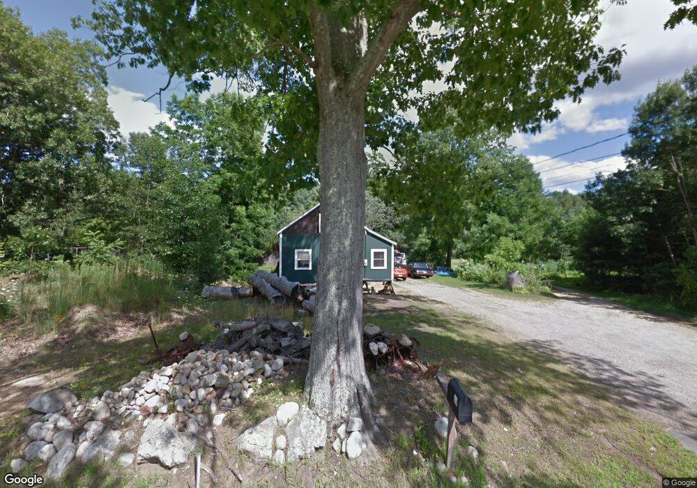
37 Kingston Rd Plaistow, NH 03865
Estimated Value: $330,774 - $434,000
1
Bed
1
Bath
1,128
Sq Ft
$338/Sq Ft
Est. Value
About This Home
This home is located at 37 Kingston Rd, Plaistow, NH 03865 and is currently estimated at $381,194, approximately $337 per square foot. 37 Kingston Rd is a home with nearby schools including Pollard Elementary School, Timberlane Regional Middle School, and Timberlane Regional High School.
Ownership History
Date
Name
Owned For
Owner Type
Purchase Details
Closed on
Nov 6, 2002
Sold by
Nejezchleba Steven F
Bought by
Sainsbury Samuel M
Current Estimated Value
Purchase Details
Closed on
Jul 31, 1998
Sold by
Clements Paul E and Clements Dianne J
Bought by
Nejezchleba Steven F
Home Financials for this Owner
Home Financials are based on the most recent Mortgage that was taken out on this home.
Original Mortgage
$102,812
Interest Rate
6.92%
Create a Home Valuation Report for This Property
The Home Valuation Report is an in-depth analysis detailing your home's value as well as a comparison with similar homes in the area
Home Values in the Area
Average Home Value in this Area
Purchase History
| Date | Buyer | Sale Price | Title Company |
|---|---|---|---|
| Sainsbury Samuel M | $135,000 | -- | |
| Nejezchleba Steven F | $103,000 | -- |
Source: Public Records
Mortgage History
| Date | Status | Borrower | Loan Amount |
|---|---|---|---|
| Previous Owner | Nejezchleba Steven F | $102,812 |
Source: Public Records
Tax History Compared to Growth
Tax History
| Year | Tax Paid | Tax Assessment Tax Assessment Total Assessment is a certain percentage of the fair market value that is determined by local assessors to be the total taxable value of land and additions on the property. | Land | Improvement |
|---|---|---|---|---|
| 2024 | $4,407 | $212,700 | $167,100 | $45,600 |
| 2023 | $4,888 | $218,800 | $167,100 | $51,700 |
| 2022 | $4,159 | $218,800 | $167,100 | $51,700 |
| 2021 | $4,148 | $218,800 | $167,100 | $51,700 |
| 2020 | $4,194 | $193,740 | $126,040 | $67,700 |
| 2019 | $4,129 | $193,740 | $126,040 | $67,700 |
| 2018 | $4,139 | $168,310 | $99,110 | $69,200 |
| 2017 | $4,033 | $168,310 | $99,110 | $69,200 |
| 2016 | $3,787 | $168,310 | $99,110 | $69,200 |
| 2015 | $3,681 | $152,370 | $102,070 | $50,300 |
| 2014 | $3,683 | $146,560 | $102,160 | $44,400 |
| 2011 | $3,621 | $146,560 | $102,160 | $44,400 |
Source: Public Records
Map
Nearby Homes