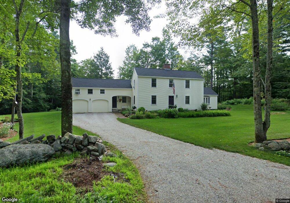
37 MacK Hill Rd Amherst, NH 03031
Estimated Value: $691,000 - $744,000
3
Beds
4
Baths
2,654
Sq Ft
$271/Sq Ft
Est. Value
About This Home
This home is located at 37 MacK Hill Rd, Amherst, NH 03031 and is currently estimated at $719,065, approximately $270 per square foot. 37 MacK Hill Rd is a home with nearby schools including Wilkins Elementary School, Amherst Middle School, and Souhegan Cooperative High School.
Create a Home Valuation Report for This Property
The Home Valuation Report is an in-depth analysis detailing your home's value as well as a comparison with similar homes in the area
Home Values in the Area
Average Home Value in this Area
Tax History Compared to Growth
Tax History
| Year | Tax Paid | Tax Assessment Tax Assessment Total Assessment is a certain percentage of the fair market value that is determined by local assessors to be the total taxable value of land and additions on the property. | Land | Improvement |
|---|---|---|---|---|
| 2024 | $11,630 | $507,200 | $137,500 | $369,700 |
| 2023 | $11,098 | $507,200 | $137,500 | $369,700 |
| 2022 | $10,717 | $507,200 | $137,500 | $369,700 |
| 2021 | $10,808 | $507,200 | $137,500 | $369,700 |
| 2020 | $10,549 | $370,400 | $110,000 | $260,400 |
| 2019 | $9,986 | $370,400 | $110,000 | $260,400 |
| 2018 | $10,086 | $370,400 | $110,000 | $260,400 |
| 2017 | $9,634 | $370,400 | $110,000 | $260,400 |
| 2016 | $9,297 | $370,400 | $110,000 | $260,400 |
| 2015 | $8,818 | $333,000 | $126,000 | $207,000 |
| 2014 | $8,878 | $333,000 | $126,000 | $207,000 |
| 2013 | $8,808 | $333,000 | $126,000 | $207,000 |
Source: Public Records
Map
Nearby Homes
- 3 Renee Dr
- 1B Debbie Ln
- 23 Bloody Brook Rd
- 4 Bloody Brook Rd
- 135 Amherst St Unit 28
- 007-056 MacK Hill Rd
- 25 Atherton Ln
- 6 Whittemore Ln
- 37 Baboosic Lake Rd
- 67 Christian Hill Rd
- 7 Miles Rd
- 80 Christian Hill Rd
- 1A Debbie Ln
- 9 Northfield Rd
- 64 Lyndeborough Rd
- 4 Tranquility Ln
- 18 Storybrook Ln
- 7 Corduroy Rd Unit 20
- 16 Storybrook Ln
- 4 Milford St