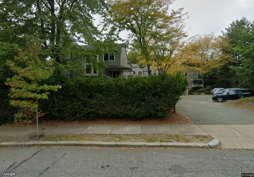
37 Murray Rd West Newton, MA 02465
Auburndale NeighborhoodEstimated Value: $756,000 - $950,000
2
Beds
2
Baths
1,180
Sq Ft
$688/Sq Ft
Est. Value
About This Home
This home is located at 37 Murray Rd, West Newton, MA 02465 and is currently estimated at $811,616, approximately $687 per square foot. 37 Murray Rd is a home located in Middlesex County with nearby schools including C.C. Burr, F.A. Day Middle School, and Newton North High School.
Ownership History
Date
Name
Owned For
Owner Type
Purchase Details
Closed on
Dec 31, 2020
Sold by
Ozhogin Pavel and Ozhogin Heather
Bought by
Zhang Yuxiang and Zhang Sheng
Current Estimated Value
Home Financials for this Owner
Home Financials are based on the most recent Mortgage that was taken out on this home.
Original Mortgage
$496,000
Outstanding Balance
$438,278
Interest Rate
2.67%
Mortgage Type
Purchase Money Mortgage
Estimated Equity
$373,338
Purchase Details
Closed on
Jun 22, 2016
Sold by
Horman Peter J and Horman Rachel
Bought by
Ozhogin Heather and Ozhogin Pavel
Home Financials for this Owner
Home Financials are based on the most recent Mortgage that was taken out on this home.
Original Mortgage
$452,000
Interest Rate
3.57%
Mortgage Type
New Conventional
Purchase Details
Closed on
May 22, 2006
Sold by
Maroney Kathleen A
Bought by
Horman Peter J and Cormack Rachel A
Home Financials for this Owner
Home Financials are based on the most recent Mortgage that was taken out on this home.
Original Mortgage
$343,000
Interest Rate
6.42%
Mortgage Type
Purchase Money Mortgage
Create a Home Valuation Report for This Property
The Home Valuation Report is an in-depth analysis detailing your home's value as well as a comparison with similar homes in the area
Home Values in the Area
Average Home Value in this Area
Purchase History
| Date | Buyer | Sale Price | Title Company |
|---|---|---|---|
| Zhang Yuxiang | $620,000 | None Available | |
| Ozhogin Heather | $565,000 | -- | |
| Horman Peter J | $429,000 | -- |
Source: Public Records
Mortgage History
| Date | Status | Borrower | Loan Amount |
|---|---|---|---|
| Open | Zhang Yuxiang | $496,000 | |
| Previous Owner | Ozhogin Heather | $452,000 | |
| Previous Owner | Horman Peter J | $343,000 |
Source: Public Records
Tax History
| Year | Tax Paid | Tax Assessment Tax Assessment Total Assessment is a certain percentage of the fair market value that is determined by local assessors to be the total taxable value of land and additions on the property. | Land | Improvement |
|---|---|---|---|---|
| 2025 | $6,582 | $671,600 | $0 | $671,600 |
| 2024 | $6,364 | $652,000 | $0 | $652,000 |
| 2023 | $6,246 | $613,600 | $0 | $613,600 |
| 2022 | $6,148 | $584,400 | $0 | $584,400 |
| 2021 | $5,932 | $551,300 | $0 | $551,300 |
| 2020 | $5,756 | $551,300 | $0 | $551,300 |
| 2019 | $5,593 | $535,200 | $0 | $535,200 |
| 2018 | $5,046 | $466,400 | $0 | $466,400 |
| 2017 | $4,893 | $440,000 | $0 | $440,000 |
| 2016 | $4,679 | $411,200 | $0 | $411,200 |
| 2015 | $4,546 | $391,600 | $0 | $391,600 |
Source: Public Records
Map
Nearby Homes
- 160 Pine St Unit 15
- 160 Pine St Unit 12
- 7 Sharon Ave Unit 7
- 1917 Commonwealth Ave Unit 1917
- 8 Curve St
- 0 Duncan Rd Unit 72925240
- 194 Auburn St Unit 2
- 226 Auburn St Unit 226
- 214 River St Unit 214
- 8 Elm St Unit 8
- 16 Elm St Unit 16
- 2 Elm St Unit 2
- 101-103 Lexington St
- 106 River St Unit 18
- 232 Melrose St Unit 2
- 14 Cottage Place Unit 14
- 49 Staniford St
- 383 Cherry St Unit 383
- 10 Higgins St
- 283 Melrose St
- 41 Murray Rd
- 39 Murray Rd
- 35 Murray Rd
- 33 Murray Rd
- 29 Murray Rd
- 37 Murray Rd Unit 37
- 45 Murray Rd
- 13 Murray Terrace
- 45 Prairie Ave
- 20 Dolan Ave
- 49 Prairie Ave Unit 3
- 49 Prairie Ave Unit 2
- 49 Prairie Ave Unit 1
- 42 Murray Rd
- 39 Prairie Ave Unit 41
- 50 Murray Rd
- 30 Murray Rd
- 192 Auburndale Ave
- 15 Murray Rd
- 55 Murray Rd