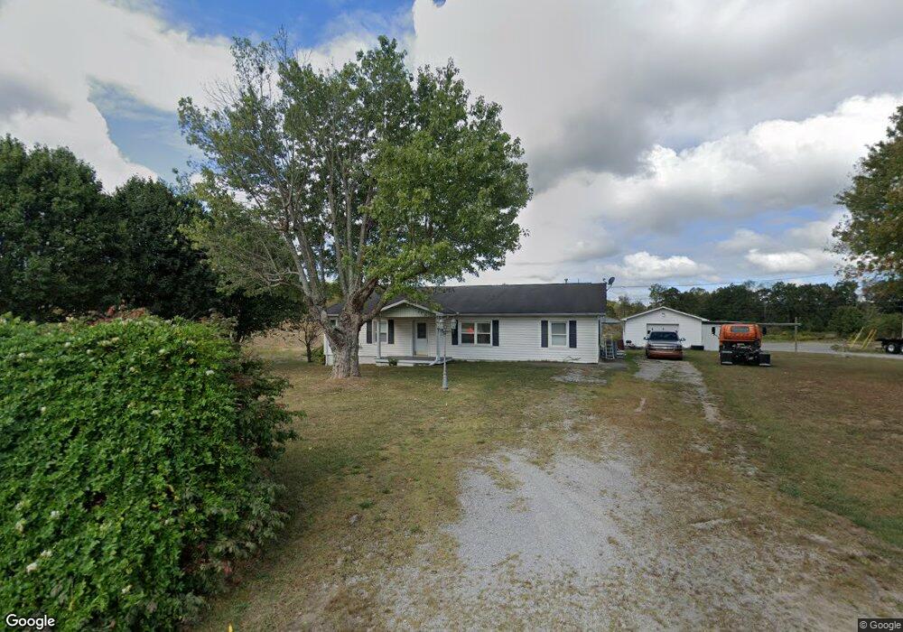
37 Old U S Highway 127 Crossville, TN 38571
Estimated Value: $294,732 - $345,000
3
Beds
2
Baths
1,802
Sq Ft
$179/Sq Ft
Est. Value
About This Home
This home is located at 37 Old U S Highway 127, Crossville, TN 38571 and is currently estimated at $322,683, approximately $179 per square foot. 37 Old U S Highway 127 is a home located in Cumberland County with nearby schools including North Cumberland Elementary School and Stone Memorial High School.
Ownership History
Date
Name
Owned For
Owner Type
Purchase Details
Closed on
Feb 2, 2010
Sold by
Federal Home Loan Mortgage Corporation
Bought by
Deromo Leonard
Current Estimated Value
Purchase Details
Closed on
Oct 7, 2009
Sold by
Blaylock Kelly
Bought by
Federal Home Loan Mortgage Corporation
Purchase Details
Closed on
Apr 1, 2004
Sold by
Graves Anthony C
Bought by
Blaylock Kelly Etvir
Home Financials for this Owner
Home Financials are based on the most recent Mortgage that was taken out on this home.
Original Mortgage
$131,100
Interest Rate
5.54%
Purchase Details
Closed on
Feb 11, 2002
Sold by
Graves Anthony and Graves Pamela
Bought by
Jones Daniel L
Purchase Details
Closed on
Aug 5, 1999
Sold by
Moore James L
Bought by
Graves Anthony
Home Financials for this Owner
Home Financials are based on the most recent Mortgage that was taken out on this home.
Original Mortgage
$123,247
Interest Rate
7.65%
Create a Home Valuation Report for This Property
The Home Valuation Report is an in-depth analysis detailing your home's value as well as a comparison with similar homes in the area
Home Values in the Area
Average Home Value in this Area
Purchase History
| Date | Buyer | Sale Price | Title Company |
|---|---|---|---|
| Deromo Leonard | $135,000 | -- | |
| Federal Home Loan Mortgage Corporation | $127,105 | -- | |
| Blaylock Kelly Etvir | $138,000 | -- | |
| Jones Daniel L | $3,000 | -- | |
| Graves Anthony | $124,000 | -- |
Source: Public Records
Mortgage History
| Date | Status | Borrower | Loan Amount |
|---|---|---|---|
| Previous Owner | Graves Anthony | $131,100 | |
| Previous Owner | Graves Anthony | $123,247 |
Source: Public Records
Tax History Compared to Growth
Tax History
| Year | Tax Paid | Tax Assessment Tax Assessment Total Assessment is a certain percentage of the fair market value that is determined by local assessors to be the total taxable value of land and additions on the property. | Land | Improvement |
|---|---|---|---|---|
| 2024 | $546 | $48,100 | $12,475 | $35,625 |
| 2023 | $546 | $48,100 | $0 | $0 |
| 2022 | $546 | $48,100 | $12,475 | $35,625 |
| 2021 | $473 | $30,200 | $11,800 | $18,400 |
| 2020 | $473 | $30,200 | $11,800 | $18,400 |
| 2019 | $473 | $30,200 | $11,800 | $18,400 |
| 2018 | $473 | $30,200 | $11,800 | $18,400 |
| 2017 | $471 | $30,200 | $11,800 | $18,400 |
| 2016 | $467 | $30,600 | $11,800 | $18,800 |
| 2015 | $458 | $30,600 | $11,800 | $18,800 |
| 2014 | $458 | $30,596 | $0 | $0 |
Source: Public Records
Map
Nearby Homes
- 0 Ferry Bend Tr Unit 1292974
- 0 Ferry Bend Tr Unit RTC2995085
- 0 Ferry Bend Tr Unit RTC2995089
- 0 Ferry Bend Tr Unit 1292975
- 0 Ferry Bend Tr Unit 1292679
- 0 Ferry Bend Tr Unit RTC2995090
- 205 Ferry Bend Trail
- Lot 12 Ferry Bend Trail
- Lot 11 Ferry Bend Trail
- Lot 10 Ferry Bend Trail
- 74 Farmer Rd
- 469 Ferry Bend Trail
- 4.47 ac 523 Ferry Bend Trail
- 523 Ferry Bend Trail
- 515 Ferry Bend Trail
- 4.47 ac 523 Ferry Bend Tr
- 447 523 Ferry Bend Tr
- 1 Smith Rd
- 2 Smith Rd
- 3 Smith Rd
- 37 Old Us Highway 127
- 9 Old Us Highway 127
- 7 Old Us Highway 127
- 5 Old Us Highway 127
- 15883 Highway 127 N
- 10 Old Us Highway 127
- 8 Old Us Highway 127
- 0 Old Us Highway 127
- 6 Old Us Highway 127
- 106 Old Us Highway 127
- 15834 Highway 127 N
- 144 Mary Carr Rd
- 173 Old Us Highway 127
- 80 England Ln
- 15678 Highway 127 N
- 15757 Highway 127 N
- 186 Mary Carr Rd
- 291 Old Us Highway 127
- 291 Old U S Highway 127
- 15616 Highway 127 N