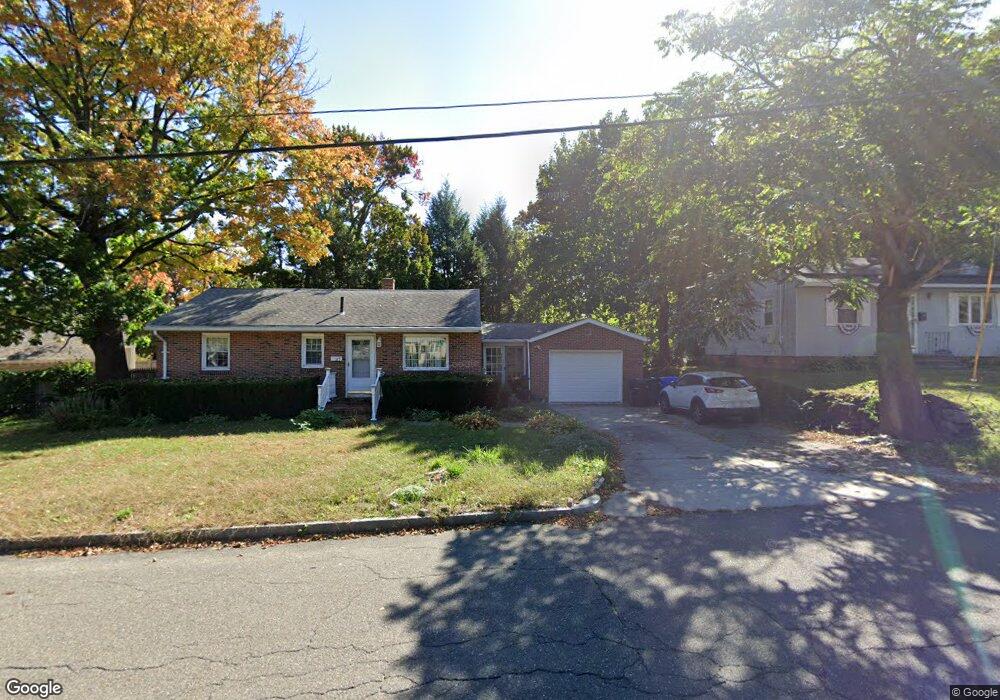
37 Pauline St Springfield, MA 01104
Liberty Heights NeighborhoodEstimated Value: $279,000 - $325,000
3
Beds
1
Bath
1,220
Sq Ft
$251/Sq Ft
Est. Value
About This Home
This home is located at 37 Pauline St, Springfield, MA 01104 and is currently estimated at $306,614, approximately $251 per square foot. 37 Pauline St is a home located in Hampden County with nearby schools including Glenwood School, Van Sickle Academy, and High School Of Commerce.
Ownership History
Date
Name
Owned For
Owner Type
Purchase Details
Closed on
Sep 11, 1995
Sold by
Sheehan Margaret E
Bought by
Cruz Zaida
Current Estimated Value
Home Financials for this Owner
Home Financials are based on the most recent Mortgage that was taken out on this home.
Original Mortgage
$67,850
Interest Rate
7.8%
Mortgage Type
Purchase Money Mortgage
Purchase Details
Closed on
May 1, 1990
Sold by
Walsh Thomas
Bought by
Walsh Margaret E
Home Financials for this Owner
Home Financials are based on the most recent Mortgage that was taken out on this home.
Original Mortgage
$60,400
Interest Rate
10.26%
Mortgage Type
Purchase Money Mortgage
Create a Home Valuation Report for This Property
The Home Valuation Report is an in-depth analysis detailing your home's value as well as a comparison with similar homes in the area
Home Values in the Area
Average Home Value in this Area
Purchase History
| Date | Buyer | Sale Price | Title Company |
|---|---|---|---|
| Cruz Zaida | $90,500 | -- | |
| Walsh Margaret E | $60,000 | -- |
Source: Public Records
Mortgage History
| Date | Status | Borrower | Loan Amount |
|---|---|---|---|
| Open | Walsh Margaret E | $80,000 | |
| Closed | Walsh Margaret E | $67,850 | |
| Previous Owner | Walsh Margaret E | $75,000 | |
| Previous Owner | Walsh Margaret E | $60,400 | |
| Closed | Walsh Margaret E | $18,100 |
Source: Public Records
Tax History Compared to Growth
Tax History
| Year | Tax Paid | Tax Assessment Tax Assessment Total Assessment is a certain percentage of the fair market value that is determined by local assessors to be the total taxable value of land and additions on the property. | Land | Improvement |
|---|---|---|---|---|
| 2025 | $4,505 | $287,300 | $39,100 | $248,200 |
| 2024 | $4,293 | $267,300 | $39,100 | $228,200 |
| 2023 | $4,377 | $256,700 | $34,600 | $222,100 |
| 2022 | $3,804 | $202,100 | $32,400 | $169,700 |
| 2021 | $3,676 | $194,500 | $29,400 | $165,100 |
| 2020 | $3,299 | $168,900 | $29,400 | $139,500 |
| 2019 | $3,261 | $165,700 | $32,000 | $133,700 |
| 2018 | $3,102 | $157,600 | $32,000 | $125,600 |
| 2017 | $2,959 | $150,500 | $29,000 | $121,500 |
| 2016 | $2,399 | $122,000 | $27,400 | $94,600 |
| 2015 | $2,358 | $119,900 | $27,400 | $92,500 |
Source: Public Records
Map
Nearby Homes
- 1060 Liberty St
- 11 Calvin St
- 596-598 Newbury St
- 98 Mildred Ave
- 28 Hartley St
- 74 David St
- 31 Denton Cir
- 11 Leroy Place
- 140 Wait St
- 27 Parallel St
- 92 Miller St
- 44-46 Hastings St
- 41 Nevada St
- 255 Moore St
- 723-725 Carew St
- 708-710 Carew St
- 774-776 Liberty St
- 62-64 Governor St
- 20 Gilbert Ave
- 55 Governor St
- 27 Pauline St
- 1052 Liberty St
- 1046 Liberty St
- 19 Pauline St
- 25 Tourigny St
- 1070 Liberty St
- 1038 Liberty St Unit 1040
- 1038/1040 Liberty St
- 14 Tourigny St
- 11 Pauline St Unit 13
- 20 Tourigny St
- 20 Pauline St
- 1024 Liberty St Unit 1026
- 26 Tourigny St
- 1055 Liberty St
- 1078 Liberty St
- 1037 Liberty St
- 1030 Liberty St Unit 1032
- 1065 Liberty St
- 32 Tourigny St