Estimated Value: $2,095,000 - $3,124,000
3
Beds
4
Baths
3,055
Sq Ft
$811/Sq Ft
Est. Value
About This Home
This home is located at 37 Pier 7, Charlestown, MA 02129 and is currently estimated at $2,478,297, approximately $811 per square foot. 37 Pier 7 is a home located in Suffolk County with nearby schools including Boston Children's School and St John School.
Ownership History
Date
Name
Owned For
Owner Type
Purchase Details
Closed on
Jul 7, 2025
Sold by
Strawbridge Norris and Strawbridge Elise M
Bought by
37 Constellation Wharf Rt and Strawbridge
Current Estimated Value
Purchase Details
Closed on
Jun 19, 1998
Sold by
Hunt Thomas J and Hunt Elaine F
Bought by
Strawbridge Norris and Strawbridge Lisa M
Create a Home Valuation Report for This Property
The Home Valuation Report is an in-depth analysis detailing your home's value as well as a comparison with similar homes in the area
Home Values in the Area
Average Home Value in this Area
Purchase History
| Date | Buyer | Sale Price | Title Company |
|---|---|---|---|
| 37 Constellation Wharf Rt | -- | -- | |
| 37 Constellation Wharf Rt | -- | -- | |
| Strawbridge Norris | $680,000 | -- |
Source: Public Records
Mortgage History
| Date | Status | Borrower | Loan Amount |
|---|---|---|---|
| Previous Owner | Strawbridge Norris | $206,000 | |
| Previous Owner | Strawbridge Norris | $228,000 |
Source: Public Records
Tax History Compared to Growth
Tax History
| Year | Tax Paid | Tax Assessment Tax Assessment Total Assessment is a certain percentage of the fair market value that is determined by local assessors to be the total taxable value of land and additions on the property. | Land | Improvement |
|---|---|---|---|---|
| 2025 | $29,968 | $2,587,900 | $0 | $2,587,900 |
| 2024 | $26,347 | $2,417,200 | $0 | $2,417,200 |
| 2023 | $24,725 | $2,302,100 | $0 | $2,302,100 |
| 2022 | $24,515 | $2,253,200 | $0 | $2,253,200 |
| 2021 | $24,042 | $2,253,200 | $0 | $2,253,200 |
| 2020 | $24,117 | $2,283,800 | $0 | $2,283,800 |
| 2019 | $23,599 | $2,239,020 | $0 | $2,239,020 |
| 2018 | $22,348 | $2,132,400 | $0 | $2,132,400 |
| 2017 | $21,713 | $2,050,337 | $0 | $2,050,337 |
| 2016 | $21,277 | $1,934,280 | $0 | $1,934,280 |
| 2015 | $19,520 | $1,611,900 | $0 | $1,611,900 |
| 2014 | $17,881 | $1,421,400 | $0 | $1,421,400 |
Source: Public Records
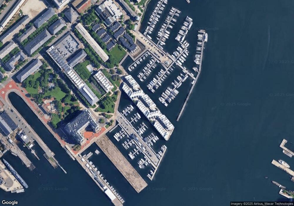
Map
Nearby Homes
- 197 8th St Unit 501
- 197 Eighth St Unit 628
- 197 Eighth St Unit 212
- 42 8th St Unit 5316
- 42 8th St Unit 4209
- 42 8th St Unit 4106
- 42 8th St Unit 1201
- 42 8th St Unit 3306
- 42 8th St Unit 2302
- 106 13th St Unit 204
- 12 Prospect St Unit 2
- 12 Prospect St Unit 1
- 73 Chelsea St Unit 401
- 3 Battery Wharf Unit 3309
- 4 Battery Wharf Unit 4604
- 4 Battery Wharf Unit 4302
- 4 Battery Wharf Unit 4602
- 99 Sumner St Unit 301
- 99 Sumner St Unit 101
- 99 Sumner St Unit 401
- 38 Constellation Wharf Unit 38
- 38 Pier 7 Unit 38
- 36 Constellation Wharf Unit 36
- 46 Constellation Wharf Unit 46
- 46 Constellation Wharf Unit 4
- 46 Constellation Wharf
- 47 Pier 7
- 47 Constellation Wharf Unit 47
- 35 Pier 7
- 35 Constellation Wharf Unit 35
- 34 Constellation Wharf Unit 34
- 34 Pier 7 Unit 34
- 36 Pier 7 Unit 36
- 3 Constellation Wharf Unit 3
- 3 Constellation Wharf Unit 65
- 3 Constellation Wharf Unit 46
- 10 Constellation Wharf Unit 10
- 7 Constellation Wharf Unit 7
- 30 Pier 7
- 12 Pier 7