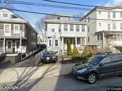
37 Raymond Ave Somerville, MA 02144
West Somerville NeighborhoodEstimated Value: $1,105,482 - $1,448,000
3
Beds
2
Baths
1,815
Sq Ft
$692/Sq Ft
Est. Value
About This Home
This home is located at 37 Raymond Ave, Somerville, MA 02144 and is currently estimated at $1,255,121, approximately $691 per square foot. 37 Raymond Ave is a home located in Middlesex County with nearby schools including Somerville High School, International School of Boston, and St. Clement Elementary School.
Ownership History
Date
Name
Owned For
Owner Type
Purchase Details
Closed on
Jan 31, 2005
Sold by
Brockman James A
Bought by
Hughes Anne M and Hughes Douglas J
Current Estimated Value
Home Financials for this Owner
Home Financials are based on the most recent Mortgage that was taken out on this home.
Original Mortgage
$428,000
Interest Rate
5.67%
Mortgage Type
Purchase Money Mortgage
Create a Home Valuation Report for This Property
The Home Valuation Report is an in-depth analysis detailing your home's value as well as a comparison with similar homes in the area
Home Values in the Area
Average Home Value in this Area
Purchase History
| Date | Buyer | Sale Price | Title Company |
|---|---|---|---|
| Hughes Anne M | $535,000 | -- |
Source: Public Records
Mortgage History
| Date | Status | Borrower | Loan Amount |
|---|---|---|---|
| Open | Ringer Kelly Llc | $618,000 | |
| Closed | Hughes Douglas J | $401,250 | |
| Closed | Hughes Douglas J | $401,250 | |
| Closed | Hughes Anne M | $428,000 |
Source: Public Records
Tax History Compared to Growth
Tax History
| Year | Tax Paid | Tax Assessment Tax Assessment Total Assessment is a certain percentage of the fair market value that is determined by local assessors to be the total taxable value of land and additions on the property. | Land | Improvement |
|---|---|---|---|---|
| 2025 | $10,558 | $967,700 | $569,800 | $397,900 |
| 2024 | $9,385 | $892,100 | $569,800 | $322,300 |
| 2023 | $9,333 | $902,600 | $569,800 | $332,800 |
| 2022 | $8,624 | $847,200 | $542,600 | $304,600 |
| 2021 | $8,421 | $826,400 | $538,700 | $287,700 |
| 2020 | $8,284 | $821,000 | $539,000 | $282,000 |
| 2019 | $7,809 | $725,700 | $490,700 | $235,000 |
| 2018 | $7,653 | $676,700 | $446,100 | $230,600 |
| 2017 | $7,373 | $631,800 | $420,900 | $210,900 |
| 2016 | $7,500 | $598,600 | $375,800 | $222,800 |
| 2015 | $7,136 | $565,900 | $347,100 | $218,800 |
Source: Public Records
Map
Nearby Homes
- 31 Conwell Ave
- 69 Conwell Ave
- 34 Curtis Ave
- 51 Curtis Ave
- 13 Conwell Ave
- 94 Conwell Ave Unit 1
- 94 Conwell Ave Unit 3
- 111 Hillsdale Rd
- 47 Teele Ave Unit 2
- 14 High St Unit 2
- 1252 Broadway Unit 5
- 86 Quincy St
- 136 -138 North St
- 1188 Broadway Unit 201
- 21 Weston Ave
- 31 Fairfax St
- 1097 Broadway
- 45 Endicott Ave Unit 5
- 9 Packard Ave
- 69 Farragut Ave
- 37 Raymond Ave
- 37 Raymond Ave Unit 1
- 35 Raymond Ave
- 31 Raymond Ave Unit 1
- 31 Raymond Ave Unit 33-3
- 31 Raymond Ave
- 31 Raymond Ave Unit 2
- 41 Raymond Ave
- 33 Raymond Ave
- 45 Raymond Ave
- 43 Raymond Ave
- 43 Raymond Ave Unit 2
- 45 Raymond Ave Unit 1
- 43 Raymond Ave Unit 43
- 29 Raymond Ave
- 49 Raymond Ave Unit 1
- 47 Raymond Ave
- 36 Conwell Ave
- 44 Raymond Ave Unit 1
- 40 Raymond Ave Unit C