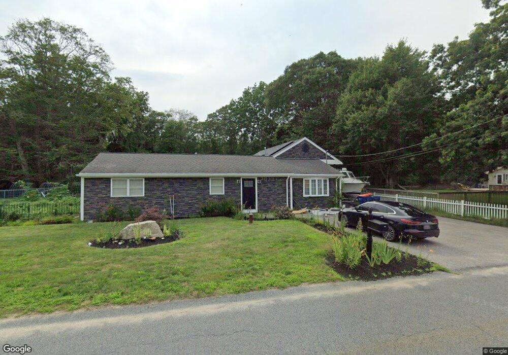
37 Robert St Westport, MA 02790
Sawdy Pond/Woods Corner NeighborhoodEstimated Value: $527,000 - $584,000
3
Beds
1
Bath
1,842
Sq Ft
$296/Sq Ft
Est. Value
About This Home
This home is located at 37 Robert St, Westport, MA 02790 and is currently estimated at $545,758, approximately $296 per square foot. 37 Robert St is a home located in Bristol County with nearby schools including Alice A. Macomber Primary School, Westport Elementary School, and Westport Middle-High School.
Ownership History
Date
Name
Owned For
Owner Type
Purchase Details
Closed on
Dec 3, 2004
Sold by
Miranda David
Bought by
Porto Sid and Porto Lisa M
Current Estimated Value
Purchase Details
Closed on
Oct 28, 2004
Sold by
Miranda David and Miranda Deolinda
Bought by
Miranda David
Purchase Details
Closed on
May 9, 2002
Sold by
Goodwin Marie L
Bought by
Miranda Deolinda
Purchase Details
Closed on
Sep 14, 1988
Sold by
Souza Gerald J
Bought by
Goodwin Jeffrey J
Create a Home Valuation Report for This Property
The Home Valuation Report is an in-depth analysis detailing your home's value as well as a comparison with similar homes in the area
Home Values in the Area
Average Home Value in this Area
Purchase History
| Date | Buyer | Sale Price | Title Company |
|---|---|---|---|
| Porto Sid | $230,000 | -- | |
| Porto Sid | $230,000 | -- | |
| Miranda David | -- | -- | |
| Miranda David | -- | -- | |
| Miranda Deolinda | $129,000 | -- | |
| Miranda Deolinda | $129,000 | -- | |
| Goodwin Jeffrey J | $98,000 | -- |
Source: Public Records
Mortgage History
| Date | Status | Borrower | Loan Amount |
|---|---|---|---|
| Open | Goodwin Jeffrey J | $107,000 | |
| Closed | Goodwin Jeffrey J | $83,200 |
Source: Public Records
Tax History Compared to Growth
Tax History
| Year | Tax Paid | Tax Assessment Tax Assessment Total Assessment is a certain percentage of the fair market value that is determined by local assessors to be the total taxable value of land and additions on the property. | Land | Improvement |
|---|---|---|---|---|
| 2025 | $3,373 | $452,700 | $154,800 | $297,900 |
| 2024 | $3,381 | $437,400 | $143,400 | $294,000 |
| 2023 | $3,315 | $406,300 | $136,600 | $269,700 |
| 2022 | $3,114 | $367,200 | $136,600 | $230,600 |
| 2021 | $2,895 | $335,900 | $124,200 | $211,700 |
| 2020 | $2,789 | $330,900 | $119,200 | $211,700 |
| 2019 | $2,603 | $314,800 | $108,400 | $206,400 |
| 2018 | $6,453 | $285,600 | $116,600 | $169,000 |
| 2017 | $5,989 | $279,800 | $116,600 | $163,200 |
| 2016 | $2,128 | $269,000 | $116,600 | $152,400 |
| 2015 | $1,986 | $250,400 | $116,600 | $133,800 |
Source: Public Records
Map
Nearby Homes
- 40 Robert St
- 33 Moniz Dr
- 47 Robert St
- 218 American Legion Hwy
- 51 Newton St
- 8 Campion Ave
- 0 Crandall Rd
- 308 Robert St
- 47 Devol Ave
- 219 Tickle Rd
- 1125 Stafford Rd Unit 5
- 14 Glendale Ave
- 6 Angel Ct
- 0 Tickle Rd Unit 73453134
- 374 Crandall Rd
- 100 Cory's Ln
- 100 Corys Ln
- 75 Montgomery St
- 771 Sanford Rd
- 447 Stafford Rd Unit E7