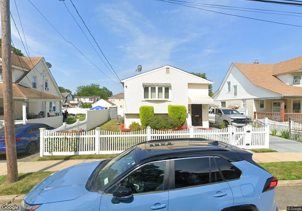
37 Rutland Rd Freeport, NY 11520
Estimated Value: $603,621 - $685,000
--
Bed
2
Baths
1,050
Sq Ft
$614/Sq Ft
Est. Value
About This Home
This home is located at 37 Rutland Rd, Freeport, NY 11520 and is currently estimated at $644,311, approximately $613 per square foot. 37 Rutland Rd is a home located in Nassau County with nearby schools including Columbus Avenue School, Caroline G. Atkinson Intermediate School, and John W Dodd Middle School.
Ownership History
Date
Name
Owned For
Owner Type
Purchase Details
Closed on
Apr 6, 2021
Sold by
Weekes Donna C
Bought by
Weekes Donna C and Weekes Keith
Current Estimated Value
Purchase Details
Closed on
Mar 31, 2008
Sold by
Weekes Donna
Purchase Details
Closed on
Feb 27, 2006
Sold by
Weekes Donna C
Purchase Details
Closed on
May 1, 1999
Sold by
Dragonetti Carmela
Bought by
Weekes Donna and Jones Merrie
Purchase Details
Closed on
Feb 22, 1999
Create a Home Valuation Report for This Property
The Home Valuation Report is an in-depth analysis detailing your home's value as well as a comparison with similar homes in the area
Home Values in the Area
Average Home Value in this Area
Purchase History
| Date | Buyer | Sale Price | Title Company |
|---|---|---|---|
| Weekes Donna C | -- | None Available | |
| -- | -- | -- | |
| -- | -- | -- | |
| Yarmie Fred | -- | -- | |
| Weekes Donna | $169,000 | -- | |
| -- | $117,293 | -- |
Source: Public Records
Tax History Compared to Growth
Tax History
| Year | Tax Paid | Tax Assessment Tax Assessment Total Assessment is a certain percentage of the fair market value that is determined by local assessors to be the total taxable value of land and additions on the property. | Land | Improvement |
|---|---|---|---|---|
| 2025 | $6,866 | $360 | $116 | $244 |
| 2024 | $802 | $373 | $120 | $253 |
| 2023 | $6,190 | $375 | $121 | $254 |
| 2022 | $6,190 | $373 | $120 | $253 |
| 2021 | $8,537 | $359 | $108 | $251 |
| 2020 | $5,418 | $458 | $348 | $110 |
| 2019 | $760 | $458 | $348 | $110 |
| 2018 | $3,059 | $458 | $0 | $0 |
| 2017 | $4,112 | $458 | $294 | $164 |
| 2016 | $4,799 | $543 | $299 | $244 |
| 2015 | $828 | $573 | $290 | $283 |
| 2014 | $828 | $573 | $290 | $283 |
| 2013 | $864 | $633 | $321 | $312 |
Source: Public Records
Map
Nearby Homes
- 96 N Columbus Ave
- 26 Rosedale Ave
- 98 N Columbus Ave
- 182 Grand Ave
- 11 Mount Ave
- 6 Frederick Ave
- 251 Grand Ave
- 47 Harding Place
- 268 Grand Ave
- 45 Lakeview Ave
- 221 E Dean St
- 45 Dehnhoff Ave
- 78 Jesse St
- 67 E Dean St
- 70 S Main St Unit 307-PH
- 101 Harris Ave
- 112 E Seaman Ave
- 173 E Seaman Ave
- 70 N Grove St Unit 1R
- 55 Harris Ave
- 41 Rutland Rd
- 33 Rutland Rd
- 45 Rutland Rd
- 29 Rutland Rd
- 10 Parsons Ave
- 46 Rutland Rd
- 46 Rutland Rd
- 50 Rutland Rd
- 52 Rutland Rd
- 48 Rutland Rd
- 60 N Columbus Ave
- 25 Rutland Rd
- 58 Rutland Rd
- 78 N Columbus Ave
- 58 N Columbus Ave
- 66 N Columbus Ave
- 64 Rutland Rd
- 42 Rutland Rd
- 54 N Columbus Ave
- 57 Rutland Rd
