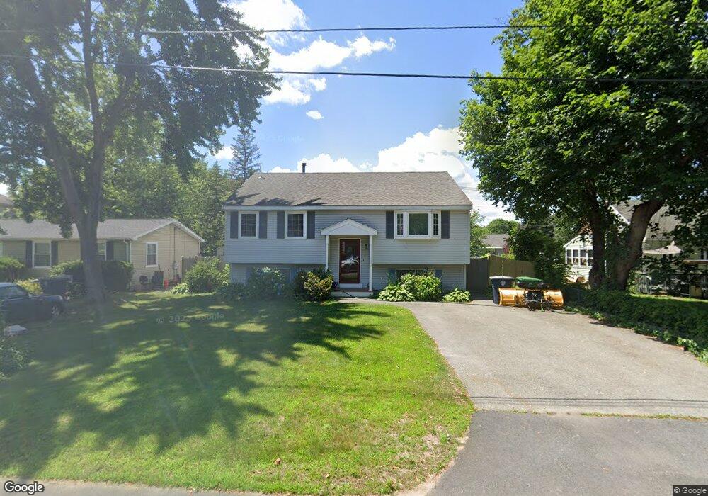
37 Saint Josephs Dr Nashua, NH 03060
South End Nashua NeighborhoodEstimated Value: $450,000 - $468,000
3
Beds
1
Bath
1,066
Sq Ft
$429/Sq Ft
Est. Value
About This Home
This home is located at 37 Saint Josephs Dr, Nashua, NH 03060 and is currently estimated at $457,781, approximately $429 per square foot. 37 Saint Josephs Dr is a home located in Hillsborough County with nearby schools including Ledge Street Elementary School, Fairgrounds Middle School, and Nashua High School South.
Ownership History
Date
Name
Owned For
Owner Type
Purchase Details
Closed on
Nov 6, 2000
Sold by
Sulfaro Steven A and Sulfaro Julie A
Bought by
Frappier Kevin J
Current Estimated Value
Home Financials for this Owner
Home Financials are based on the most recent Mortgage that was taken out on this home.
Original Mortgage
$125,800
Interest Rate
7.83%
Mortgage Type
Purchase Money Mortgage
Create a Home Valuation Report for This Property
The Home Valuation Report is an in-depth analysis detailing your home's value as well as a comparison with similar homes in the area
Home Values in the Area
Average Home Value in this Area
Purchase History
| Date | Buyer | Sale Price | Title Company |
|---|---|---|---|
| Frappier Kevin J | $148,000 | -- |
Source: Public Records
Mortgage History
| Date | Status | Borrower | Loan Amount |
|---|---|---|---|
| Open | Frappier Kevin J | $20,000 | |
| Open | Frappier Kevin J | $123,200 | |
| Closed | Frappier Kevin J | $125,800 |
Source: Public Records
Tax History Compared to Growth
Tax History
| Year | Tax Paid | Tax Assessment Tax Assessment Total Assessment is a certain percentage of the fair market value that is determined by local assessors to be the total taxable value of land and additions on the property. | Land | Improvement |
|---|---|---|---|---|
| 2024 | $6,724 | $422,900 | $134,700 | $288,200 |
| 2023 | $6,351 | $348,400 | $107,800 | $240,600 |
| 2022 | $6,296 | $348,400 | $107,800 | $240,600 |
| 2021 | $5,561 | $239,500 | $71,800 | $167,700 |
| 2020 | $5,293 | $234,100 | $71,800 | $162,300 |
| 2019 | $5,094 | $234,100 | $71,800 | $162,300 |
| 2018 | $4,965 | $234,100 | $71,800 | $162,300 |
| 2017 | $4,408 | $170,900 | $63,200 | $107,700 |
| 2016 | $4,284 | $170,900 | $63,200 | $107,700 |
| 2015 | $4,192 | $170,900 | $63,200 | $107,700 |
| 2014 | $4,086 | $169,900 | $63,200 | $106,700 |
Source: Public Records
Map
Nearby Homes
- 22 New Dunstable Rd Unit 132133
- 41 New Dunstable Rd Unit 371
- 169A W Hollis St Unit 193
- 172 Ledge St
- 22 Kern Dr
- 30 Gingras Dr
- 4 Badger St
- 97 Linwood St
- 22 Wilder St
- 30 Ledge St
- 63 Dexter St
- 38 Central St
- 8 Buck St Unit 10
- 7 Bitirnas St Unit U7
- 247 Main Dunstable Rd
- 15 Lovell St Unit 3
- 15 Lovell St Unit 10
- 5 Mulberry St
- 11 Charles St
- 4 Henry David Dr Unit 203
- 35 Saint Josephs Dr Unit 247248
- 14 Markar St Unit 253254
- 22 Markar St Unit 244245
- 34 Saint Josephs Dr
- 21 Markar St Unit 223226
- 24 Markar St Unit 241242
- 13 Markar St Unit 131/2
- 25 Markar St Unit 228229
- 30 Saint Joseph`s Dr
- 7 Markar St
- 24 Pershing St Unit 178179
- 30 Saint Josephs Dr
- 28 Pershing St Unit 175176
- 22 Pershing St Unit 181182
- 12 Belle Aire Ave
- 15 Belle Aire Ave
- 30 Pershing St Unit 172173
- 6 Markar St Unit 264
- 20 Pershing St Unit 184186
- 173 Kinsley St Unit 234