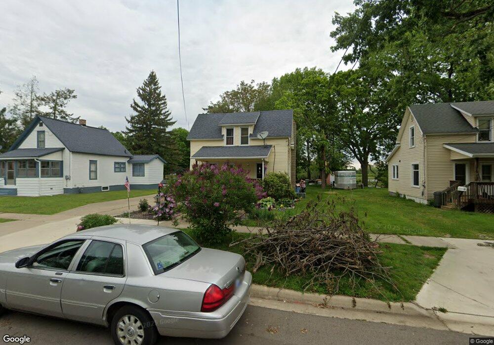
37 Sisson Ave Battle Creek, MI 49015
Central Battle Creek NeighborhoodEstimated Value: $60,000 - $111,000
3
Beds
1
Bath
1,084
Sq Ft
$82/Sq Ft
Est. Value
About This Home
This home is located at 37 Sisson Ave, Battle Creek, MI 49015 and is currently estimated at $88,547, approximately $81 per square foot. 37 Sisson Ave is a home located in Calhoun County with nearby schools including Ann J. Kellogg School, Springfield Middle School, and Battle Creek Central High School.
Ownership History
Date
Name
Owned For
Owner Type
Purchase Details
Closed on
Apr 19, 2024
Sold by
Oconnor Judy
Bought by
Carmichael Ronda and Carmichael Robert M
Current Estimated Value
Purchase Details
Closed on
Mar 15, 2016
Sold by
Connor Judy O and Estate Of William J O Connor
Bought by
Connor Judy O
Purchase Details
Closed on
Aug 9, 2007
Sold by
Lamson Lucy M and Knowles Lucy M
Bought by
Oconnor William J
Purchase Details
Closed on
Dec 11, 2006
Sold by
Lamson Charles D
Bought by
Lamson Lucy M
Purchase Details
Closed on
Oct 28, 2004
Sold by
Cowham Loran J and Cowham Darlene
Bought by
Lamson Charles
Create a Home Valuation Report for This Property
The Home Valuation Report is an in-depth analysis detailing your home's value as well as a comparison with similar homes in the area
Home Values in the Area
Average Home Value in this Area
Purchase History
| Date | Buyer | Sale Price | Title Company |
|---|---|---|---|
| Carmichael Ronda | $42,000 | Ata National Title Group | |
| Connor Judy O | -- | Attorney | |
| Oconnor William J | $64,000 | Chicago Title Of Michigan | |
| Lamson Lucy M | -- | None Available | |
| Lamson Charles | $21,000 | None Available |
Source: Public Records
Tax History Compared to Growth
Tax History
| Year | Tax Paid | Tax Assessment Tax Assessment Total Assessment is a certain percentage of the fair market value that is determined by local assessors to be the total taxable value of land and additions on the property. | Land | Improvement |
|---|---|---|---|---|
| 2025 | -- | $34,700 | $0 | $0 |
| 2024 | $1,001 | $30,496 | $0 | $0 |
| 2023 | $1,144 | $28,699 | $0 | $0 |
| 2022 | $904 | $24,432 | $0 | $0 |
| 2021 | $1,080 | $23,109 | $0 | $0 |
| 2020 | $1,044 | $23,041 | $0 | $0 |
| 2019 | $1,038 | $22,082 | $0 | $0 |
| 2018 | $1,038 | $19,559 | $600 | $18,959 |
| 2017 | $1,080 | $15,811 | $0 | $0 |
| 2016 | $1,104 | $17,797 | $0 | $0 |
| 2015 | $1,082 | $17,585 | $2,948 | $14,637 |
| 2014 | $1,082 | $16,844 | $2,948 | $13,896 |
Source: Public Records
Map
Nearby Homes
- 0 Riverside Pkwy Unit 25036355
- 3 Riverside Pkwy
- 51 Pauline Ave
- 17 Tennyson Ave
- 1 Grand Blvd
- 77 Leitch Dr
- 15 Marine Dr
- 66 Cleveland St
- 41 Randolph St
- 32 Territorial Rd E
- 57 Boulder St
- 35 Eldred St
- 503 S Shore Dr
- 71 Burnham St W
- 96 Battle Creek Ave
- 296 Meachem Ave
- 519 S Shore Dr
- 127 W Territorial Rd
- 112 Darragh Dr
- 137 Fairfield Ave
- 43 Sisson Ave
- 33 Sisson Ave
- 44 Sisson Ave
- 34 Sisson Ave
- 38 Sisson Ave
- 28 Sisson Ave
- 15 Sisson Ave
- 22 Sisson Ave
- 327 Riverside Dr
- 319 Riverside Dr
- 331 Riverside Dr
- 313 Riverside Dr
- 360 Riverside Dr
- 324 Riverside Dr
- 293 Riverside Dr
- 334 Riverside Dr
- 359 Riverside Dr
- 342 Riverside Dr
- 306 Riverside Dr
- 316 Riverside Dr