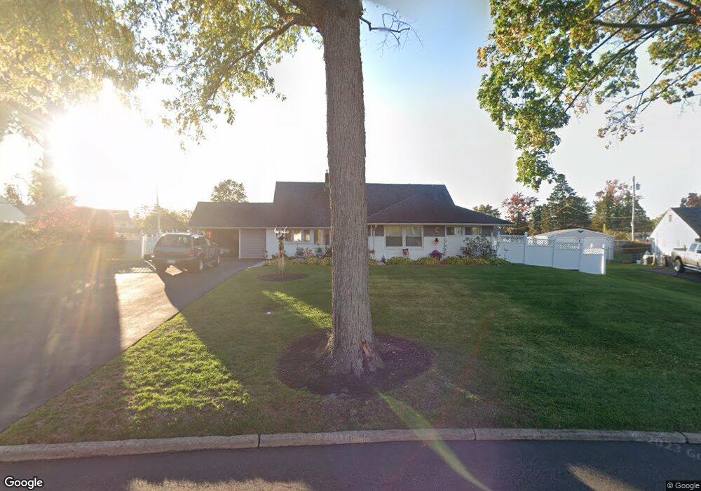
37 Spindletree Rd Levittown, PA 19056
Snowball Gate NeighborhoodEstimated Value: $502,665 - $528,000
4
Beds
3
Baths
2,125
Sq Ft
$244/Sq Ft
Est. Value
About This Home
This home is located at 37 Spindletree Rd, Levittown, PA 19056 and is currently estimated at $518,916, approximately $244 per square foot. 37 Spindletree Rd is a home located in Bucks County with nearby schools including Albert Schweitzer Elementary School, Sandburg Middle School, and Neshaminy High School.
Create a Home Valuation Report for This Property
The Home Valuation Report is an in-depth analysis detailing your home's value as well as a comparison with similar homes in the area
Home Values in the Area
Average Home Value in this Area
Tax History Compared to Growth
Tax History
| Year | Tax Paid | Tax Assessment Tax Assessment Total Assessment is a certain percentage of the fair market value that is determined by local assessors to be the total taxable value of land and additions on the property. | Land | Improvement |
|---|---|---|---|---|
| 2025 | $5,747 | $26,400 | $6,240 | $20,160 |
| 2024 | $5,747 | $26,400 | $6,240 | $20,160 |
| 2023 | $5,656 | $26,400 | $6,240 | $20,160 |
| 2022 | $5,508 | $26,400 | $6,240 | $20,160 |
| 2021 | $5,508 | $26,400 | $6,240 | $20,160 |
| 2020 | $5,442 | $26,400 | $6,240 | $20,160 |
| 2019 | $5,320 | $26,400 | $6,240 | $20,160 |
| 2018 | $5,222 | $26,400 | $6,240 | $20,160 |
| 2017 | $5,089 | $26,400 | $6,240 | $20,160 |
| 2016 | $5,089 | $26,400 | $6,240 | $20,160 |
| 2015 | $5,278 | $26,400 | $6,240 | $20,160 |
| 2014 | $5,278 | $26,400 | $6,240 | $20,160 |
Source: Public Records
Map
Nearby Homes
- 33 Red Rose Way
- 94 Juniper Dr
- 7 Canal Rd
- 14 Cleft Rock Rd
- 301 Snowball Dr
- 283 Snowball Dr
- 28 Cloister Rd
- 23 Crystal Place
- 75 Flamehill Rd
- L:070 Trenton Rd
- 19 Cobalt Ridge Dr N
- 46 Hydrangea Rd
- 62 Indian Creek Dr
- 212 Plumbridge Dr
- 43 Petunia Rd
- 114 Nursery Ave
- 14 Harp Rd
- 17 Quay Rd
- 26 Queen Lily Rd
- 0 Fir Ave
- 31 Spindletree Rd
- 39 Spindletree Rd
- 48 Sugarplum Rd
- 54 Sugarplum Rd
- 40 Sugarplum Rd
- 38 Spindletree Rd
- 29 Spindletree Rd
- 41 Spindletree Rd
- 34 Sugarplum Rd
- 74 Sweetgum Rd
- 48 Spindletree Rd
- 28 Spindletree Rd
- 47 Sugarplum Rd
- 28 Sugarplum Rd
- 23 Spindletree Rd
- 49 Spindletree Rd
- 53 Sugarplum Rd
- 41 Sugarplum Rd
- 39 Sugarplum Rd
- 78 Sweetgum Rd