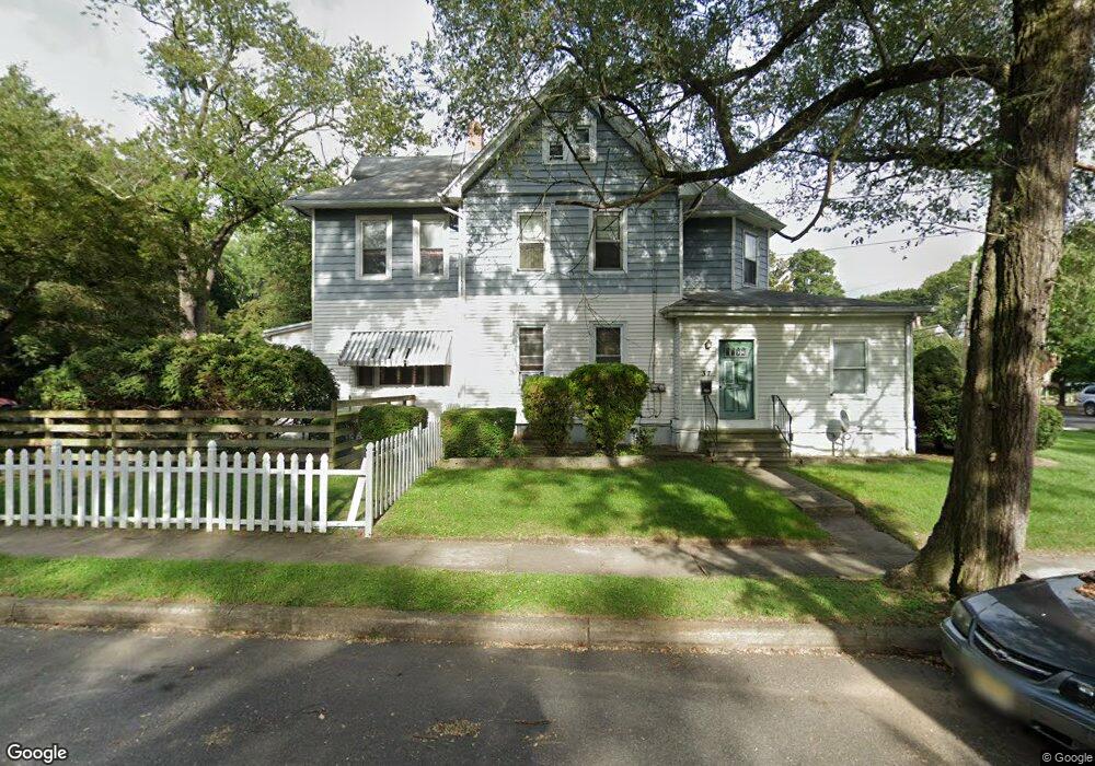
37 W Cedar Ave Merchantville, NJ 08109
Collins Tract NeighborhoodEstimated Value: $321,978 - $421,000
--
Bed
--
Bath
2,287
Sq Ft
$161/Sq Ft
Est. Value
About This Home
This home is located at 37 W Cedar Ave, Merchantville, NJ 08109 and is currently estimated at $368,495, approximately $161 per square foot. 37 W Cedar Ave is a home located in Camden County with nearby schools including Pennsauken High School, St. Peter Elementary School, and St. Cecilia School.
Ownership History
Date
Name
Owned For
Owner Type
Purchase Details
Closed on
May 19, 2022
Sold by
Fusco Joseph M
Bought by
Djaj Properties Llc
Current Estimated Value
Home Financials for this Owner
Home Financials are based on the most recent Mortgage that was taken out on this home.
Original Mortgage
$249,062
Interest Rate
5.09%
Mortgage Type
Construction
Create a Home Valuation Report for This Property
The Home Valuation Report is an in-depth analysis detailing your home's value as well as a comparison with similar homes in the area
Home Values in the Area
Average Home Value in this Area
Purchase History
| Date | Buyer | Sale Price | Title Company |
|---|---|---|---|
| Djaj Properties Llc | $200,000 | New Title Company Name |
Source: Public Records
Mortgage History
| Date | Status | Borrower | Loan Amount |
|---|---|---|---|
| Previous Owner | Djaj Properties Llc | $249,062 |
Source: Public Records
Tax History Compared to Growth
Tax History
| Year | Tax Paid | Tax Assessment Tax Assessment Total Assessment is a certain percentage of the fair market value that is determined by local assessors to be the total taxable value of land and additions on the property. | Land | Improvement |
|---|---|---|---|---|
| 2025 | $6,854 | $290,700 | $67,100 | $223,600 |
| 2024 | $6,722 | $157,500 | $45,300 | $112,200 |
| 2023 | $6,722 | $157,500 | $45,300 | $112,200 |
| 2022 | $6,078 | $157,500 | $45,300 | $112,200 |
| 2021 | $6,242 | $157,500 | $45,300 | $112,200 |
| 2020 | $5,591 | $157,500 | $45,300 | $112,200 |
| 2019 | $5,656 | $157,500 | $45,300 | $112,200 |
| 2018 | $5,686 | $157,500 | $45,300 | $112,200 |
| 2017 | $5,697 | $157,500 | $45,300 | $112,200 |
| 2016 | $5,594 | $157,500 | $45,300 | $112,200 |
| 2015 | $5,761 | $157,500 | $45,300 | $112,200 |
| 2014 | $4,694 | $84,400 | $24,800 | $59,600 |
Source: Public Records
Map
Nearby Homes
- 117 Leslie Ave
- 15 W Walnut Ave
- 6116 Rogers Ave
- 6322 Grant Ave
- 6134 Grant Ave
- 3300 Springfield Ave
- 5532 Whitman Terrace
- 117 E Park Ave
- 6566 Githens Ave
- 6702 Grant Ave
- 6539 Park Ave
- 2263 Hollinshed Ave
- 2254 Hollinshed Ave
- 2418 Norwood Ave
- 129 Maple Terrace
- 210 E Maple Ave Unit B4
- 6902 Walnut Ave
- 6936 Cedar Ave
- 26 Locust St
- 108 Volans St
- 37 W Cedar Ave
- 37 W Cedar Ave Unit B
- 33 W Cedar Ave
- 33 W Cedar Ave
- 31 W Cedar Ave
- 31 W Cedar Ave
- 6175 Cedar Ave
- 6167 Cedar Ave
- 3022 Penn St
- 27 W Cedar Ave
- 27 W Cedar Ave
- 44 W Cedar Ave
- 48 W Cedar Ave
- 40 W Cedar Ave
- 3031 Penn St
- 36 W Cedar Ave
- 28 W Cedar Ave
- 52 W Cedar Ave
- 32 W Cedar Ave
- 6159 Cedar Ave