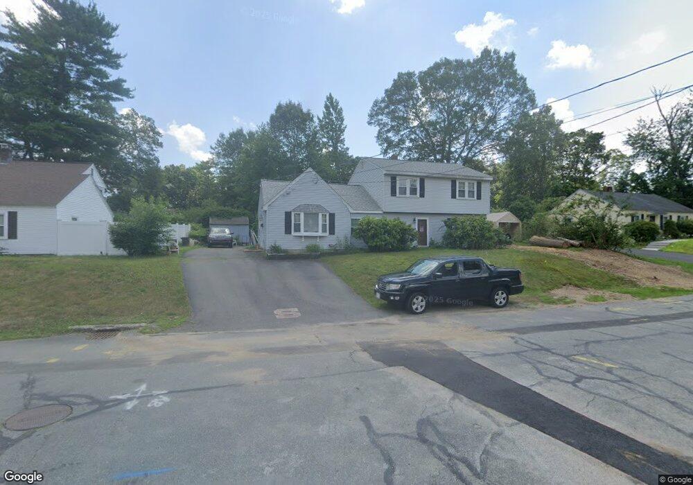
37 Woodbine Rd Stoughton, MA 02072
Estimated Value: $589,297 - $643,000
4
Beds
2
Baths
2,014
Sq Ft
$306/Sq Ft
Est. Value
About This Home
This home is located at 37 Woodbine Rd, Stoughton, MA 02072 and is currently estimated at $616,574, approximately $306 per square foot. 37 Woodbine Rd is a home located in Norfolk County with nearby schools including Wilkins Elementary School, Dr. Robert G. O'Donnell Middle School, and Stoughton High School.
Ownership History
Date
Name
Owned For
Owner Type
Purchase Details
Closed on
Jan 30, 2024
Sold by
Dolan William J and Dolan Dianne J
Bought by
Dolan Ft and Dolan
Current Estimated Value
Purchase Details
Closed on
Sep 15, 1971
Bought by
Dolan William J and Dolan Dianne J
Create a Home Valuation Report for This Property
The Home Valuation Report is an in-depth analysis detailing your home's value as well as a comparison with similar homes in the area
Home Values in the Area
Average Home Value in this Area
Purchase History
| Date | Buyer | Sale Price | Title Company |
|---|---|---|---|
| Dolan Ft | -- | None Available | |
| Dolan Ft | -- | None Available | |
| Dolan Ft | -- | None Available | |
| Dolan William J | -- | -- |
Source: Public Records
Mortgage History
| Date | Status | Borrower | Loan Amount |
|---|---|---|---|
| Previous Owner | Dolan William J | $35,000 | |
| Previous Owner | Dolan William J | $60,000 |
Source: Public Records
Tax History Compared to Growth
Tax History
| Year | Tax Paid | Tax Assessment Tax Assessment Total Assessment is a certain percentage of the fair market value that is determined by local assessors to be the total taxable value of land and additions on the property. | Land | Improvement |
|---|---|---|---|---|
| 2025 | $5,611 | $453,200 | $206,000 | $247,200 |
| 2024 | $5,422 | $425,900 | $187,800 | $238,100 |
| 2023 | $5,362 | $395,700 | $174,500 | $221,200 |
| 2022 | $5,111 | $354,700 | $159,500 | $195,200 |
| 2021 | $4,823 | $319,400 | $144,600 | $174,800 |
| 2020 | $4,623 | $310,500 | $139,600 | $170,900 |
| 2019 | $4,541 | $296,000 | $139,600 | $156,400 |
| 2018 | $4,073 | $275,000 | $132,900 | $142,100 |
| 2017 | $3,851 | $265,800 | $126,300 | $139,500 |
| 2016 | $3,674 | $245,400 | $116,300 | $129,100 |
| 2015 | $3,613 | $238,800 | $109,700 | $129,100 |
| 2014 | $3,493 | $221,900 | $99,700 | $122,200 |
Source: Public Records
Map
Nearby Homes
- 229 Stoughton St
- 32 Doty Dr
- 178 Carey Cir
- 25 Halliden St
- 0 Washington St Unit 72888098
- 0 Washington St Unit 71897113
- 102 Ewing Dr
- 120 Charles Ave
- 163 Pearl St
- 28 Faxon St Unit 4
- 26 Faxon St Unit 2
- 84 Pearl St
- 11 Monk St
- 81 Summer St Unit 1
- 30 Porter St
- 32 Marys Way
- 316 Pleasant St
- 280 Deady Ave
- 6 Grove St
- 43 Elderwood Dr Unit 43
- 29 Woodbine Rd
- 45 Woodbine Rd
- 22 Wellesley Rd
- 30 Wellesley Rd
- 36 Woodbine Rd
- 21 Woodbine Rd
- 16 Wellesley Rd
- 44 Woodbine Rd
- 53 Woodbine Rd
- 28 Woodbine Rd
- 10 Valley Dr
- 13 Valley Dr
- 13 Woodbine Rd
- 22 Woodbine Rd
- 8 Wellesley Rd
- 56 Woodbine Rd
- 67 Woodbine Rd
- 17 Wellesley Rd
- 25 Wellesley Rd
- 31 Wellesley Rd