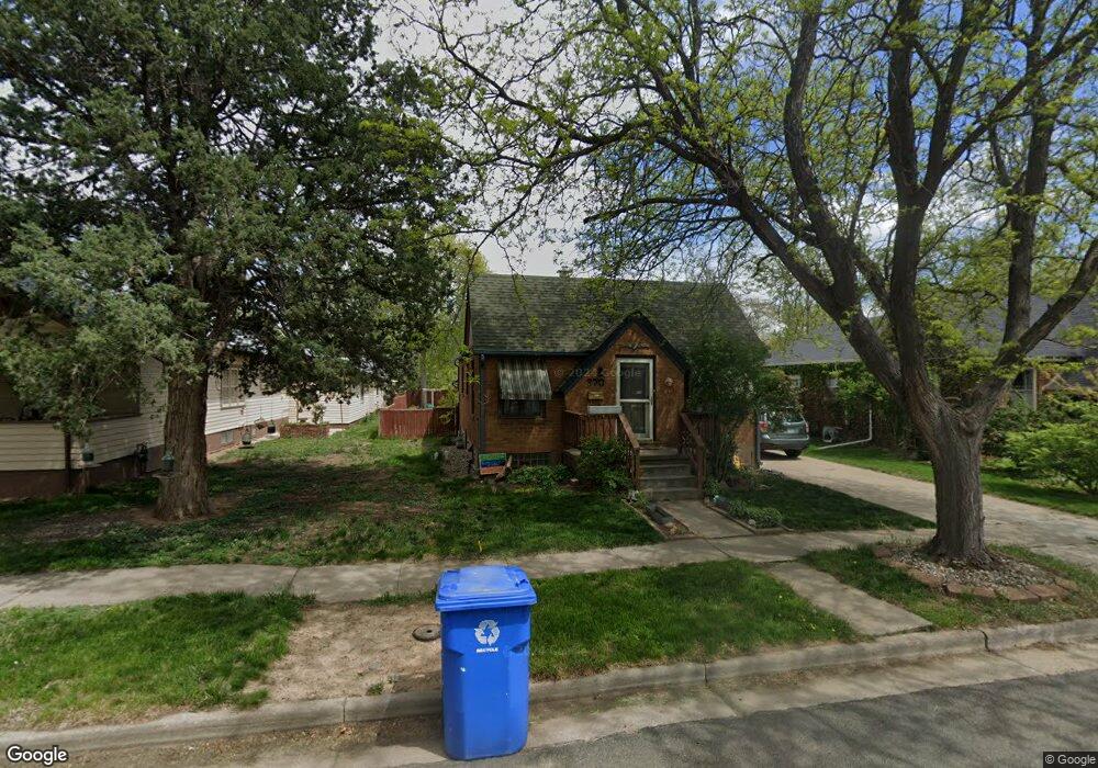
370 Logan Ave Loveland, CO 80537
Estimated Value: $407,410 - $512,000
3
Beds
2
Baths
1,648
Sq Ft
$270/Sq Ft
Est. Value
About This Home
This home is located at 370 Logan Ave, Loveland, CO 80537 and is currently estimated at $444,853, approximately $269 per square foot. 370 Logan Ave is a home located in Larimer County with nearby schools including Garfield Elementary School, Bill Reed Middle School, and Loveland High School.
Ownership History
Date
Name
Owned For
Owner Type
Purchase Details
Closed on
Jun 14, 2002
Sold by
Fruits S Dianne and Dianne Magstadt S
Bought by
Kratzke Peter and Kraver Jeraldine R
Current Estimated Value
Home Financials for this Owner
Home Financials are based on the most recent Mortgage that was taken out on this home.
Original Mortgage
$158,800
Outstanding Balance
$67,192
Interest Rate
6.82%
Estimated Equity
$377,661
Purchase Details
Closed on
May 1, 1990
Bought by
Fruits S Dianne
Create a Home Valuation Report for This Property
The Home Valuation Report is an in-depth analysis detailing your home's value as well as a comparison with similar homes in the area
Home Values in the Area
Average Home Value in this Area
Purchase History
| Date | Buyer | Sale Price | Title Company |
|---|---|---|---|
| Kratzke Peter | $198,500 | -- | |
| Fruits S Dianne | $57,000 | -- |
Source: Public Records
Mortgage History
| Date | Status | Borrower | Loan Amount |
|---|---|---|---|
| Open | Kratzke Peter | $158,800 |
Source: Public Records
Tax History Compared to Growth
Tax History
| Year | Tax Paid | Tax Assessment Tax Assessment Total Assessment is a certain percentage of the fair market value that is determined by local assessors to be the total taxable value of land and additions on the property. | Land | Improvement |
|---|---|---|---|---|
| 2025 | $1,871 | $27,135 | $3,417 | $23,718 |
| 2024 | $1,805 | $27,135 | $3,417 | $23,718 |
| 2022 | $1,879 | $23,610 | $3,545 | $20,065 |
| 2021 | $1,930 | $24,289 | $3,647 | $20,642 |
| 2020 | $1,555 | $19,563 | $3,647 | $15,916 |
| 2019 | $1,529 | $19,563 | $3,647 | $15,916 |
| 2018 | $1,360 | $16,524 | $3,672 | $12,852 |
| 2017 | $1,171 | $16,524 | $3,672 | $12,852 |
| 2016 | $1,103 | $15,037 | $4,060 | $10,977 |
| 2015 | $1,094 | $15,040 | $4,060 | $10,980 |
| 2014 | $1,032 | $13,720 | $4,060 | $9,660 |
Source: Public Records
Map
Nearby Homes
- 610 W 5th St
- 914 W 6th St
- 610 California Ave
- 633 W 6th St
- 680 Colorado Ave
- 721 Sheridan Ave
- 720 Roosevelt Ave
- 625 Harrison Ave
- 604 W 9th St
- 1330 W 6th St
- 905 Harrison Ave
- 643 W 10th St
- 143 W 2nd St
- 1016 Winona Cir
- 1100 N Taft Ave Unit 27
- 621 Split Rock Dr
- 1725 Keyes Ct
- 1667 Taft Gardens Cir
- 416 W 12th St
- 1658 Taft Gardens Cir