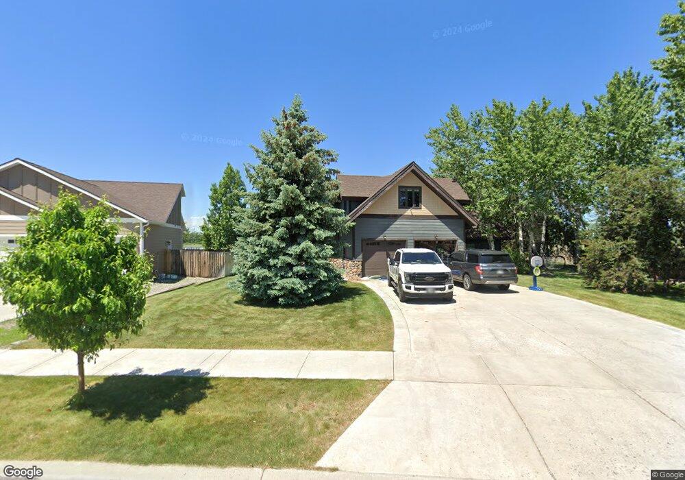
370 Shelter Grove Cir Bozeman, MT 59718
Four Corners NeighborhoodEstimated Value: $895,000 - $946,161
4
Beds
3
Baths
3,222
Sq Ft
$287/Sq Ft
Est. Value
About This Home
This home is located at 370 Shelter Grove Cir, Bozeman, MT 59718 and is currently estimated at $925,054, approximately $287 per square foot. 370 Shelter Grove Cir is a home located in Gallatin County with nearby schools including Monforton Primary School, Monforton Elementary School, and Monforton Junior High School.
Ownership History
Date
Name
Owned For
Owner Type
Purchase Details
Closed on
Aug 22, 2007
Sold by
Valkyrie Llc
Bought by
Hackbarth Travis
Current Estimated Value
Home Financials for this Owner
Home Financials are based on the most recent Mortgage that was taken out on this home.
Original Mortgage
$78,300
Outstanding Balance
$49,753
Interest Rate
6.73%
Mortgage Type
Purchase Money Mortgage
Estimated Equity
$875,301
Create a Home Valuation Report for This Property
The Home Valuation Report is an in-depth analysis detailing your home's value as well as a comparison with similar homes in the area
Home Values in the Area
Average Home Value in this Area
Purchase History
| Date | Buyer | Sale Price | Title Company |
|---|---|---|---|
| Hackbarth Travis | -- | Security Title Company |
Source: Public Records
Mortgage History
| Date | Status | Borrower | Loan Amount |
|---|---|---|---|
| Open | Hackbarth Travis | $78,300 |
Source: Public Records
Tax History Compared to Growth
Tax History
| Year | Tax Paid | Tax Assessment Tax Assessment Total Assessment is a certain percentage of the fair market value that is determined by local assessors to be the total taxable value of land and additions on the property. | Land | Improvement |
|---|---|---|---|---|
| 2025 | $4,801 | $1,157,000 | $0 | $0 |
| 2024 | $5,738 | $1,036,800 | $0 | $0 |
| 2023 | $6,024 | $1,036,800 | $0 | $0 |
| 2022 | $4,111 | $589,400 | $0 | $0 |
| 2021 | $4,596 | $589,400 | $0 | $0 |
| 2020 | $5,306 | $597,100 | $0 | $0 |
| 2019 | $5,256 | $597,100 | $0 | $0 |
| 2018 | $4,456 | $457,800 | $0 | $0 |
| 2017 | $4,093 | $457,800 | $0 | $0 |
| 2016 | $3,852 | $390,200 | $0 | $0 |
| 2015 | $3,729 | $390,200 | $0 | $0 |
| 2014 | $3,369 | $208,343 | $0 | $0 |
Source: Public Records
Map
Nearby Homes
- 51 Forest Grove Ln
- 42 Indian Grove Ln
- 37 Voyager Ln
- 160 Tail Feather Ln Unit D
- 158 Tail Feather Ln Unit C
- 84 Tail Feather Ln Unit B
- 908 Quail Run Rd Unit B
- 20 Prairie Grass Ct Unit B
- 106 Milky Way Dr
- 101 Milky Way Dr
- Lot 2 River Rd
- Lot 5 River Rd
- 27901 Norris Rd Unit 89
- 9200 & 9202 River Rd
- 9200 River Rd
- 223 New Ventures Dr Unit E
- 223 New Ventures Dr Unit D
- 247 New Ventures Dr Unit B
- 26 Locomotive Loop
- 26 Big Chief Trail
- 358 Shelter Grove Cir
- 382 Shelter Grove Cir
- 369 Shelter Grove Cir
- 394 Shelter Grove Cir
- 345 Shelter Grove Cir
- 145 Forest Grove Ln
- 331 Shelter Grove Cir
- 131 Forest Grove Ln
- 414 Shelter Grove Cir
- 113 Forest Grove Ln
- 317 Shelter Grove Cir
- 311 Shelter Grove Cir
- 105 Forest Grove Ln
- 91 Forest Grove Ln
- 132 Forest Grove Ln
- 444 Shelter Grove Cir
- 298 Shelter Grove Cir
- 118 Forest Grove Ln
- 297 Shelter Grove Cir
- 79 Forest Grove Ln