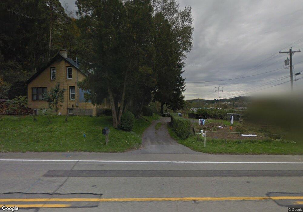
370 State Route 28 and 66 Kittanning, PA 16201
Rayburn Township NeighborhoodEstimated Value: $136,432 - $228,000
3
Beds
1
Bath
1,745
Sq Ft
$106/Sq Ft
Est. Value
About This Home
This home is located at 370 State Route 28 and 66, Kittanning, PA 16201 and is currently estimated at $184,108, approximately $105 per square foot. 370 State Route 28 and 66 is a home with nearby schools including West Hills Intermediate School, West Hills Primary School, and Grace Christian School.
Ownership History
Date
Name
Owned For
Owner Type
Purchase Details
Closed on
Jun 2, 1995
Current Estimated Value
Create a Home Valuation Report for This Property
The Home Valuation Report is an in-depth analysis detailing your home's value as well as a comparison with similar homes in the area
Home Values in the Area
Average Home Value in this Area
Purchase History
| Date | Buyer | Sale Price | Title Company |
|---|---|---|---|
| -- | $45,000 | -- |
Source: Public Records
Tax History Compared to Growth
Tax History
| Year | Tax Paid | Tax Assessment Tax Assessment Total Assessment is a certain percentage of the fair market value that is determined by local assessors to be the total taxable value of land and additions on the property. | Land | Improvement |
|---|---|---|---|---|
| 2025 | $1,847 | $21,130 | $14,220 | $6,910 |
| 2024 | $1,741 | $21,130 | $14,220 | $6,910 |
| 2023 | $1,674 | $21,130 | $14,220 | $6,910 |
| 2022 | $1,674 | $21,130 | $14,220 | $6,910 |
| 2021 | $1,674 | $21,130 | $14,220 | $6,910 |
| 2020 | $1,674 | $21,130 | $14,220 | $6,910 |
| 2019 | $1,674 | $21,130 | $14,220 | $6,910 |
| 2018 | $1,652 | $20,315 | $10,445 | $9,870 |
| 2017 | $1,639 | $21,130 | $14,220 | $6,910 |
| 2016 | $1,639 | $21,130 | $14,220 | $6,910 |
| 2015 | $1,166 | $21,130 | $14,220 | $6,910 |
| 2014 | $1,166 | $21,130 | $14,220 | $6,910 |
Source: Public Records
Map
Nearby Homes
- 142.19 Acs Along Elkin & Beck Roads
- 0 Cadogen Slatelick Unit 1702842
- 293 Troy Hill Rd
- 119 6th St
- 117 Red Mill Rd
- 166 Clearfield Pike
- 139 Oak Ave
- 435 1/2 Reesman Dr Unit 2
- 114 S Mckean St
- 143 N Grant Ave
- 136 Queen St
- 156 S Jefferson St
- 614 Woodward Ave
- 414 North Ave
- 1017 Johnston Ave
- 422-424 Highland Ave
- 509 N Jefferson St
- 203-205 Maple St
- 176 Wray Plan Rd
- 1033 Wilson Ave
- 364 State Route 28 and 66
- 117 Mcgregor Rd
- 380 State Route 28 and 66
- 366 State Route 28 and 66
- 390 State Route 28 and 66
- 142 Stitt Gray Rd
- 151 Staleys Dr
- 122 Stover Rd
- 122 Stover Rd
- 11930 State Route 85
- 168 Poverty Hill Rd
- 182 Poverty Hill Rd
- 473 Troy Hill Rd
- 169 Poverty Hill Rd
- 115 Stitt Gray Rd
- 461 Troy Hill Rd
- 455 Troy Hill Rd
- 11931 State Route 85
- 188 Poverty Hill Rd
- 11931 Pennsylvania 85