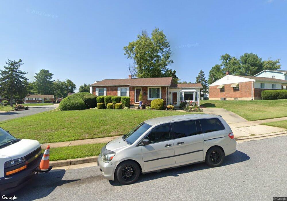
3700 Hamor Ct Randallstown, MD 21133
Estimated Value: $327,764 - $356,000
--
Bed
2
Baths
1,204
Sq Ft
$286/Sq Ft
Est. Value
About This Home
This home is located at 3700 Hamor Ct, Randallstown, MD 21133 and is currently estimated at $344,691, approximately $286 per square foot. 3700 Hamor Ct is a home located in Baltimore County with nearby schools including Randallstown Elementary School, Deer Park Middle Magnet School, and Randallstown High School.
Ownership History
Date
Name
Owned For
Owner Type
Purchase Details
Closed on
Oct 12, 2006
Sold by
Grimes John E
Bought by
Cheek Trene D
Current Estimated Value
Home Financials for this Owner
Home Financials are based on the most recent Mortgage that was taken out on this home.
Original Mortgage
$270,000
Outstanding Balance
$161,203
Interest Rate
6.47%
Mortgage Type
Purchase Money Mortgage
Estimated Equity
$183,488
Purchase Details
Closed on
Sep 28, 2006
Sold by
Grimes John E
Bought by
Cheek Trene D
Home Financials for this Owner
Home Financials are based on the most recent Mortgage that was taken out on this home.
Original Mortgage
$270,000
Outstanding Balance
$161,203
Interest Rate
6.47%
Mortgage Type
Purchase Money Mortgage
Estimated Equity
$183,488
Purchase Details
Closed on
May 30, 1997
Sold by
Hitchman Cleveland A
Bought by
Grimes John E and Grimes Shanta E
Purchase Details
Closed on
Nov 10, 1976
Sold by
Zamojski Robert S
Bought by
Hitchman Cleveland A
Create a Home Valuation Report for This Property
The Home Valuation Report is an in-depth analysis detailing your home's value as well as a comparison with similar homes in the area
Home Values in the Area
Average Home Value in this Area
Purchase History
| Date | Buyer | Sale Price | Title Company |
|---|---|---|---|
| Cheek Trene D | $270,000 | -- | |
| Cheek Trene D | $270,000 | -- | |
| Grimes John E | $109,900 | -- | |
| Hitchman Cleveland A | $40,000 | -- |
Source: Public Records
Mortgage History
| Date | Status | Borrower | Loan Amount |
|---|---|---|---|
| Open | Cheek Trene D | $270,000 | |
| Closed | Cheek Trene D | $270,000 |
Source: Public Records
Tax History Compared to Growth
Tax History
| Year | Tax Paid | Tax Assessment Tax Assessment Total Assessment is a certain percentage of the fair market value that is determined by local assessors to be the total taxable value of land and additions on the property. | Land | Improvement |
|---|---|---|---|---|
| 2025 | $3,560 | $245,867 | -- | -- |
| 2024 | $3,560 | $221,600 | $74,300 | $147,300 |
| 2023 | $1,743 | $210,233 | $0 | $0 |
| 2022 | $3,349 | $198,867 | $0 | $0 |
| 2021 | $3,395 | $187,500 | $56,300 | $131,200 |
| 2020 | $3,395 | $182,967 | $0 | $0 |
| 2019 | $3,100 | $178,433 | $0 | $0 |
| 2018 | $3,007 | $173,900 | $56,300 | $117,600 |
| 2017 | $3,314 | $166,733 | $0 | $0 |
| 2016 | $3,184 | $159,567 | $0 | $0 |
| 2015 | $3,184 | $152,400 | $0 | $0 |
| 2014 | $3,184 | $152,400 | $0 | $0 |
Source: Public Records
Map
Nearby Homes
- 3805 Terka Cir
- 9044 Allenswood Rd
- 3816 Cassandra Rd
- 9202 Samoset Rd
- 3705 Allenswood Ct
- 9303 Samoset Rd
- 9112 Meadow Heights Rd
- 9124 Liberty Rd
- 8908 Meadow Heights Rd
- 1205/99 Winands Rd
- 3506 Bayer Ave
- 9105 Amber Oaks Way
- 1 Rock Story Ct
- 9101 Amber Oaks Way
- 3907 Roxanne Rd
- 3418 Carroll Ave
- 3402 Offutt Rd
- 8829 Sigrid Rd
- 3332 Offutt Rd
- 8806 Gilly Way Unit D