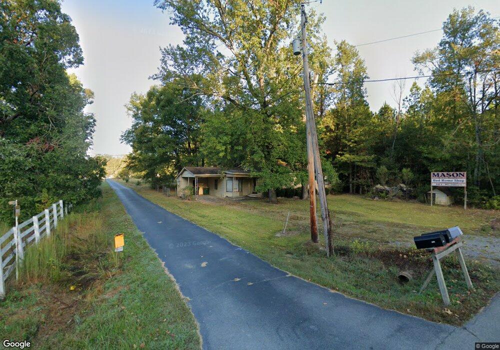
3700 S Bowman Rd Little Rock, AR 72211
Western Little Rock NeighborhoodEstimated Value: $128,447 - $216,000
--
Bed
1
Bath
1,282
Sq Ft
$140/Sq Ft
Est. Value
About This Home
This home is located at 3700 S Bowman Rd, Little Rock, AR 72211 and is currently estimated at $179,612, approximately $140 per square foot. 3700 S Bowman Rd is a home located in Pulaski County with nearby schools including J.A. Fair K8 Preparatory School, Henderson Middle School, and Little Rock Southwest High School.
Ownership History
Date
Name
Owned For
Owner Type
Purchase Details
Closed on
Jul 16, 1999
Sold by
Hud
Bought by
Mason John W and Mason Ien L
Current Estimated Value
Purchase Details
Closed on
Feb 17, 1999
Sold by
First Union Mtg Corp
Bought by
Hud
Purchase Details
Closed on
Feb 9, 1999
Sold by
Wilson & Associates P L L C
Bought by
First Union Mtg Corp
Purchase Details
Closed on
Jun 2, 1998
Sold by
Wilson & Associates P L L C
Bought by
First Union Mtg Corp
Create a Home Valuation Report for This Property
The Home Valuation Report is an in-depth analysis detailing your home's value as well as a comparison with similar homes in the area
Home Values in the Area
Average Home Value in this Area
Purchase History
| Date | Buyer | Sale Price | Title Company |
|---|---|---|---|
| Mason John W | -- | United Abstract & Title Co | |
| Hud | -- | -- | |
| First Union Mtg Corp | $61,997 | -- | |
| First Union Mtg Corp | $52,439 | -- |
Source: Public Records
Tax History Compared to Growth
Tax History
| Year | Tax Paid | Tax Assessment Tax Assessment Total Assessment is a certain percentage of the fair market value that is determined by local assessors to be the total taxable value of land and additions on the property. | Land | Improvement |
|---|---|---|---|---|
| 2024 | $1,134 | $22,034 | $912 | $21,122 |
| 2023 | $1,134 | $22,034 | $912 | $21,122 |
| 2022 | $1,040 | $22,034 | $912 | $21,122 |
| 2021 | $952 | $13,500 | $220 | $13,280 |
| 2020 | $945 | $13,500 | $220 | $13,280 |
| 2019 | $945 | $13,500 | $220 | $13,280 |
| 2018 | $945 | $13,500 | $220 | $13,280 |
| 2017 | $945 | $13,500 | $220 | $13,280 |
| 2016 | $1,000 | $14,290 | $830 | $13,460 |
| 2015 | $995 | $14,290 | $830 | $13,460 |
| 2014 | $995 | $14,190 | $830 | $13,360 |
Source: Public Records
Map
Nearby Homes
- 12 Summer Ridge Ct
- 2 Cottonwood Ct
- 12425 Brodie Creek Trail
- 10 Summerhill Ct
- 000 Colonel Glenn Ct
- 0 Colonel Glenn Ct
- 12 Woodfern Dr
- 00 S Shackleford Rd
- 2612 Peach Tree Dr
- 9 Winterfern Cove
- 3818 S Shackleford Rd
- 2806 Woodsgate Dr
- 2820 Mossy Creek Dr
- 2904 Sweetgrass Dr
- 12700 Lawson Rd
- 13320 Colonel Glenn Rd
- 2905 Woodsgate Dr
- 11612 Shady Creek Dr
- 11701 Shady Creek Dr
- 3015 Woodsgate Dr
- 3701 S Bowman Rd
- 3701 & 3707 Bowman Rd
- 3707 S Bowman Rd
- 11921 W 36th St
- 3600 S Bowman Rd
- 11915 W 36th St
- 3801 S Bowman Rd
- 11901 W 36th St
- 3805 S Bowman Rd
- 3510 S Bowman Rd
- 11821 W 36th St
- 11801 W 36th St
- 11701 W 36th St
- 3710 S Bowman Rd
- 3500 S Bowman Rd
- 11623 W 36th St
- 11624 W 36th St
- 4200 Bowman Rd
- 4100 Bowman Rd
- 3321 S Bowman Rd