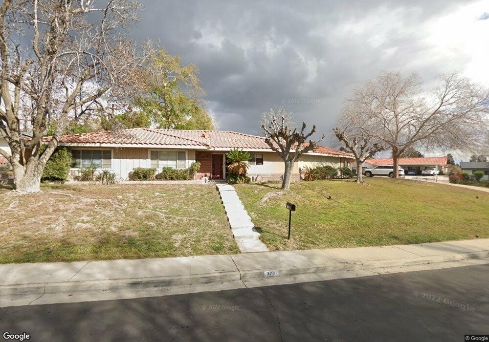
3701 Dalehurst Dr Bakersfield, CA 93306
Bakersfield Country Club NeighborhoodEstimated Value: $401,086 - $434,000
4
Beds
2
Baths
2,069
Sq Ft
$199/Sq Ft
Est. Value
About This Home
This home is located at 3701 Dalehurst Dr, Bakersfield, CA 93306 and is currently estimated at $411,772, approximately $199 per square foot. 3701 Dalehurst Dr is a home located in Kern County with nearby schools including Harding Elementary School, Compton Junior High School, and East Bakersfield High School.
Ownership History
Date
Name
Owned For
Owner Type
Purchase Details
Closed on
Nov 3, 2015
Sold by
Curtis Alvis Dee and Curtis Norma L
Bought by
The Curtis Family Trust
Current Estimated Value
Purchase Details
Closed on
Sep 7, 2011
Sold by
Jones Sharon E and Souza Vicki L
Bought by
Curtis Alvis Dee and Curtis Norma L
Create a Home Valuation Report for This Property
The Home Valuation Report is an in-depth analysis detailing your home's value as well as a comparison with similar homes in the area
Home Values in the Area
Average Home Value in this Area
Purchase History
| Date | Buyer | Sale Price | Title Company |
|---|---|---|---|
| The Curtis Family Trust | -- | None Available | |
| Curtis Alvis Dee | $160,000 | First American Title Company |
Source: Public Records
Tax History
| Year | Tax Paid | Tax Assessment Tax Assessment Total Assessment is a certain percentage of the fair market value that is determined by local assessors to be the total taxable value of land and additions on the property. | Land | Improvement |
|---|---|---|---|---|
| 2025 | $3,659 | $232,356 | $75,357 | $156,999 |
| 2024 | $3,569 | $227,801 | $73,880 | $153,921 |
| 2023 | $3,569 | $223,335 | $72,432 | $150,903 |
| 2022 | $3,460 | $218,957 | $71,012 | $147,945 |
| 2021 | $3,347 | $214,665 | $69,620 | $145,045 |
| 2020 | $3,307 | $212,465 | $68,907 | $143,558 |
| 2019 | $3,218 | $212,465 | $68,907 | $143,558 |
| 2018 | $3,135 | $204,217 | $66,232 | $137,985 |
| 2017 | $3,081 | $200,214 | $64,934 | $135,280 |
| 2016 | $2,720 | $196,289 | $63,661 | $132,628 |
| 2015 | $2,715 | $193,341 | $62,705 | $130,636 |
| 2014 | $2,620 | $189,555 | $61,477 | $128,078 |
Source: Public Records
Map
Nearby Homes
- 3531 Country Club Dr
- 2504 Kent Dr
- 5205 Lansdale Dr
- 5008 College Ave
- 5208 Greenbrier Ave
- 1815 Ridgewood Dr
- 1904 Ridgewood Dr
- 1757 Oswell St
- 1812 Country Club Dr
- 0 Claremont Dr
- 3136 Saratoga St
- 3131 Saratoga St
- 2100 Kent Dr
- 3625 Bernard St Unit 5
- 1800 Country Club Dr
- 3017 Saratoga St
- 2814 College Ave
- 3112 Ridgedale St
- 2904 Glenwood Cir
- 1733 Crestmont Dr
- 5216 Montecito Dr
- 3751 Dalehurst Dr
- 5124 Montecito Dr
- 3720 Dalehurst Dr
- 5207 Montecito Dr
- 3734 Dalehurst Dr
- 5222 Montecito Dr
- 5213 Montecito Dr
- 5201 Montecito Dr
- 3750 Dalehurst Dr
- 5201 Kent Dr
- 5114 Montecito Dr
- 5219 Montecito Dr
- 3774 Dalehurst Dr
- 5207 Kent Dr
- 5228 Montecito Dr
- 3616 Dalehurst Dr
- 5225 Montecito Dr
- 5108 Montecito Dr
- 3626 Country Club Dr
Your Personal Tour Guide
Ask me questions while you tour the home.