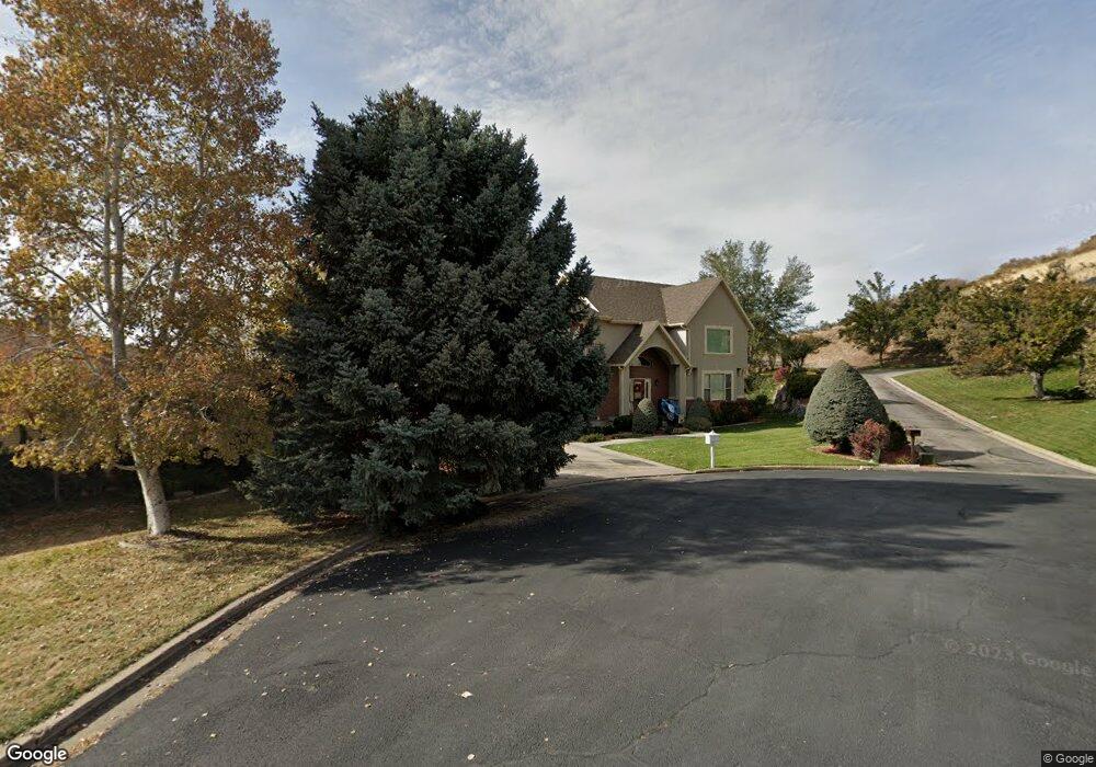
3701 N 920 E Provo, UT 84604
Rock Canyon NeighborhoodEstimated Value: $1,003,548 - $1,252,000
5
Beds
5
Baths
5,179
Sq Ft
$214/Sq Ft
Est. Value
About This Home
This home is located at 3701 N 920 E, Provo, UT 84604 and is currently estimated at $1,109,387, approximately $214 per square foot. 3701 N 920 E is a home located in Utah County with nearby schools including Edgemont School, Centennial Middle School, and Timpview High School.
Ownership History
Date
Name
Owned For
Owner Type
Purchase Details
Closed on
Feb 4, 2016
Sold by
Smith Daniel A
Bought by
Mcvey Patrick T and Mcvey Ann M
Current Estimated Value
Home Financials for this Owner
Home Financials are based on the most recent Mortgage that was taken out on this home.
Original Mortgage
$388,000
Outstanding Balance
$309,607
Interest Rate
3.98%
Mortgage Type
New Conventional
Estimated Equity
$799,780
Purchase Details
Closed on
Sep 8, 2015
Sold by
Smith Lily C
Bought by
Smith Daniel A and The Daniel Lowry Smith & Lily Croan Smit
Purchase Details
Closed on
Jun 11, 2008
Sold by
Bevan Wayne R
Bought by
Smith D Lowry and Smith Lily C
Home Financials for this Owner
Home Financials are based on the most recent Mortgage that was taken out on this home.
Original Mortgage
$390,000
Interest Rate
6.05%
Mortgage Type
Purchase Money Mortgage
Purchase Details
Closed on
May 15, 2008
Sold by
Mcconkie Jessie R
Bought by
Bevan Wayne R and Investment Health
Home Financials for this Owner
Home Financials are based on the most recent Mortgage that was taken out on this home.
Original Mortgage
$390,000
Interest Rate
6.05%
Mortgage Type
Purchase Money Mortgage
Purchase Details
Closed on
Nov 22, 2005
Sold by
Red Walter Edward and Red Joann
Bought by
Mcconkie Jessie R
Home Financials for this Owner
Home Financials are based on the most recent Mortgage that was taken out on this home.
Original Mortgage
$155,000
Interest Rate
5.93%
Mortgage Type
Seller Take Back
Purchase Details
Closed on
Feb 28, 2000
Sold by
Manning Stanley D and Manning Nancy Lou
Bought by
Red Walter Edward and Red Joann
Home Financials for this Owner
Home Financials are based on the most recent Mortgage that was taken out on this home.
Original Mortgage
$178,000
Interest Rate
8.37%
Mortgage Type
Purchase Money Mortgage
Purchase Details
Closed on
Jul 9, 1999
Sold by
Gallentine Dale P
Bought by
Manning Stanley D and Manning Nancy Lou
Create a Home Valuation Report for This Property
The Home Valuation Report is an in-depth analysis detailing your home's value as well as a comparison with similar homes in the area
Home Values in the Area
Average Home Value in this Area
Purchase History
| Date | Buyer | Sale Price | Title Company |
|---|---|---|---|
| Mcvey Patrick T | -- | Summit Escrow & Title | |
| Smith Daniel A | -- | None Available | |
| Smith D Lowry | -- | Action Title Company | |
| Bevan Wayne R | -- | Action Title Company | |
| Mcconkie Jessie R | -- | Action Title Company | |
| Red Walter Edward | -- | Mountain West Title Co | |
| Manning Stanley D | -- | Mountain West Title Co |
Source: Public Records
Mortgage History
| Date | Status | Borrower | Loan Amount |
|---|---|---|---|
| Open | Mcvey Patrick T | $388,000 | |
| Previous Owner | Smith D Lowry | $390,000 | |
| Previous Owner | Bevan Wayne R | $476,086 | |
| Previous Owner | Mcconkie Jessie R | $155,000 | |
| Previous Owner | Red Walter Edward | $178,000 |
Source: Public Records
Tax History
| Year | Tax Paid | Tax Assessment Tax Assessment Total Assessment is a certain percentage of the fair market value that is determined by local assessors to be the total taxable value of land and additions on the property. | Land | Improvement |
|---|---|---|---|---|
| 2025 | $1,255 | $440,660 | -- | -- |
| 2024 | $1,255 | $426,910 | $0 | $0 |
| 2023 | $1,063 | $390,885 | $0 | $0 |
| 2022 | $2,116 | $377,410 | $0 | $0 |
| 2021 | $1,300 | $522,600 | $185,400 | $337,200 |
| 2020 | $1,221 | $491,800 | $161,200 | $330,600 |
| 2019 | $2,962 | $492,800 | $162,200 | $330,600 |
| 2018 | $1,215 | $489,100 | $158,500 | $330,600 |
| 2017 | $1,171 | $261,800 | $0 | $0 |
| 2016 | -- | $249,425 | $0 | $0 |
| 2015 | $2,717 | $237,325 | $0 | $0 |
| 2014 | $2,531 | $230,505 | $0 | $0 |
Source: Public Records
Map
Nearby Homes
- 3702 N 920 E
- 3711 N Canyon Rd
- 3250 Mohawk Ln
- 407 E 3900 Rd N Unit 1
- 407 E 3900 Rd N
- 4006 Sherwood Dr
- 5600 N Canyon Rd
- 3129 Cherokee Ln
- 981 Waterford Dr Unit 5&6
- 299 E 4000 N
- 4299 Ivy Ln
- 3043 Bannock Dr
- 4277 N Imperial Way Unit 347
- 758 E 3030 N
- 4601 Foothill Dr
- 4529 Windsor Dr
- 4606 Brookshire Cir
- 3025 N 250 E
- 645 Foothill Dr
- 4640 Brookshire Cir
- 3601 N 920 E Unit 56
- 3676 N 870 E
- 3687 N 920 E
- 3712 N 920 E
- 895 Quail Valley Dr
- 3709 N 920 E
- 3700 N 920 E Unit 54
- 3700 N 920 E
- 927 Quail Valley Dr
- 883 Quail Valley Dr
- 3687 N 870 E
- 3725 N 970 E
- 3713 N 970 E
- 3682 N 870 E Unit 1
- 3675 N 870 E
- 3804 Quail Summit Dr
- 3804 N Quail Summit Ln
- 890 Quail Valley Dr
- 870 E 3750 N
- 3663 N 870 E
Your Personal Tour Guide
Ask me questions while you tour the home.