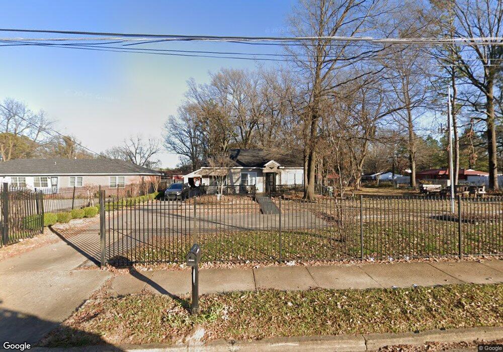
3702 Millbranch Rd Memphis, TN 38116
Whitehaven NeighborhoodEstimated Value: $96,564 - $125,000
3
Beds
1
Bath
986
Sq Ft
$109/Sq Ft
Est. Value
About This Home
This home is located at 3702 Millbranch Rd, Memphis, TN 38116 and is currently estimated at $107,891, approximately $109 per square foot. 3702 Millbranch Rd is a home located in Shelby County with nearby schools including Robert R. Church Elementary School, A. Maceo Walker Middle School, and Freedom Preparatory Academy Elementary School.
Ownership History
Date
Name
Owned For
Owner Type
Purchase Details
Closed on
Jan 31, 2003
Sold by
Shepherd John S and Rutherford Glenn A
Bought by
Brown Ester
Current Estimated Value
Home Financials for this Owner
Home Financials are based on the most recent Mortgage that was taken out on this home.
Original Mortgage
$48,000
Interest Rate
7%
Purchase Details
Closed on
Oct 30, 2001
Sold by
Cousins Henry B and Moon Jeffrey D
Bought by
Shepherd John S and Rutherford Glenn A
Purchase Details
Closed on
Oct 27, 1995
Bought by
Rutherford G A G and Rutherford Sheph S
Create a Home Valuation Report for This Property
The Home Valuation Report is an in-depth analysis detailing your home's value as well as a comparison with similar homes in the area
Home Values in the Area
Average Home Value in this Area
Purchase History
| Date | Buyer | Sale Price | Title Company |
|---|---|---|---|
| Brown Ester | $50,000 | -- | |
| Shepherd John S | -- | -- | |
| Rutherford G A G | $27,000 | -- |
Source: Public Records
Mortgage History
| Date | Status | Borrower | Loan Amount |
|---|---|---|---|
| Closed | Brown Ester | $48,000 |
Source: Public Records
Tax History Compared to Growth
Tax History
| Year | Tax Paid | Tax Assessment Tax Assessment Total Assessment is a certain percentage of the fair market value that is determined by local assessors to be the total taxable value of land and additions on the property. | Land | Improvement |
|---|---|---|---|---|
| 2025 | $366 | $17,125 | $4,125 | $13,000 |
| 2024 | $366 | $10,800 | $3,500 | $7,300 |
| 2023 | $658 | $10,800 | $3,500 | $7,300 |
| 2022 | $658 | $10,800 | $3,500 | $7,300 |
| 2021 | $666 | $10,800 | $3,500 | $7,300 |
| 2020 | $629 | $8,675 | $3,500 | $5,175 |
| 2019 | $629 | $8,675 | $3,500 | $5,175 |
| 2018 | $629 | $8,675 | $3,500 | $5,175 |
| 2017 | $357 | $8,675 | $3,500 | $5,175 |
| 2016 | $246 | $5,625 | $0 | $0 |
| 2014 | $246 | $5,625 | $0 | $0 |
Source: Public Records
Map
Nearby Homes
- 3687 Windcrest Rd
- 3779 Mickey Dr
- 3804 Cazassa Rd
- 1811 Dale Lavern Rd
- 1460 Lehr Dr
- 1950 Victoria Ave
- 1718 Borden Dr
- 1435 Blueberry Dr
- 3639 Huckleberry St
- 3979 Wisteria Dr
- 1358 Old Hickory Rd
- 1406 Randall Dr
- 1328 Old Hickory Rd
- 3693 Hermitage Dr
- 1277 Singing Trees Dr
- 1534 E Raines Rd
- 1268 Royal Oaks Cove
- 3898 Barton Dr
- 1327 David Dr
- 4425 Faronia Dr
- 3694 Millbranch Rd
- 1724 Berwind Rd
- 1705 Berwind Rd
- 1717 Berwind Rd
- 1717 Victoria Rd
- 1727 Victoria Rd
- 3721 Millbranch Rd
- 1727 Berwind Rd
- 1735 Victoria Rd
- 1742 Berwind Rd
- 3672 Millbranch Rd
- 1737 Berwind Rd
- 1743 Victoria Rd
- 1716 Victoria Rd
- 1750 Berwind Rd
- 1726 Victoria Rd
- 3664 Millbranch Rd
- 1745 Berwind Rd
- 1751 Victoria Rd
- 1751 Victoria Ave