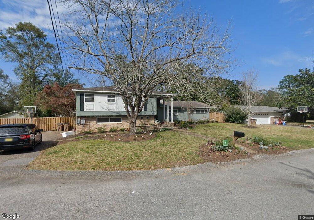
3704 Kimberly Cir Mobile, AL 36608
College Park NeighborhoodEstimated Value: $490,000 - $653,000
4
Beds
4
Baths
2,280
Sq Ft
$244/Sq Ft
Est. Value
About This Home
This home is located at 3704 Kimberly Cir, Mobile, AL 36608 and is currently estimated at $557,065, approximately $244 per square foot. 3704 Kimberly Cir is a home located in Mobile County with nearby schools including Mary B. Austin Elementary School, CL Scarborough Middle School, and Murphy High School.
Ownership History
Date
Name
Owned For
Owner Type
Purchase Details
Closed on
Dec 23, 2019
Sold by
Andrews Martin W and Andrews Charlotte
Bought by
Steele David Fitzgerald and Steele Emily Page
Current Estimated Value
Home Financials for this Owner
Home Financials are based on the most recent Mortgage that was taken out on this home.
Original Mortgage
$420,000
Outstanding Balance
$367,887
Interest Rate
3.6%
Mortgage Type
Future Advance Clause Open End Mortgage
Estimated Equity
$189,178
Purchase Details
Closed on
Sep 4, 2012
Sold by
Johnston Vivian G
Bought by
Andrews Martin W and Andrews Charlotte
Purchase Details
Closed on
Nov 24, 1998
Sold by
Potter Thomas J
Bought by
Tew John T and Tew Kimberly A
Home Financials for this Owner
Home Financials are based on the most recent Mortgage that was taken out on this home.
Original Mortgage
$152,000
Interest Rate
6.37%
Create a Home Valuation Report for This Property
The Home Valuation Report is an in-depth analysis detailing your home's value as well as a comparison with similar homes in the area
Home Values in the Area
Average Home Value in this Area
Purchase History
| Date | Buyer | Sale Price | Title Company |
|---|---|---|---|
| Steele David Fitzgerald | $420,000 | None Available | |
| Andrews Martin W | $8,000 | None Available | |
| Tew John T | -- | -- |
Source: Public Records
Mortgage History
| Date | Status | Borrower | Loan Amount |
|---|---|---|---|
| Open | Steele David Fitzgerald | $420,000 | |
| Previous Owner | Tew John T | $152,000 |
Source: Public Records
Tax History
| Year | Tax Paid | Tax Assessment Tax Assessment Total Assessment is a certain percentage of the fair market value that is determined by local assessors to be the total taxable value of land and additions on the property. | Land | Improvement |
|---|---|---|---|---|
| 2025 | $2,660 | $42,770 | $8,000 | $34,770 |
| 2024 | $2,660 | $40,190 | $8,000 | $32,190 |
| 2023 | $2,496 | $39,880 | $8,000 | $31,880 |
| 2022 | $2,436 | $38,340 | $8,000 | $30,340 |
| 2021 | $4,724 | $74,400 | $16,000 | $58,400 |
| 2020 | $1,796 | $29,330 | $8,000 | $21,330 |
| 2019 | $1,679 | $27,500 | $0 | $0 |
| 2018 | $1,679 | $27,500 | $0 | $0 |
| 2017 | $1,679 | $27,500 | $0 | $0 |
| 2016 | $1,468 | $24,180 | $0 | $0 |
| 2013 | $1,528 | $24,640 | $0 | $0 |
Source: Public Records
Map
Nearby Homes
- 323 Dalewood Dr
- 949 Knowles Ln
- 1100 Bristol Ct
- 559 Brawood Dr
- 506 Mann Dr
- 259 Dilston Ln
- 305 Springwood Dr N
- 21 Provident Ln
- 1121 Stevens Ln
- 407 Stillwood Ln
- 3615 Stein St
- 1124 Forest Glen Dr N
- 8 Lancaster Rd
- 4009 Old Shell Rd Unit E12
- 4009 Old Shell Rd Unit C 14
- 132 Batre Ln
- 3503 Spring Hill Ave
- 13 Princess Anne Rd
- 7230 Old Shell Rd
- 4719 Oxford Dr
- 607 Tuthill Ln
- 3705 Tudor Ln
- 3708 Kimberly Cir
- 611 Tuthill Ln
- 3705 Kimberly Cir
- 3709 Tudor Ln
- 3710 Kimberly Cir
- 3709 Kimberly Cir
- 603 Tuthill Ln
- 608 Tuthill Ln
- 3704 Tudor Ln
- 612 Tuthill Ln
- 617 Tuthill Ln
- 602 Tuthill Ln
- 3713 Tudor Ln
- 616 Tuthill Ln
- 3721 Dunstan Ct
- 3725 Dunstan Ct
- 620 Tudor Ln
- 600 Tuthill Ln
Your Personal Tour Guide
Ask me questions while you tour the home.