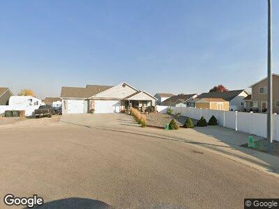
3705 Hoback Ave Gillette, WY 82718
Estimated Value: $319,000 - $384,549
4
Beds
3
Baths
1,355
Sq Ft
$262/Sq Ft
Est. Value
About This Home
This home is located at 3705 Hoback Ave, Gillette, WY 82718 and is currently estimated at $355,137, approximately $262 per square foot. 3705 Hoback Ave is a home located in Campbell County with nearby schools including Westwood High School, Sunflower Elementary School, and Sage Valley Junior High School.
Ownership History
Date
Name
Owned For
Owner Type
Purchase Details
Closed on
Oct 26, 2020
Sold by
Dennison Michael G
Bought by
Lang Rod Alan and Lang Suzy Michelle
Current Estimated Value
Home Financials for this Owner
Home Financials are based on the most recent Mortgage that was taken out on this home.
Original Mortgage
$256,500
Outstanding Balance
$233,904
Interest Rate
2.8%
Mortgage Type
New Conventional
Purchase Details
Closed on
Dec 17, 2008
Sold by
Monument Homebuilders Inc
Bought by
Dennison Michael G
Home Financials for this Owner
Home Financials are based on the most recent Mortgage that was taken out on this home.
Original Mortgage
$260,022
Interest Rate
6.19%
Mortgage Type
FHA
Create a Home Valuation Report for This Property
The Home Valuation Report is an in-depth analysis detailing your home's value as well as a comparison with similar homes in the area
Home Values in the Area
Average Home Value in this Area
Purchase History
| Date | Buyer | Sale Price | Title Company |
|---|---|---|---|
| Lang Rod Alan | -- | First American Title | |
| Dennison Michael G | $275,500 | None Available | |
| Monument Homebuilders Inc | -- | None Available |
Source: Public Records
Mortgage History
| Date | Status | Borrower | Loan Amount |
|---|---|---|---|
| Open | Lang Rod Alan | $256,500 | |
| Previous Owner | Dennison Michael G | $238,399 | |
| Previous Owner | Dennison Michael G | $260,022 |
Source: Public Records
Tax History Compared to Growth
Tax History
| Year | Tax Paid | Tax Assessment Tax Assessment Total Assessment is a certain percentage of the fair market value that is determined by local assessors to be the total taxable value of land and additions on the property. | Land | Improvement |
|---|---|---|---|---|
| 2024 | $2,207 | $31,384 | $6,401 | $24,983 |
| 2023 | $2,221 | $31,575 | $6,401 | $25,174 |
| 2022 | $1,891 | $26,808 | $4,786 | $22,022 |
| 2021 | $0 | $25,502 | $4,786 | $20,716 |
| 2020 | $1,558 | $22,888 | $4,786 | $18,102 |
| 2019 | $1,538 | $22,652 | $4,786 | $17,866 |
| 2018 | $1,488 | $22,002 | $4,786 | $17,216 |
| 2017 | $1,658 | $24,576 | $7,054 | $17,522 |
| 2016 | $1,646 | $24,365 | $4,560 | $19,805 |
| 2015 | -- | $23,102 | $4,560 | $18,542 |
| 2014 | -- | $22,824 | $4,560 | $18,264 |
Source: Public Records
Map
Nearby Homes
- 3801 Red Lodge Dr
- 3805 Red Lodge Dr
- 162 Royal Cir
- 158 Royal Cir
- 166 Royal Cir
- 154 Royal Cir
- 150 Royal Cir
- 1 Parkside Cir
- 146 Royal Cir
- 142 Royal Cir
- 170 Royal Cir
- 138 Royal Cir
- 134 Royal Cir
- 130 Royal Cir
- 167 Royal Cir
- 126 Royal Cir
- 174 Royal Cir
- 103 Wolf Creek Ln
- 122 Royal Cir
- 4255 S Butler-Spaeth Rd
- 3705 Hoback Ave
- 3703 Hoback Ave
- 1210 Sioux Ave
- 1212 Sioux Ave
- 1208 Sioux Ave
- 3704 Chippewa Ave
- 1214 Sioux Ave
- 3702 Chippewa Ave
- 1206 Sioux Ave
- 3700 Chippewa Ave
- 1216 Sioux Ave
- 1204 Sioux Ave
- 3704 Hoback Ave
- 3611 Hoback Ave
- 1202 Sioux Ave
- 1203 Blackhills St
- 3702 Hoback Ave
- 1205 Blackhills St
- 1211 Sioux Ave
- 1209 Sioux Ave