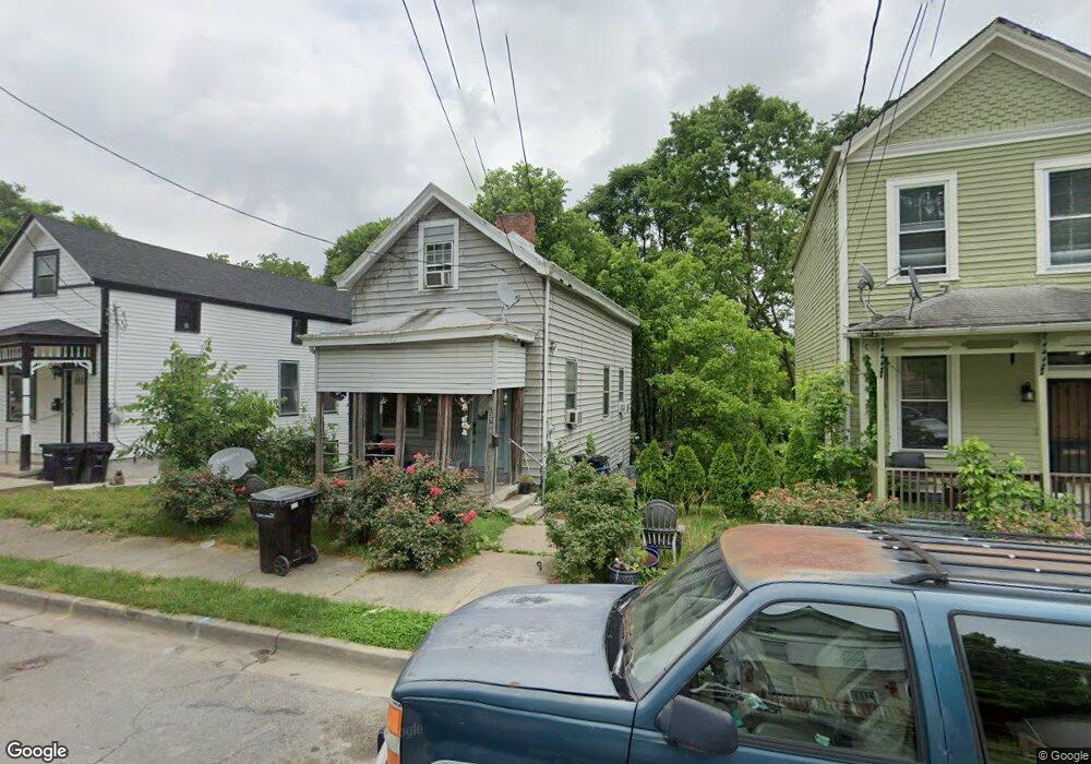
3708 Cass Ave Cincinnati, OH 45223
South Cumminsville NeighborhoodEstimated Value: $80,563 - $116,000
2
Beds
1
Bath
1,348
Sq Ft
$71/Sq Ft
Est. Value
About This Home
This home is located at 3708 Cass Ave, Cincinnati, OH 45223 and is currently estimated at $95,641, approximately $70 per square foot. 3708 Cass Ave is a home located in Hamilton County with nearby schools including Ethel M. Taylor Academy, Western Hills High School, and Gilbert A. Dater High School.
Ownership History
Date
Name
Owned For
Owner Type
Purchase Details
Closed on
Aug 23, 2021
Sold by
Bennett Clyde
Bought by
Goldblatt Greg A
Current Estimated Value
Purchase Details
Closed on
Apr 22, 2011
Sold by
Sorg J
Bought by
Bennett Clyde and Dean Denise R
Home Financials for this Owner
Home Financials are based on the most recent Mortgage that was taken out on this home.
Original Mortgage
$10,000
Interest Rate
4.77%
Mortgage Type
Seller Take Back
Purchase Details
Closed on
Feb 28, 2007
Sold by
Gholz Justin
Bought by
Sorg J and 3708 Cass Ave Land Trust
Purchase Details
Closed on
Mar 28, 2002
Sold by
Harris Deborah A and Harris Jerry
Bought by
Gholz Justin
Purchase Details
Closed on
Mar 1, 2002
Sold by
Harris Idell
Bought by
Harris Deborah A
Purchase Details
Closed on
Mar 28, 1997
Sold by
Harris Jerry and Harris Deborah
Bought by
Harris Idele
Create a Home Valuation Report for This Property
The Home Valuation Report is an in-depth analysis detailing your home's value as well as a comparison with similar homes in the area
Home Values in the Area
Average Home Value in this Area
Purchase History
| Date | Buyer | Sale Price | Title Company |
|---|---|---|---|
| Goldblatt Greg A | -- | -- | |
| Bennett Clyde | $10,000 | None Available | |
| Sorg J | -- | None Available | |
| Gholz Justin | $30,000 | All Ohio Title Agency Inc | |
| Harris Deborah A | -- | -- | |
| Harris Idele | $35,100 | -- |
Source: Public Records
Mortgage History
| Date | Status | Borrower | Loan Amount |
|---|---|---|---|
| Previous Owner | Bennett Clyde | $10,000 |
Source: Public Records
Tax History
| Year | Tax Paid | Tax Assessment Tax Assessment Total Assessment is a certain percentage of the fair market value that is determined by local assessors to be the total taxable value of land and additions on the property. | Land | Improvement |
|---|---|---|---|---|
| 2025 | $33 | $6,570 | $1,985 | $4,585 |
| 2024 | $24 | $6,570 | $1,985 | $4,585 |
| 2023 | $29 | $6,570 | $1,985 | $4,585 |
| 2022 | $34 | $5,048 | $1,985 | $3,063 |
| 2021 | $20 | $5,048 | $1,985 | $3,063 |
| 2020 | $28 | $5,048 | $1,985 | $3,063 |
| 2019 | $27 | $5,048 | $1,985 | $3,063 |
| 2018 | $28 | $5,048 | $1,985 | $3,063 |
| 2017 | $21 | $5,048 | $1,985 | $3,063 |
| 2016 | $370 | $4,988 | $1,992 | $2,996 |
| 2015 | $335 | $4,988 | $1,992 | $2,996 |
| 2014 | $337 | $4,988 | $1,992 | $2,996 |
| 2013 | $359 | $5,251 | $2,097 | $3,154 |
Source: Public Records
Map
Nearby Homes
- 1932 Powers St
- 1930 Powers St
- 3923 Cass Ave
- 1817 Elmore St
- 3813 Borden St
- 3836 Llewellyn Ave
- 1785 Townsend St
- 1771 Townsend St
- 256 Nottingham Rd
- 2352 Iroll Ave
- 4034 Colerain Ave
- 4110 Jerome Ave
- 4210 Colerain Ave
- 3910 Cherry St
- 4114 Gordon St
- 1616 Elmore St
- 1763 Hanfield St
- 1743 Hanfield St
- 1619 Powers St
- 4411 Colerain Ave
Your Personal Tour Guide
Ask me questions while you tour the home.