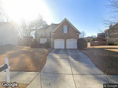
3708 Southland Dr Buford, GA 30519
Estimated Value: $482,000 - $528,000
5
Beds
3
Baths
2,771
Sq Ft
$183/Sq Ft
Est. Value
About This Home
This home is located at 3708 Southland Dr, Buford, GA 30519 and is currently estimated at $507,001, approximately $182 per square foot. 3708 Southland Dr is a home located in Gwinnett County with nearby schools including Patrick Elementary School and Glenn C. Jones Middle School.
Ownership History
Date
Name
Owned For
Owner Type
Purchase Details
Closed on
May 12, 2011
Sold by
Kirkland Alan and Kirkland Ashley
Bought by
Ko Woo S and Ko Paruchana
Current Estimated Value
Home Financials for this Owner
Home Financials are based on the most recent Mortgage that was taken out on this home.
Original Mortgage
$200,214
Interest Rate
4.85%
Mortgage Type
VA
Purchase Details
Closed on
Mar 31, 2004
Sold by
Touchstone Homes Georgia Inc
Bought by
Kirkland Alan and Kirkland Ashley
Home Financials for this Owner
Home Financials are based on the most recent Mortgage that was taken out on this home.
Original Mortgage
$177,856
Interest Rate
5.55%
Mortgage Type
New Conventional
Create a Home Valuation Report for This Property
The Home Valuation Report is an in-depth analysis detailing your home's value as well as a comparison with similar homes in the area
Home Values in the Area
Average Home Value in this Area
Purchase History
| Date | Buyer | Sale Price | Title Company |
|---|---|---|---|
| Ko Woo S | $196,000 | -- | |
| Kirkland Alan | $222,400 | -- |
Source: Public Records
Mortgage History
| Date | Status | Borrower | Loan Amount |
|---|---|---|---|
| Open | Ko Woo Sung | $160,140 | |
| Closed | Ko Woo Sung | $203,269 | |
| Closed | Ko Woo S | $200,214 | |
| Previous Owner | Kirkland Alan | $177,856 |
Source: Public Records
Tax History Compared to Growth
Tax History
| Year | Tax Paid | Tax Assessment Tax Assessment Total Assessment is a certain percentage of the fair market value that is determined by local assessors to be the total taxable value of land and additions on the property. | Land | Improvement |
|---|---|---|---|---|
| 2023 | $1,822 | $185,800 | $34,000 | $151,800 |
| 2022 | $1,497 | $156,840 | $29,200 | $127,640 |
| 2021 | $693 | $117,600 | $22,800 | $94,800 |
| 2020 | $3,936 | $117,600 | $22,800 | $94,800 |
| 2019 | $3,821 | $117,600 | $22,800 | $94,800 |
| 2018 | $3,641 | $109,040 | $20,000 | $89,040 |
| 2016 | $3,359 | $95,080 | $18,000 | $77,080 |
| 2015 | $3,223 | $87,360 | $16,000 | $71,360 |
| 2014 | $3,452 | $87,360 | $16,000 | $71,360 |
Source: Public Records
Map
Nearby Homes
- 3643 Southland Dr NE
- 3705 Rolling Creek Dr
- 2585 Chandler Grove Dr
- 3634 Lost Oak Dr
- 3557 Bryant Meadow Cir
- 3708 Heirloom Loop Ct NE
- 2669 Ambria Dr
- 2727 Lost Mill Trace
- 2845 Hamil Chase Dr
- 3735 Hamilton Mill Rd
- 2577 Kilgore Rd
- 2570 Kilgore Rd
- 3681 Hamilton Mill Rd
- 2557 Kilgore Rd
- 2810 Promenade Place
- 2716 Hamilton Mill Rd
- 3874 Lost Oak Dr
- 4020 Inman Park Ln
- 2499 E Maddox Rd
- 3708 Southland Dr
- 3698 Southland Dr
- 3728 Southland Dr
- 3748 Southland Dr
- 3688 Southland Dr
- 3703 Southland Dr
- 3758 Southland Dr
- 3693 Southland Dr
- 2753 Blue Moon Dr Unit 4
- 3758 Southland Dr NE
- 3733 Southland Dr
- 3673 Southland Dr
- 0 Blue Moon Dr
- 2752 Blue Moon Dr
- 3678 Southland Dr
- 3768 Southland Dr Unit 4
- 2763 Blue Moon Dr
- 2840 Chandler Grove Dr
- 3665 Mystic Dr Unit 2
- 3655 Mystic Dr Unit 2