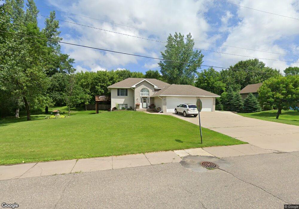
371 3rd St S Montrose, MN 55363
Estimated Value: $350,000 - $373,537
5
Beds
2
Baths
1,280
Sq Ft
$282/Sq Ft
Est. Value
About This Home
This home is located at 371 3rd St S, Montrose, MN 55363 and is currently estimated at $361,134, approximately $282 per square foot. 371 3rd St S is a home located in Wright County with nearby schools including Montrose Elementary School, Buffalo Community Middle School, and Buffalo Senior High School.
Ownership History
Date
Name
Owned For
Owner Type
Purchase Details
Closed on
Jan 28, 2009
Sold by
Wells Fargo Bank Na
Bought by
Mattson Leslie J
Current Estimated Value
Purchase Details
Closed on
May 16, 2005
Sold by
Gjerstad Byron L and Gjerstad Lisa
Bought by
Hokkanen Bryant
Purchase Details
Closed on
Jun 20, 2001
Sold by
Hausladen Cory D and Hausladen Mandy M
Bought by
Gjerstad Byron L
Purchase Details
Closed on
Jul 1, 1998
Sold by
Hausladen Cory and Hausladen Mandy
Bought by
Hausladen Jerse A and Bebo Shari
Create a Home Valuation Report for This Property
The Home Valuation Report is an in-depth analysis detailing your home's value as well as a comparison with similar homes in the area
Home Values in the Area
Average Home Value in this Area
Purchase History
| Date | Buyer | Sale Price | Title Company |
|---|---|---|---|
| Mattson Leslie J | $128,500 | -- | |
| Hokkanen Bryant | -- | -- | |
| Gjerstad Byron L | $175,000 | -- | |
| Hausladen Jerse A | $116,800 | -- |
Source: Public Records
Tax History Compared to Growth
Tax History
| Year | Tax Paid | Tax Assessment Tax Assessment Total Assessment is a certain percentage of the fair market value that is determined by local assessors to be the total taxable value of land and additions on the property. | Land | Improvement |
|---|---|---|---|---|
| 2025 | $4,282 | $369,400 | $79,000 | $290,400 |
| 2024 | $4,076 | $340,400 | $57,600 | $282,800 |
| 2023 | $4,152 | $355,900 | $72,600 | $283,300 |
| 2022 | $3,896 | $333,700 | $76,100 | $257,600 |
| 2021 | $3,784 | $273,500 | $49,500 | $224,000 |
| 2020 | $3,786 | $261,000 | $44,000 | $217,000 |
| 2019 | $3,344 | $256,300 | $0 | $0 |
| 2018 | $3,054 | $219,800 | $0 | $0 |
| 2017 | $2,804 | $202,300 | $0 | $0 |
| 2016 | $2,672 | $0 | $0 | $0 |
| 2015 | $2,606 | $0 | $0 | $0 |
| 2014 | -- | $0 | $0 | $0 |
Source: Public Records
Map
Nearby Homes
- 301 Center Ave S
- 517 2nd St S
- 305 Garfield Ave S
- 161 Mindy Ln Unit 9
- 149 Mindy Ln
- 426 Dillon Ave N
- 140 Garner Cir
- 1766 US Highway 12 SW
- 137 Pheasant Ridge Dr
- 150 Pheasant Ridge Dr
- 151 Garner Cir
- 683 Aspen Ln
- 684 Aspen Ln
- 685 Aspen Ln
- 687 Aspen Ln
- 689 Aspen Ln
- 690 Aspen Ln
- 691 Aspen Ln
- 726 7th St N
- 692 Aspen Ln
- 351 3rd St S
- 370 2nd St S
- 400 3rd St S
- 400 2nd St S
- 315 Dakota Ave S
- 280 Fairmont Ave S
- 290 Fairmont Ave S
- 360 2nd St S
- 270 Fairmont Ave S
- 331 3rd St S
- 350 2nd St S
- 325 Dakota Ave S
- 260 Fairmont Ave S
- 340 2nd St S
- 310 Dakota Ave S
- 355 Emerson Ave S
- 300 Fairmont Ave S
- 330 2nd St S
- 250 Fairmont Ave S
- 310 Fairmont Ave S