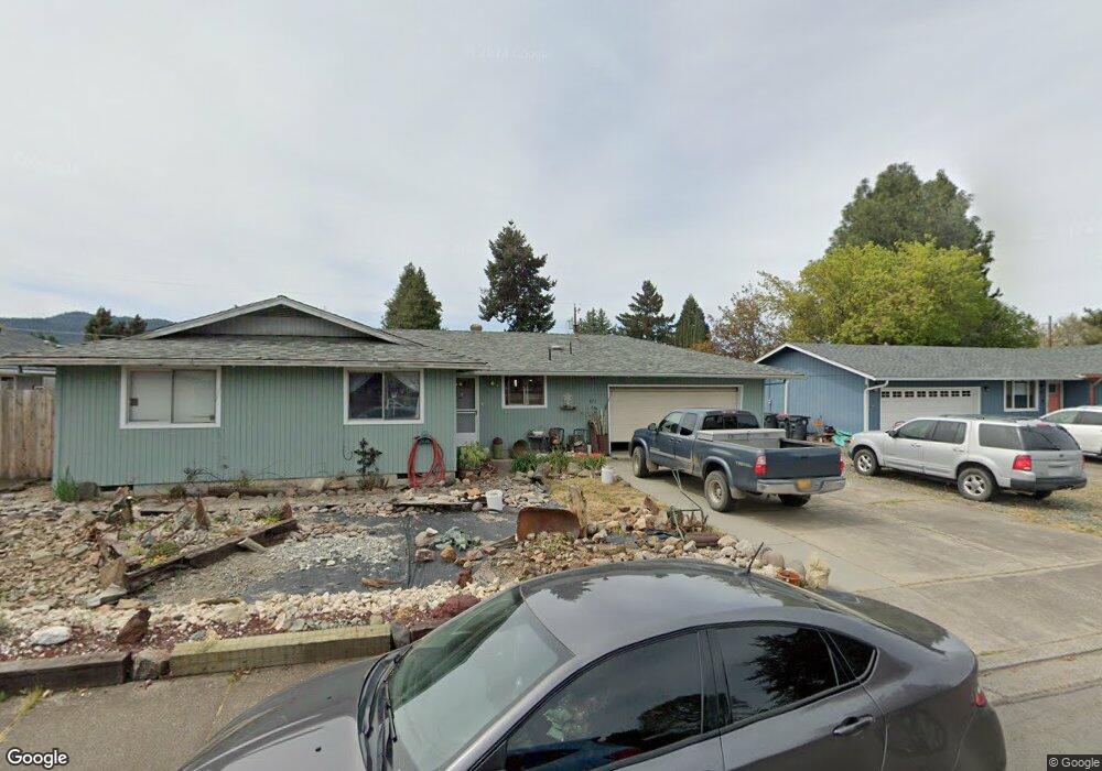
371 Brad Way Central Point, OR 97502
Estimated Value: $299,000 - $333,022
3
Beds
2
Baths
1,200
Sq Ft
$257/Sq Ft
Est. Value
About This Home
This home is located at 371 Brad Way, Central Point, OR 97502 and is currently estimated at $308,506, approximately $257 per square foot. 371 Brad Way is a home located in Jackson County with nearby schools including Richardson Elementary School, Scenic Middle School, and Crater High School.
Ownership History
Date
Name
Owned For
Owner Type
Purchase Details
Closed on
Apr 23, 2025
Sold by
Knight Investment Properties Iv Llc
Bought by
Hayes Donald and Ann Hammack Hayes Deirdre
Current Estimated Value
Home Financials for this Owner
Home Financials are based on the most recent Mortgage that was taken out on this home.
Original Mortgage
$293,000
Outstanding Balance
$290,875
Interest Rate
4%
Mortgage Type
VA
Estimated Equity
$17,631
Purchase Details
Closed on
Sep 9, 2020
Sold by
Knight Robert William
Bought by
Knight Investment Properties Iv Llc
Purchase Details
Closed on
Jan 22, 2018
Sold by
Knight Shirley L and Knight Rick David
Bought by
Robert W Knight And Shirley L Knight Revocabl and Knight
Purchase Details
Closed on
Jul 30, 2014
Sold by
Knight Robert W and Knight Shirley L
Bought by
The Robert W Knight & Shirley L Knight R
Create a Home Valuation Report for This Property
The Home Valuation Report is an in-depth analysis detailing your home's value as well as a comparison with similar homes in the area
Home Values in the Area
Average Home Value in this Area
Purchase History
| Date | Buyer | Sale Price | Title Company |
|---|---|---|---|
| Hayes Donald | $295,000 | First American Title | |
| Knight Investment Properties Iv Llc | -- | None Available | |
| Robert W Knight And Shirley L Knight Revocabl | -- | None Listed On Document | |
| The Robert W Knight & Shirley L Knight R | -- | None Available |
Source: Public Records
Mortgage History
| Date | Status | Borrower | Loan Amount |
|---|---|---|---|
| Open | Hayes Donald | $293,000 |
Source: Public Records
Tax History Compared to Growth
Tax History
| Year | Tax Paid | Tax Assessment Tax Assessment Total Assessment is a certain percentage of the fair market value that is determined by local assessors to be the total taxable value of land and additions on the property. | Land | Improvement |
|---|---|---|---|---|
| 2025 | $3,036 | $182,580 | $98,080 | $84,500 |
| 2024 | $3,036 | $177,270 | $95,220 | $82,050 |
| 2023 | $2,938 | $172,110 | $92,440 | $79,670 |
| 2022 | $2,869 | $172,110 | $92,440 | $79,670 |
| 2021 | $2,788 | $167,100 | $89,740 | $77,360 |
| 2020 | $2,706 | $162,240 | $87,130 | $75,110 |
| 2019 | $2,640 | $152,940 | $82,140 | $70,800 |
| 2018 | $2,559 | $148,490 | $79,750 | $68,740 |
| 2017 | $2,495 | $148,490 | $79,750 | $68,740 |
| 2016 | $2,422 | $139,980 | $75,180 | $64,800 |
| 2015 | $2,321 | $139,980 | $75,180 | $64,800 |
| 2014 | $2,216 | $131,960 | $70,870 | $61,090 |
Source: Public Records
Map
Nearby Homes
- 619 Palo Verde Way
- 407 Silver Creek Dr
- 626 Griffin Oaks Dr
- 349 W Pine St
- 25 Donna Way
- 420 Mayberry Ln
- 21 Hickory Ln
- 1134 Steamboat Dr
- 429 Mayberry Ln
- 1135 Shake Dr
- 570 Bachand Cir
- 3642 Oak Pine Way
- 487 Creekside Cir
- 342 Hazel St
- 465 Creekside Cir
- 0 Boulder Ridge St
- 1159 Rustler Peak St
- 1167 Boulder Ridge St
- 431 N 5th St
- 55 Crater Ln