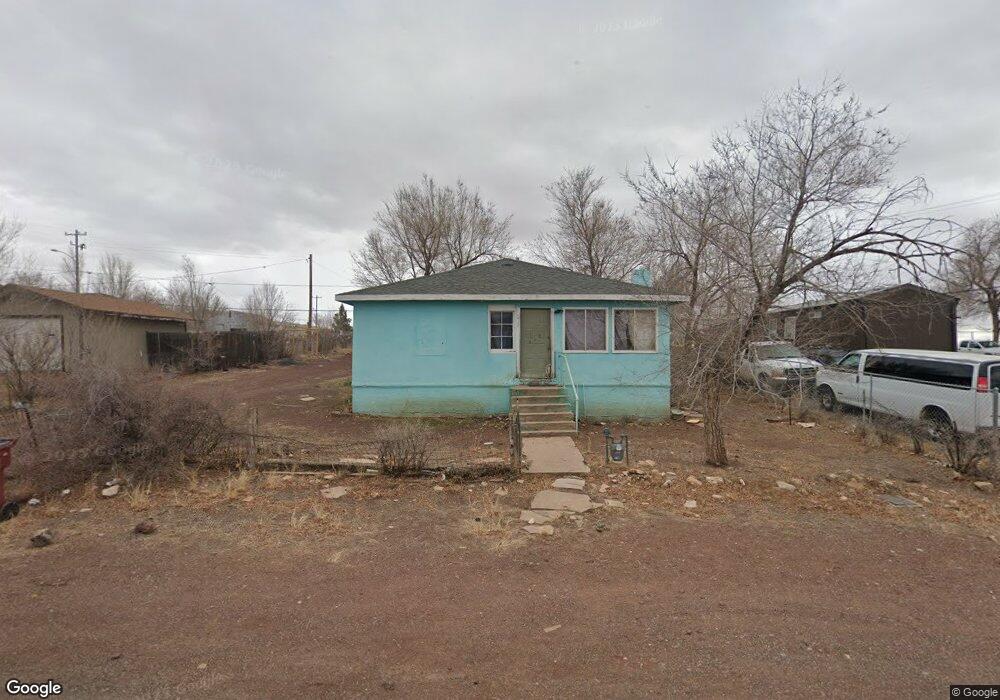
371 Maple Ave Ash Fork, AZ 86320
Ash Fork NeighborhoodEstimated Value: $193,000 - $320,000
2
Beds
2
Baths
1,223
Sq Ft
$196/Sq Ft
Est. Value
About This Home
This home is located at 371 Maple Ave, Ash Fork, AZ 86320 and is currently estimated at $239,863, approximately $196 per square foot. 371 Maple Ave is a home located in Yavapai County with nearby schools including Ash Fork Elementary School, Ash Fork Middle School, and Ash Fork High School.
Ownership History
Date
Name
Owned For
Owner Type
Purchase Details
Closed on
Oct 25, 2016
Sold by
Bank Of America Na
Bought by
Fan Ying
Current Estimated Value
Purchase Details
Closed on
Oct 23, 2015
Sold by
May Everett
Bought by
Bank Of America Na
Purchase Details
Closed on
Oct 19, 2006
Sold by
Medrano Tony E and Medrado Joanna L
Bought by
May Everett
Home Financials for this Owner
Home Financials are based on the most recent Mortgage that was taken out on this home.
Original Mortgage
$52,000
Interest Rate
6.28%
Mortgage Type
New Conventional
Purchase Details
Closed on
Apr 10, 2003
Sold by
Fifth Third Investment Co
Bought by
Elliott Patrick P and Erman Arthur G
Create a Home Valuation Report for This Property
The Home Valuation Report is an in-depth analysis detailing your home's value as well as a comparison with similar homes in the area
Home Values in the Area
Average Home Value in this Area
Purchase History
| Date | Buyer | Sale Price | Title Company |
|---|---|---|---|
| Fan Ying | $28,000 | Servicelink Aliquippa Title | |
| Bank Of America Na | $51,000 | Accommodation | |
| May Everett | $65,000 | Yavapai Title Agency Inc | |
| Elliott Patrick P | $10,500 | Yavapai Title Agency |
Source: Public Records
Mortgage History
| Date | Status | Borrower | Loan Amount |
|---|---|---|---|
| Previous Owner | May Everett | $52,000 | |
| Closed | May Everett | $10,000 |
Source: Public Records
Tax History
| Year | Tax Paid | Tax Assessment Tax Assessment Total Assessment is a certain percentage of the fair market value that is determined by local assessors to be the total taxable value of land and additions on the property. | Land | Improvement |
|---|---|---|---|---|
| 2026 | $883 | $17,842 | -- | -- |
| 2024 | $859 | $16,828 | -- | -- |
| 2023 | $859 | $14,632 | $924 | $13,708 |
| 2022 | $783 | $13,192 | $585 | $12,607 |
| 2021 | $717 | $12,128 | $490 | $11,638 |
| 2020 | $723 | $0 | $0 | $0 |
| 2019 | $745 | $0 | $0 | $0 |
| 2018 | $803 | $0 | $0 | $0 |
| 2017 | $722 | $0 | $0 | $0 |
| 2016 | $674 | $0 | $0 | $0 |
| 2015 | -- | $0 | $0 | $0 |
| 2014 | -- | $0 | $0 | $0 |
Source: Public Records
Map
Nearby Homes
- 279 W Park Ave
- 2576 W Roberts Rd
- 268 Park Ave
- 0 Ash Fork Unit AZ 86320
- 46812 N 8th St
- 11cxx Old Route 66
- 11 Old Route 66
- 000 Juniperwood Ranch
- 644 Cortez Ranch Rd
- 205 Couchman's Trail
- 996 Couchman's Trail
- 996 Couchman's Trail Unit 204
- 10111 W Old Highway 66
- 0000 W Old Highway 66
- 8406 W Old Highway 66
- 00 N Trackside Trail 211 Ln
- 1505 W Bernadine S Way
- 00 N Trackside Trail Ln
- 00 N Trackside Trail Ln Unit 211
- 2185 W Joseph Dr
Your Personal Tour Guide
Ask me questions while you tour the home.