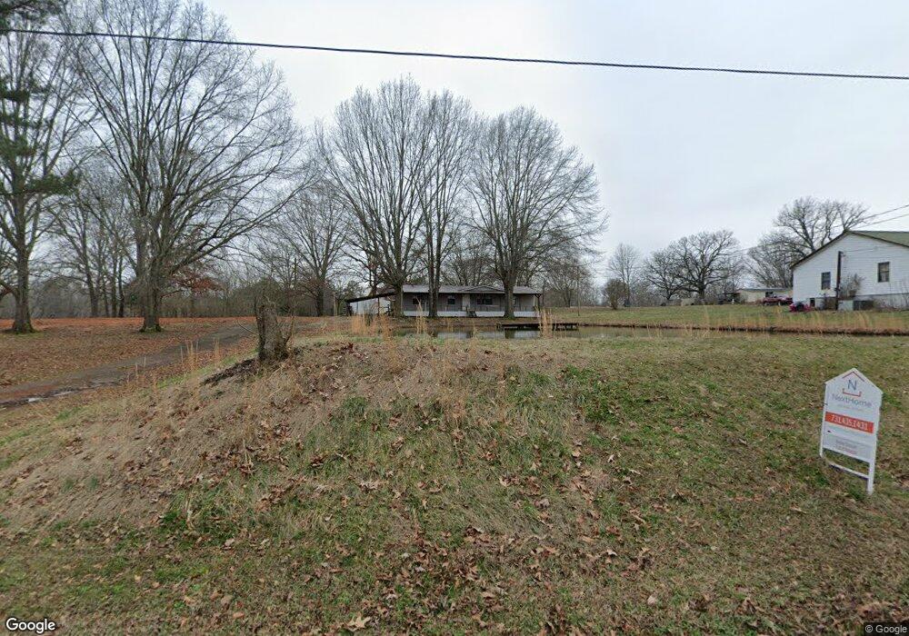
3710 Litt Wilson Rd Finger, TN 38334
Estimated Value: $106,000 - $197,000
4
Beds
2
Baths
1,792
Sq Ft
$83/Sq Ft
Est. Value
About This Home
This home is located at 3710 Litt Wilson Rd, Finger, TN 38334 and is currently estimated at $149,385, approximately $83 per square foot. 3710 Litt Wilson Rd is a home located in McNairy County with nearby schools including Bethel Springs Elementary School, Selmer Elementary School, and Adamsville Elementary School.
Ownership History
Date
Name
Owned For
Owner Type
Purchase Details
Closed on
Apr 23, 2020
Sold by
Griswell Ronald Lee and Leon Pearl Griswell Trust
Bought by
Hurst Shella and Hurst Steven
Current Estimated Value
Purchase Details
Closed on
May 20, 2016
Sold by
Griswell Leona
Bought by
Griswell Leona
Purchase Details
Closed on
Apr 20, 2016
Sold by
Griswell Leona
Bought by
Griswell Leona
Purchase Details
Closed on
Jul 7, 2000
Sold by
Griswell Leona
Bought by
Griswell Leona
Purchase Details
Closed on
May 27, 1997
Sold by
Miller Jerry R
Bought by
Griswell Leona
Create a Home Valuation Report for This Property
The Home Valuation Report is an in-depth analysis detailing your home's value as well as a comparison with similar homes in the area
Home Values in the Area
Average Home Value in this Area
Purchase History
| Date | Buyer | Sale Price | Title Company |
|---|---|---|---|
| Hurst Shella | $20,000 | None Available | |
| Griswell Leona | -- | -- | |
| Griswell Leona | -- | -- | |
| Griswell Leona | $1,300 | -- | |
| Griswell Leona | $1,250 | -- |
Source: Public Records
Tax History Compared to Growth
Tax History
| Year | Tax Paid | Tax Assessment Tax Assessment Total Assessment is a certain percentage of the fair market value that is determined by local assessors to be the total taxable value of land and additions on the property. | Land | Improvement |
|---|---|---|---|---|
| 2025 | $220 | $13,925 | $0 | $0 |
| 2024 | $220 | $13,925 | $600 | $13,325 |
| 2023 | $220 | $13,925 | $600 | $13,325 |
| 2022 | $216 | $13,725 | $600 | $13,125 |
| 2021 | $245 | $11,950 | $600 | $11,350 |
| 2020 | $93 | $4,550 | $600 | $3,950 |
| 2019 | $93 | $4,550 | $600 | $3,950 |
| 2018 | $93 | $4,550 | $600 | $3,950 |
| 2017 | $93 | $4,550 | $600 | $3,950 |
| 2016 | $91 | $4,550 | $600 | $3,950 |
| 2015 | $95 | $4,550 | $600 | $3,950 |
| 2014 | $132 | $6,325 | $600 | $5,725 |
Source: Public Records
Map
Nearby Homes
- 0 Young Rd
- 0 Center Hill Rd
- 226 Sherry Lynn Dr
- 0 Sol Colston Rd
- 0 Smith Rd
- 50 Braund Rd
- 1295 Mayfield Rd
- 171 Malone Cemetery Rd
- 0 Otis Paine Rd
- 115 Harmony Ln
- 6140 Finger Leapwood Rd
- X Cedar Brook Ln
- 1 Otis Paine Rd
- 2885 Old Friendship Rd
- 3677 Center Hill Rd
- 1890 Montezuma Rd
- 5310 Old Friendship Rd
- 3202 Otis Plunk Rd
- Lot 23 Timberwood Cove
- 00 Highway 45 S
- 3702 Litt Wilson Rd
- 3703 Litt Wilson Rd
- 3654 Litt Wilson Rd
- 3778 Litt Wilson Rd
- 155 Sundown Ln
- 1765 Finger Leapwood Rd
- 1841 Finger Leapwood Rd
- 1709 Finger Leapwood Rd
- 3577 Litt Wilson Rd
- 3556 Litt Wilson Rd
- 111 Sundown Ln
- 1941 Finger Leapwood Rd
- 1894 Finger Leapwood Rd
- 1691 Finger Leapwood Rd
- 1673 Finger Leapwood Rd
- 112 Oak St
- 1924 Finger Leapwood Rd
- 54 Oak St
- 1967 Finger Leapwood Rd
- 1948 Finger Leapwood Rd