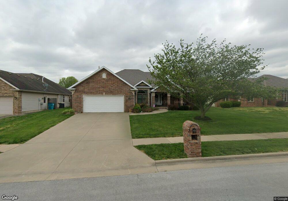
3717 N Oak Point Ave Springfield, MO 65803
Estimated Value: $307,396 - $332,000
3
Beds
2
Baths
1,816
Sq Ft
$179/Sq Ft
Est. Value
About This Home
This home is located at 3717 N Oak Point Ave, Springfield, MO 65803 and is currently estimated at $325,099, approximately $179 per square foot. 3717 N Oak Point Ave is a home located in Greene County with nearby schools including Truman Elementary School, Pleasant View K-8 School, and Hillcrest High School.
Ownership History
Date
Name
Owned For
Owner Type
Purchase Details
Closed on
May 8, 2020
Sold by
Taylor C Paul C and Taylor Crystal
Bought by
Babyak Gordon and Babyak Barbara
Current Estimated Value
Home Financials for this Owner
Home Financials are based on the most recent Mortgage that was taken out on this home.
Original Mortgage
$139,000
Outstanding Balance
$123,632
Interest Rate
3.5%
Mortgage Type
New Conventional
Estimated Equity
$201,467
Purchase Details
Closed on
Jul 31, 2013
Sold by
Futrell Debra and Futrell Leland
Bought by
Jaynes Barry W and Jaynes Mary Jane
Create a Home Valuation Report for This Property
The Home Valuation Report is an in-depth analysis detailing your home's value as well as a comparison with similar homes in the area
Purchase History
| Date | Buyer | Sale Price | Title Company |
|---|---|---|---|
| Babyak Gordon | -- | None Available | |
| Jaynes Barry W | -- | None Available |
Source: Public Records
Mortgage History
| Date | Status | Borrower | Loan Amount |
|---|---|---|---|
| Open | Babyak Gordon | $139,000 |
Source: Public Records
Tax History
| Year | Tax Paid | Tax Assessment Tax Assessment Total Assessment is a certain percentage of the fair market value that is determined by local assessors to be the total taxable value of land and additions on the property. | Land | Improvement |
|---|---|---|---|---|
| 2025 | $2,527 | $47,140 | $7,600 | $39,540 |
| 2024 | $2,527 | $43,660 | $5,700 | $37,960 |
| 2023 | $2,515 | $43,660 | $5,700 | $37,960 |
| 2022 | $2,295 | $39,050 | $5,700 | $33,350 |
| 2021 | $2,195 | $39,050 | $5,700 | $33,350 |
| 2020 | $1,991 | $33,630 | $5,700 | $27,930 |
| 2019 | $1,935 | $33,630 | $5,700 | $27,930 |
| 2018 | $1,929 | $33,350 | $5,700 | $27,650 |
| 2017 | $1,911 | $30,340 | $5,700 | $24,640 |
| 2016 | $1,736 | $30,340 | $5,700 | $24,640 |
| 2015 | $1,723 | $30,340 | $5,700 | $24,640 |
| 2014 | $1,733 | $30,340 | $5,700 | $24,640 |
Source: Public Records
Map
Nearby Homes
- 3740 N Oak Point Ave
- 3630 N Thistlewood Ct
- 3582 N Thistlewood Ct
- 3645 N Oak Point Ave
- 671 W Bridgewood Ct
- 3714 N Mount Zion Ct
- 1122 W Vancouver St
- 3764 N Huntington Ave
- 3879 N Williams Ct
- 1632 N Grant Ave
- 1420 W Farm Road 102
- 4353 N Toby Ave
- 4377 N Toby Ave
- 4449 N Toby Ave
- 4230 N Farm Road 159
- 3486 N Farm Road 143
- 725 E Smith St
- 748 E Bluff Dr
- 3144 N Pierce Ave
- 347 Dry River Ct
- 3729 N Oak Point Ave
- 3705 N Oak Point Ave
- 3741 N Oak Point Ave
- 3716 N Oak Point Ave
- 709 W Beverly Hills Dr
- 3704 N Oak Point Ave
- 3728 N Oak Point Ave
- 3703 N Farm Road 151
- 3693 N Oak Point Ave
- 3741 N Grant Ave
- 715 W Beverly Hills Dr
- 3753 N Oak Point Ave
- 3692 N Oak Point Ave
- 3709 N Ashbury Dr
- 3764 N Oak Point Ave
- 723 W Beverly Hills Dr
- 3681 N Oak Point Ave
- 3731 N Ashbury Dr
- 3752 N Oak Point Ave
- 3741 N Farm Road 151
Your Personal Tour Guide
Ask me questions while you tour the home.