Estimated Value: $192,607 - $284,000
Studio
--
Bath
1,944
Sq Ft
$125/Sq Ft
Est. Value
About This Home
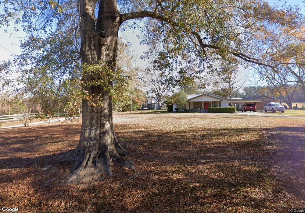
This home is located at 372 Batson Rd, Petal, MS 39465 and is currently estimated at $243,652, approximately $125 per square foot. 372 Batson Rd is a home located in Forrest County with nearby schools including Petal Primary School, Petal Elementary School, and Petal Upper Elementary School.
Ownership History
Date
Name
Owned For
Owner Type
Purchase Details
Closed on
Feb 14, 2023
Sold by
Napier Genevia
Bought by
Napier Bruce A and Napier Christa D
Current Estimated Value
Purchase Details
Closed on
Jan 23, 2018
Sold by
Napier John Raymond and Napier Wanda G
Bought by
Napier Genevia and Napier John Raymond
Purchase Details
Closed on
Aug 15, 2017
Sold by
Napier John Raymond and Napier Genevia
Bought by
Napier John Raymond and Napier Genevia
Home Financials for this Owner
Home Financials are based on the most recent Mortgage that was taken out on this home.
Original Mortgage
$80,900
Interest Rate
3.92%
Mortgage Type
Unknown
Create a Home Valuation Report for This Property
The Home Valuation Report is an in-depth analysis detailing your home's value as well as a comparison with similar homes in the area
Purchase History
| Date | Buyer | Sale Price | Title Company |
|---|---|---|---|
| Napier Bruce A | -- | Deep South Title | |
| Napier Genevia | -- | -- | |
| Napier John Raymond | -- | -- |
Source: Public Records
Mortgage History
| Date | Status | Borrower | Loan Amount |
|---|---|---|---|
| Previous Owner | Napier John Raymond | $80,900 |
Source: Public Records
Tax History
| Year | Tax Paid | Tax Assessment Tax Assessment Total Assessment is a certain percentage of the fair market value that is determined by local assessors to be the total taxable value of land and additions on the property. | Land | Improvement |
|---|---|---|---|---|
| 2024 | $208 | $9,068 | $0 | $0 |
| 2023 | $207 | $87,490 | $0 | $0 |
| 2022 | $160 | $8,763 | $0 | $0 |
| 2021 | $227 | $9,282 | $0 | $0 |
| 2020 | $193 | $8,999 | $0 | $0 |
| 2019 | $192 | $9,001 | $0 | $0 |
| 2018 | $193 | $9,002 | $0 | $0 |
| 2017 | $474 | $11,139 | $0 | $0 |
| 2016 | $395 | $10,544 | $0 | $0 |
| 2015 | -- | $110,511 | $0 | $0 |
| 2014 | -- | $11,007 | $0 | $0 |
Source: Public Records
Map
Nearby Homes
- 41 Forest Barnes Rd
- 88 Sunline Dr
- 91 Sunline Dr
- 15 Stonemore Rd
- 78 Sunline Dr
- 152 Sunline Dr
- 69 Sunline Dr
- 6 Grand Cove
- 151 Baker St
- 189 Sunline Dr
- 2 Grand Cove
- 12 Stonemore Rd
- 24 Rotan Ct
- 60+/- AC Luther Carter Rd
- 92 High Meadows Cir
- 1424 Carterville Rd
- 13 S Village Ln
- 118 van Slyke Ln
- 1408 Carterville Rd
- 116 High Ridge Dr
- 370 Batson Rd
- 360 Batson Rd
- 236 Bunton Rd
- 350 Batson Rd
- 344 Batson Rd
- 343 Batson Rd
- 212 Bunton Rd
- 412 Batson Rd
- 7 Woody Clark Rd
- 218 Bunton Rd
- 10 Woody Clark Rd
- 217 Bunton Rd
- 215 Bunton Rd
- 414 Batson Rd
- 988 Luther Carter Rd
- 959 Luther Carter Rd
- 0 Luther Carter Rd
- 425 Batson Rd
- 422 Batson Rd
- 000 Bellamy Ln
Your Personal Tour Guide
Ask me questions while you tour the home.