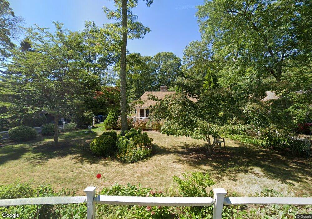
372 Locustfield Rd East Falmouth, MA 02536
Hatchville NeighborhoodEstimated Value: $479,392 - $564,000
2
Beds
1
Bath
1,070
Sq Ft
$500/Sq Ft
Est. Value
About This Home
This home is located at 372 Locustfield Rd, East Falmouth, MA 02536 and is currently estimated at $534,848, approximately $499 per square foot. 372 Locustfield Rd is a home located in Barnstable County with nearby schools including Mullen-Hall School, Morse Pond School, and Lawrence School.
Ownership History
Date
Name
Owned For
Owner Type
Purchase Details
Closed on
Jul 30, 2021
Sold by
Vanbuskirk Philip C and Vanbuskirk Judith F
Bought by
Vanbuskirk Judith F
Current Estimated Value
Purchase Details
Closed on
Jan 1, 1973
Bought by
Vanbuskirk Philip C and Vanbuskirk Judith F
Create a Home Valuation Report for This Property
The Home Valuation Report is an in-depth analysis detailing your home's value as well as a comparison with similar homes in the area
Home Values in the Area
Average Home Value in this Area
Purchase History
| Date | Buyer | Sale Price | Title Company |
|---|---|---|---|
| Vanbuskirk Judith F | -- | None Available | |
| Vanbuskirk Judith F | -- | None Available | |
| Vanbuskirk Philip C | -- | -- |
Source: Public Records
Mortgage History
| Date | Status | Borrower | Loan Amount |
|---|---|---|---|
| Previous Owner | Vanbuskirk Philip C | $160,000 | |
| Previous Owner | Vanbuskirk Philip C | $90,000 | |
| Previous Owner | Vanbuskirk Philip C | $75,000 |
Source: Public Records
Tax History Compared to Growth
Tax History
| Year | Tax Paid | Tax Assessment Tax Assessment Total Assessment is a certain percentage of the fair market value that is determined by local assessors to be the total taxable value of land and additions on the property. | Land | Improvement |
|---|---|---|---|---|
| 2025 | $2,514 | $428,200 | $149,400 | $278,800 |
| 2024 | $2,488 | $396,100 | $141,600 | $254,500 |
| 2023 | $2,257 | $326,100 | $141,600 | $184,500 |
| 2022 | $2,188 | $271,800 | $106,700 | $165,100 |
| 2021 | $2,115 | $248,800 | $102,100 | $146,700 |
| 2020 | $2,057 | $239,500 | $92,800 | $146,700 |
| 2019 | $1,977 | $230,900 | $92,800 | $138,100 |
| 2018 | $1,925 | $223,800 | $92,800 | $131,000 |
| 2017 | $1,870 | $219,200 | $92,800 | $126,400 |
| 2016 | $1,831 | $218,700 | $92,800 | $125,900 |
| 2015 | $1,791 | $218,700 | $92,800 | $125,900 |
| 2014 | $1,813 | $222,500 | $97,700 | $124,800 |
Source: Public Records
Map
Nearby Homes
- 12 Beach Plum Path
- 4 Josiah Path
- 7 Josiah Path
- 18 Josiah Path
- 20 Josiah Path
- 21 Josiah Path
- 30 Josiah Path
- 273 Sandwich Rd
- 149 Brick Kiln Rd
- 25 Percival Rd
- 32 Jamie Ln
- 12 Rock Hollow Dr
- 63 Pine Valley Dr Unit 63 aka 30A
- 17 Pinewood Dr
- 68 Deepwood Dr
- 59 Whitecaps Dr
- 131 Heritage Cir
- 34 Mckenna Ridge Rd
- 70 Meredith Dr
- 376 Locustfield Rd
- 368 Locustfield Rd
- 369 Locustfield Rd
- 373 Locustfield Rd
- 365 Locustfield Rd
- 379 Locustfield Rd
- 382 Locustfield Rd
- 382A Locustfield Rd
- 359 Locustfield Rd
- 383 Locustfield Rd
- 364 Locustfield Rd
- 41 Mares Pond Dr
- 39 Mares Pond Dr
- 8 Pattee Rd
- 49 Mares Pond Dr
- 393 Locustfield Rd
- 392 Locustfield Rd
- 31 Mares Pond Dr
- 16 Pattee Rd
- 25 Mares Pond Dr