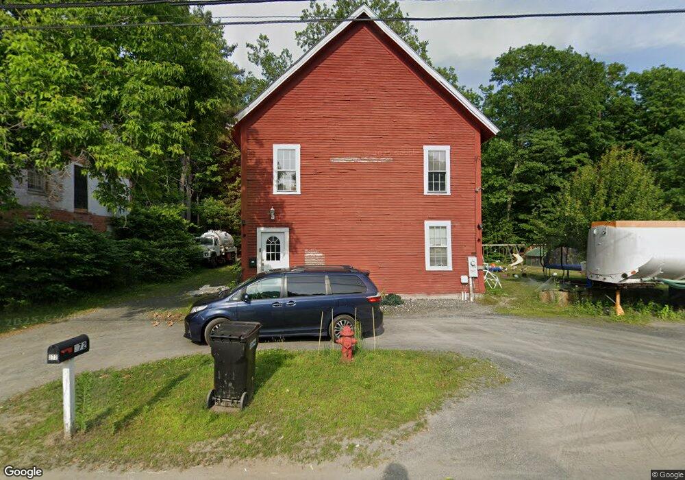
372 River Rd Charlestown, NH 03603
Estimated Value: $279,000 - $311,128
2
Beds
1
Bath
1,860
Sq Ft
$159/Sq Ft
Est. Value
About This Home
This home is located at 372 River Rd, Charlestown, NH 03603 and is currently estimated at $296,282, approximately $159 per square foot. 372 River Rd is a home located in Sullivan County with nearby schools including North Charlestown Community School, Charlestown Middle School, and Fall Mountain Regional High School.
Ownership History
Date
Name
Owned For
Owner Type
Purchase Details
Closed on
Nov 18, 2013
Sold by
Stpierre Gabriel A
Bought by
Dion Shannon M and Glidden Dustin T
Current Estimated Value
Purchase Details
Closed on
Mar 28, 2007
Sold by
Stpierre Albert and Stpierre Carol
Bought by
Stpierre Gabriel A
Home Financials for this Owner
Home Financials are based on the most recent Mortgage that was taken out on this home.
Original Mortgage
$70,000
Interest Rate
6.33%
Mortgage Type
Commercial
Create a Home Valuation Report for This Property
The Home Valuation Report is an in-depth analysis detailing your home's value as well as a comparison with similar homes in the area
Home Values in the Area
Average Home Value in this Area
Purchase History
| Date | Buyer | Sale Price | Title Company |
|---|---|---|---|
| Dion Shannon M | $109,000 | -- | |
| Stpierre Gabriel A | $70,000 | -- |
Source: Public Records
Mortgage History
| Date | Status | Borrower | Loan Amount |
|---|---|---|---|
| Previous Owner | Stpierre Gabriel A | $70,000 |
Source: Public Records
Tax History Compared to Growth
Tax History
| Year | Tax Paid | Tax Assessment Tax Assessment Total Assessment is a certain percentage of the fair market value that is determined by local assessors to be the total taxable value of land and additions on the property. | Land | Improvement |
|---|---|---|---|---|
| 2024 | $5,948 | $163,600 | $19,100 | $144,500 |
| 2023 | $5,613 | $163,600 | $19,100 | $144,500 |
| 2022 | $5,279 | $163,600 | $19,100 | $144,500 |
| 2021 | $5,924 | $187,400 | $19,100 | $168,300 |
| 2020 | $2,957 | $76,500 | $22,300 | $54,200 |
| 2019 | $2,261 | $57,800 | $22,300 | $35,500 |
| 2017 | $2,110 | $57,800 | $22,300 | $35,500 |
| 2016 | $2,026 | $57,800 | $22,300 | $35,500 |
| 2015 | $2,269 | $70,500 | $23,600 | $46,900 |
| 2014 | $2,220 | $70,500 | $23,600 | $46,900 |
| 2013 | $2,276 | $70,500 | $23,600 | $46,900 |
Source: Public Records
Map
Nearby Homes
- 0 Peperes Rd Unit 24.10
- 0 Peperes Rd Unit 93
- 81 River Rd
- 3507 Claremont Rd
- 3910 Claremont Rd
- 60 Spencer Hollow Rd
- 0 Spencer Hollow Rd Unit 5048342
- 145 Grissom Ln
- 00 Stage Rd Unit 440
- 63 David Ave
- 0 Old Claremont Rd
- 237 Halls Pond Rd
- 152 Parkview Rd
- 664 Spencer Hollow Rd
- 76 Hillside Dr
- 25 Morways Park
- 004 W Unity Rd
- 003 W Unity Rd
- 02 W Unity Rd
- 1010 Morways Park
- 373 River Rd
- 390 River Rd
- 391 River Rd
- 398 River Rd
- 397 River Rd
- 38 Depot Hill
- 343 River Rd
- 53 Depot Hill
- 423 River Rd
- 71 Buttonwood Ln
- 7 Buttonwood Ln
- 437 River Rd
- 26 Chestnut Hill Rd
- 26 Chestnut Hill Village (Subdiv Lot #26)
- 26 Chestnut Hill Rd Unit Lot 26
- 18 Chestnut Hill Rd
- 18 Chestnut Hill Rd
- 18 Chestnut Hill Rd Unit Lot 18
- 24 Chestnut Hill Rd
- 24 Chestnut Hill Village (Subdiv Lot #24)