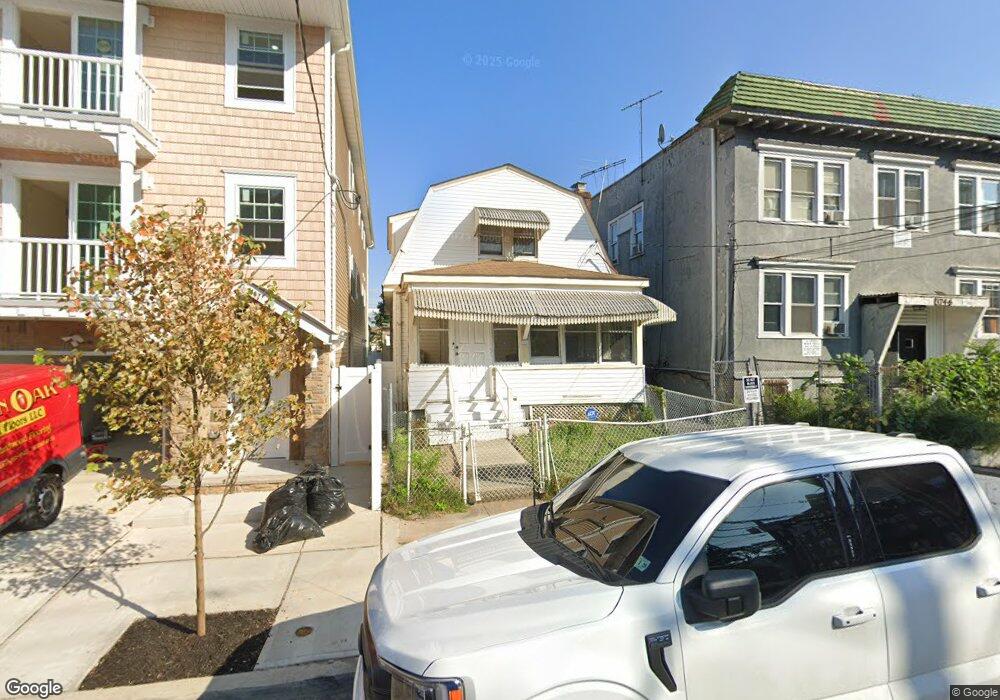
372 Sanford Ave Newark, NJ 07106
Upper Vailsburg NeighborhoodEstimated Value: $339,841 - $508,000
Studio
--
Bath
1,208
Sq Ft
$342/Sq Ft
Est. Value
About This Home
This home is located at 372 Sanford Ave, Newark, NJ 07106 and is currently estimated at $413,460, approximately $342 per square foot. 372 Sanford Ave is a home located in Essex County with nearby schools including Lincoln Elementary School, Mt. Vernon School, and Hawthorne Avenue Elementary School.
Ownership History
Date
Name
Owned For
Owner Type
Purchase Details
Closed on
Feb 9, 2024
Sold by
Mingo Lesley R
Bought by
Mingo Lesley R and Mingo Nathan C
Current Estimated Value
Purchase Details
Closed on
Nov 23, 1983
Bought by
Mingo Nathan and Mingo Lenore G
Create a Home Valuation Report for This Property
The Home Valuation Report is an in-depth analysis detailing your home's value as well as a comparison with similar homes in the area
Home Values in the Area
Average Home Value in this Area
Purchase History
| Date | Buyer | Sale Price | Title Company |
|---|---|---|---|
| Mingo Lesley R | -- | None Listed On Document | |
| Mingo Nathan | $39,500 | -- |
Source: Public Records
Tax History
| Year | Tax Paid | Tax Assessment Tax Assessment Total Assessment is a certain percentage of the fair market value that is determined by local assessors to be the total taxable value of land and additions on the property. | Land | Improvement |
|---|---|---|---|---|
| 2025 | $4,090 | $109,700 | $14,600 | $95,100 |
| 2024 | $4,090 | $109,700 | $14,600 | $95,100 |
Source: Public Records
Map
Nearby Homes
- 85 Smith St
- 74 Smith St
- 32 Palm St
- 31 Halstead St
- 143 Smith St
- 149 Smith St
- 106 Halstead St Unit 110
- 491 Norwood St
- 36 Mckay Ave
- 510 Halsted St
- 78 Monticello Ave
- 459 Norwood St
- 552 Norwood St
- 443 Norwood St Unit 45
- 443 Norwood St Unit 4
- 95 Crawford St
- 20 Stuyvesant Ave
- 83 Bedford St
- 129 Brookwood St
- 129 Brookwood St Unit 2
- 370 Sanford Ave
- 368 Sanford Ave Unit Room 1
- 368 Sanford Ave Unit Room 2
- 368 Sanford Ave Unit Room 3
- 368 Sanford Ave
- 374 Sanford Ave Unit 376
- 378 Sanford Ave
- 364-366 Sanford Ave
- 364 Sanford Ave Unit 366
- 367 Sandford Ave Unit 2
- 367 Sandford Ave Unit 2R
- 380 Sanford Ave
- 67 Palm St
- 61 Palm St Unit 65
- 367-369 Sandford Ave
- 69 Palm St Unit 71
- 75 Palm St
- 380 Sandford Ave
- 362 Sandford Ave
- 382 Sanford Ave
Your Personal Tour Guide
Ask me questions while you tour the home.