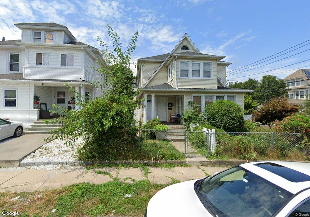
372 Summit St Bridgeport, CT 06606
North End NeighborhoodEstimated Value: $423,227 - $643,000
4
Beds
2
Baths
2,708
Sq Ft
$193/Sq Ft
Est. Value
About This Home
This home is located at 372 Summit St, Bridgeport, CT 06606 and is currently estimated at $521,807, approximately $192 per square foot. 372 Summit St is a home located in Fairfield County with nearby schools including Blackham School, Central High School, and Northeastern Adventist Academy - Fairfield County.
Ownership History
Date
Name
Owned For
Owner Type
Purchase Details
Closed on
Jun 3, 2010
Sold by
Marroquin Carlos
Bought by
Marroquin Blanca
Current Estimated Value
Purchase Details
Closed on
Apr 13, 2005
Sold by
Bailey Ramdy and Bailey Monica
Bought by
Marroquin Carlos and Marroquin Blanca
Home Financials for this Owner
Home Financials are based on the most recent Mortgage that was taken out on this home.
Original Mortgage
$287,920
Interest Rate
6.25%
Create a Home Valuation Report for This Property
The Home Valuation Report is an in-depth analysis detailing your home's value as well as a comparison with similar homes in the area
Home Values in the Area
Average Home Value in this Area
Purchase History
| Date | Buyer | Sale Price | Title Company |
|---|---|---|---|
| Marroquin Blanca | -- | -- | |
| Marroquin Blanca | -- | -- | |
| Marroquin Carlos | $359,900 | -- | |
| Marroquin Carlos | $359,900 | -- |
Source: Public Records
Mortgage History
| Date | Status | Borrower | Loan Amount |
|---|---|---|---|
| Previous Owner | Marroquin Carlos | $287,920 | |
| Previous Owner | Marroquin Carlos | $176,300 |
Source: Public Records
Tax History
| Year | Tax Paid | Tax Assessment Tax Assessment Total Assessment is a certain percentage of the fair market value that is determined by local assessors to be the total taxable value of land and additions on the property. | Land | Improvement |
|---|---|---|---|---|
| 2025 | $7,241 | $166,646 | $63,126 | $103,520 |
| 2024 | $7,241 | $166,646 | $63,126 | $103,520 |
| 2023 | $7,241 | $166,646 | $63,126 | $103,520 |
| 2022 | $7,241 | $166,646 | $63,126 | $103,520 |
| 2021 | $7,241 | $166,646 | $63,126 | $103,520 |
| 2020 | $6,643 | $123,040 | $38,260 | $84,780 |
| 2019 | $6,643 | $123,040 | $38,260 | $84,780 |
| 2018 | $6,690 | $123,040 | $38,260 | $84,780 |
| 2017 | $6,690 | $123,040 | $38,260 | $84,780 |
| 2016 | $6,690 | $123,040 | $38,260 | $84,780 |
| 2015 | $6,776 | $160,560 | $38,560 | $122,000 |
| 2014 | $6,776 | $160,560 | $38,560 | $122,000 |
Source: Public Records
Map
Nearby Homes
- 1265 Lindley St
- 457 Summit St
- 329 Ezra St
- 926 Hart St
- 916 Hart St
- 208 Fairview Ave Unit 210
- 25 Westfield Ave
- 45 Stevens St Unit 3L
- 936 Lindley St
- 95 Savoy St
- 138 Infield St
- 74 Harlem Ave
- 3461 Main St
- 234 Savoy St
- 355 Exeter St
- 213 Exeter St
- 219 Exeter St
- 123 Harlem Ave
- 355 Chamberlain Ave
- 245 Indian Ave
- 382 Summit St
- 392 Summit St Unit 394
- 1165 Lindley St
- 1184 Lindley St
- 1155 Lindley St
- 1215 Lindley St Unit 3rd
- 1215 Lindley St Unit 2nd
- 1215 Lindley St Unit 1219
- 1215 Lindley St Unit 1218
- 1215 Lindley St Unit 1st
- 1219 Lindley St Unit 3rd
- 524 Gurdon St
- 1190 Lindley St Unit 1194
- 400 Summit St
- 1164 Lindley St
- 514 Gurdon St
- 570 Gurdon St Unit 572
- 340 Summit St
- 1145 Lindley St
Your Personal Tour Guide
Ask me questions while you tour the home.